Dayton Transportation Plan 2040 - Overview

Presentation for an introductory public input meeting for the City of Dayton, Ohio's Transportation Plan 2040. The City of Dayton is evaluating transportation needs and is seeking community input to help establish a transportation plan for the next quarter century. The Transportation Plan 2040 will establish goals and objectives for thoroughfare design, walkability, bikeability, public transit, accessibility, traffic calming and aesthetic design. The plan is expected to include considerations for multi-modal corridors, accessibility, land uses, economic development, and safer, more efficient transportation for all users. The project timeline is approximately eight months, with the final plan presented to Dayton Plan Board in the summer of 2016.

Recommandé
Contenu connexe
Tendances
Tendances (18)
En vedette
En vedette (16)
Similaire à Dayton Transportation Plan 2040 - Overview
Similaire à Dayton Transportation Plan 2040 - Overview (20)
Plus de City of Dayton
Plus de City of Dayton (20)
Dernier
Dernier (20)
Dayton Transportation Plan 2040 - Overview
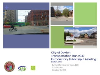
- 1. + City of Dayton Transportation Plan 2040 Introductory Public Input Meeting Dayton, Ohio Burton Planning Services, LLC CYP Studios October 15, 2015
- 2. INTRODUCTIONS DESIGN TEAM BACKGROUND WHAT IS DAYTON 2040 WHY DAYTON 2040 HOW DO WE GET TO DAYTON 2040 Q+A AGENDA
- 4. INTRODUCTIONS CYP STUDIOS Eugenia Martin, FASLA Daniel Phillabaum, AICP, ASLA Kenn Bates, ASLA CITY OF DAYTON Kathleen Riggs Mark Elma BPS Kimberly Burton, P.E., AICP CTP, LEED AP ND Kim Littleton, AICP Rodney Saylor, GISP Michael Blau, AICP
- 6. Completed over 120 planning, engineering, and environmental projects to-date 50 years of experience in transportation planning in the private and public sectors Certified DBE, EDGE firm and licensed engineering firm. National Complete Streets Coalition Bronze Partner U.S. Green Building Council Organizational Member Burton Planning Services DESIGN TEAM BACKGROUND
- 7. Award winning Woman Business Enterprise (WBE), Small Business Enterprise (SBE) and EDGE Certified firm 20 years of knowledge and experience in landscape architecture & planning in the private + public sector Expertise in Low Impact Development as well as Healthy Community Design Integrate environmental + social sustainability as well as walkability + bikeabilty CYP Studios DESIGN TEAM BACKGROUND
- 8. WHAT IS DAYTON 2040
- 9. Build upon successes Livable Streets Policy CitiPlan Dayton The 2020 Vision 2025 Bike Action Plan Incorporate needs + desires of all users Transportation + Land Use | Always Linked Economic Development Existing and Future Land Uses Tool for efficient pre-planning of roadways Tool to build consensus and remove barriers PROJECT BACKGROUND Transportation Plan 2040
- 10. Complete Streets Policies Ensure that the entire right-of-way is planned, designed, constructed, operated, and maintained to provide safe access for all users COMPLETE STREETS
- 11. Complete Streets does not mean: One ‘special’ street project A design prescription Streets only for bicycles + pedestrians, but for all modes A mandate for immediate retrofit A silver bullet; other issues must be addressed: Land use (proximity, mixed-use) Environmental concerns Transportation Demand Management COMPLETE STREETS
- 12. WHY DAYTON 2040
- 13. Americans want choices of Americans want more transportation options so they have the freedom to choose how to get where they need to go. Future of Transportation National Survey (2010) 66% 73% 57% currently feel they have no choice but to drive as much as they do. would like to spend less time in the car. WHY DAYTON 2040
- 14. The tremendous potential Of all trips: National Household Travel Survey (2009) 39% are less than 3 miles 17% are less than 1 mile 47% are driven of these trips… WHY DAYTON 2040
- 15. The tremendous potential Every trip starts and ends with walking. WHY DAYTON 2040 The Surgeon General’s Call to Action: Promote Walking and Walkable Communities
- 16. People will walk Centers for Disease Control and Prevention 2012, newpublichealth.org WHY DAYTON 2040
- 17. Livable Communities "Livability means being able to take your kids to school, go to work, see a doctor, drop by the grocery or post office, go out to dinner and a movie, and play with your kids at the park—all without having to get in your car." — Ray LaHood, Former U.S. DOT, Secretary of Transportation WHY DAYTON 2040
- 18. WHY DAYTON 2040
- 19. Benefits | Economy 32 new business establishments $80,000 in sales tax annually Washington, DC Barracks Row/8th Street SE $8M public investment $8M in private investment in following 2 years WHY DAYTON 2040 Reduced speeding Fewer crashes 50 new businesses 800 new jobs Vacancy rate: 4% Sales tax revenue: + 26% Reconstruction Changed signal timing Added landscape Created center “rambla” $10 million public investment Lancaster, California
- 20. Benefits | Economy Millennials want to work in areas with high quality transportation and high quality of life. Walkable commercial neighborhoods in Washington, D.C. have 75% higher office rents than drivable, suburban neighborhoods. In most metro areas, every +1 point on the 100 point Walk Score scale = ! of $500- $3,000 in home value. WHY DAYTON 2040
- 21. Benefits | Safety 0 20 40 60 80 20mph 30mph 40mph Probabilityofpedestrianfatality Speed Slowing traffic improves safety for people walking W.A. Leaf and D.F. Preusser, “Literature Review on Vehicle Travel Speeds and Pedestrian Injuries Among Selected Racial/Ethnic Groups,” US Department of Transportation, National Highway Traffic Safety Administration (1999). WHY DAYTON 2040
- 22. WHY DAYTON 2040 Transportation accounts for nearly 1/3 of all greenhouse gas emissions. Switching to walking or bicycling for short trips = reduce CO2 emissions by 12 to 22 million tons/year. Many elements of street design, construction, and operation can achieve both Complete Streets that work for all travelers and ‘green’ streets that improve environmental sustainability. Benefits | Environmental
- 23. The Centers for Disease Control and Prevention recommend adoption of Complete Streets policies as a strategy to prevent obesity. Benefits | Health Risk of obesity: Frank, L., et. al. (2004). Obesity Relationships with Community Design, Physical Activity, and Time Spent in Cars. American Journal of Preventative Medicine 27(2). Increases 6% for each hours spent in a car. Decreases 4.8% for each additional kilometer walked. WHY DAYTON 2040
- 24. Women who walk or bike 30 minutes a day have a lower risk of breast cancer. A 30-minute round-trip bicycle commute is associated with better mental health in men. People who live in walkable neighborhoods get more exercise than those who do not. Benefits | Health WHY DAYTON 2040
- 25. Walkable communities = happier communities Residents of walkable communities: are more likely to be socially engaged and trusting report being in good health and happy more often Shannon H. Rogers, et al. Examining Walkability and Social Capital as Indicators of Quality of Life at the Municipal and Neighborhood Scales. (2010) WHY DAYTON 2040 Benefits | Social
- 26. About ½ of all non-drivers over the age of 65 would like to get out more often Complete Streets = staying active and involved in communities Dedicated, safe space for bicycling and walking help kids be active and gain independence Complete Streets can reduce isolation and dependence WHY DAYTON 2040 Benefits | Social
- 27. HOW DO WE GET TO DAYTON 2040
- 28. HOW TO WE GET TO DAYTON 2040 Preliminary Project Goals Emphasize land use + transportation connections Accentuate livability in high traffic areas Identify and address conflicts with other plans + policies Address subdivision regulations + zoning code Support transitions with intermediary district typologies Ensure the road fits in the context of the land use Recommend right-of-way widths Develop urban design guidelines Communicate through highly visual graphics Develop one comprehensive document
- 29. Integrate Current Transportation Policies & Plans Establish Vision, Goals, and Objectives aesthetic design walkability bikeability traffic calming public transit accessibility signage & wayfinding Assess Transportation Needs Engage Public for Input (PIP) Develop Complete Streets Design Project Objectives HOW TO WE GET TO DAYTON 2040
- 30. Examine existing conditions Evaluate existing roads to set standards Review functional classification of existing network | expand to include land use Examine Census + MPO data for various crucial factors employment opportunities population trends existing + future travel patterns Assess Transportation Needs HOW TO WE GET TO DAYTON 2040
- 31. Final Deliverables HOW TO WE GET TO DAYTON 2040 Identify a Design District incorporate many of the identified classification types Use visualization tools create easy to follow + relatable typical sections Include typical roadway section identify travel zones for each user Include maps prioritization graphics etc
- 32. Milestone Projected Date Start Date July 2015 Initiation Public Involvement August 2015 Data Collection August – October 2015 Public Input September – October 2015 Data Analysis October – December 2015 25 % Completed November 2015 50 % Completed January 2016 75 % Completed March 2016 100 % Completed May 2016 Project Development Timeline HOW TO WE GET TO DAYTON 2040
- 33. public input | introductory bike ride + walk introductory public meeting | open house stakeholder meeting focus area meetings + neighborhood walks public input | midway stakeholder meetings focus area meetings public meeting | open house public input | final final presentation | open house Public Input Program (PIP) HOW TO WE GET TO DAYTON 2040
- 34. October 24th | 11am to 2pm Bike Ride | Walk October 27th | 9am to 3:30pm Neighborhood Walks | North + South Public Input Meeting (repeat of Oct 15th) October 29th | 9am to 4:30pm Neighborhood Walks | East + West Public Input | Introductory HOW TO WE GET TO DAYTON 2040
- 35. Q+A
- 36. THANK YOU!