Science Hack Day Dublin 2013
•Télécharger en tant que PPT, PDF•
0 j'aime•603 vues

Lightning Talk at Science Hack Day Dublin in Dublin City University on 2nd March 2013

Recommandé
Recommandé
Contenu connexe
Tendances
Tendances (15)
En vedette
En vedette (20)
Similaire à Science Hack Day Dublin 2013
Similaire à Science Hack Day Dublin 2013 (20)
Plus de Fingal Open Data
Plus de Fingal Open Data (12)
Dernier
Dernier (20)
Science Hack Day Dublin 2013
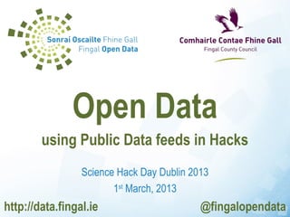
- 1. Open Data using Public Data feeds in Hacks Science Hack Day Dublin 2013 1st March, 2013 http://data.fingal.ie @fingalopendata
- 2. Open Data
- 3. Fingal Open Data website http://data.fingal.ie
- 4. 170 datasets in 12 categories
- 5. Dublin Region Innovation Network http://dublinked.ie
- 6. Over 250 datasets in Datastore
- 7. PublicData.eu http://publicdata.eu/
- 8. Apps
- 9. apps4fingal COMPETITION 9th November, 2011 – 9th January, 2012 €11,500 in prizes Community, Enterprise, Tourism, Student & Ideas Categories
- 10. apps4fingal 22 Apps created 36 Ideas entered
- 11. Apps4Fingal http://data.fingal.ie/apps4fingal
- 13. KidsMaps http://www.kidsmaps.ie
- 14. Who is my TD? http://www.whoismytd.com/
- 15. U.S. Quality of Life Indicators http://countysinrankings.org/
- 16. New York City ‘311’ Calls Visualisation
- 17. German Federal Budget http://bund.offenerhaushalt.de/
- 18. Europe’s Energy http://energy.publicdata.eu/ee/
- 19. Dutch Elm Disease Monitoring http://www.openelm.org.im/
- 20. Crowdsourcing
- 22. Data Quality Improvement http://mappa-mercia.org/novam/
- 23. Service Locations http://fixcity.org/
- 26. Copenhagen Wheel http://senseable.mit.edu/copenhagenwheel/
- 27. Sensor Web
- 28. Changing Behaviour through Fun
- 29. Get Involved
- 30. Irish Open Data Community #OpenDataIRL https://tito.io/open-data-ireland/
- 31. Open Data Ireland Online https://groups.google.com/forum/?fromgroups=#!forum/open-data-ireland
- 32. Open Data Day 2013 Hackathon Projects • Visualise university performance • How thick are your kids? • Do I need this health insurance? • Open Data Finder • Pedestrianise this street? • Hospital Dashboard • Where should business locate? • Crystal (Swing States) • Crowdsourcing local history • Distance from open space http://wiki.opendataday.org/Dublin2013
- 33. Open Data using Public Data feeds in Hacks http://data.fingal.ie http://twitter.com/fingalopendata
- 34. www.slideshare.net/fingalopendata Licensed under a Creative Commons Attribution-NonCommercial-ShareAlike 3.0 Unported License http://creativecommons.org/licenses/by-nc-sa/3.0/ Use of any Fingal County Council or Fingal Development Board logos and brands are not covered by this license. Pictures as marked used under Creative Commons license. If you believe any content is infringing copyright, please contact us via http://data.fingal.ie
Notes de l'éditeur
- Today I am going to talk about Data & Visualisation and why it is important; give an overview of how Fingal has used data & visualisation; give an overview of Open Data; share our experience with Fingal Open Data; give an overview of eGovernment and its role in civic governance
- Fingal County Council launched the first Open Data website in the country in November 2010 Fingal Open Data evolved from the principles of the Fingal Data Hub and the Open Data movement. In Summer 2010 we were preparing a report with data about all Local Authorities which was difficult to find and only available in PDF We discovered the Open Data movement and felt that this was a better way We decided to take the initiative with the backing of the County Manager and Fingal Open Data was born It is available at data.fingal.ie The website, which you can see on screen, provides public access to source data from Council systems.
- There are currently over 120 datasets organised into 12 categories Detailed information is provided about each dataset, including description, date published and available formats.
- www.dublinked.ie
- Datastore 200 datasets (557 files) Data from 4 Dublin Councils and OSI data in research zone (thanks to OSI for being the first) National datasets (Hazardous & Transfrontier Waste Shipments; National Public Transport Nodes; NIAH) Regional Datasets Themes focussed for first release of data were Land Use, Transport & Environmental Zones – Open and Research (Members) – O & M Data criteria for Members zone – Legal issues, Technical (e.g. streaming/live data (samples); binary (Traffic)), Commercial (high-value) Formats – open & non-proprietary where possible; can be onerous to convert – working towards this goal; go ugly early; respond to feedback Metadata for each dataset – Dublinked ‘lite’ standard developed in partnership with Dept. Environment, NUI Galway, Dept. Marine & Natural Resources; compliant with international standards
- In order to encourage the reuse of data published on Fingal Open Data and Dublinked, Fingal County Council organised the Apps4Fingal competition The competition ran from 9 th November 2011 to 9 th January 2012 There was a prize fund of €11,500 thanks to the generosity of our sponsors
- 23 Apps were submitted
- The Apps4Fingal section of Fingal Open Data contains all the information about the competition including details of and links to the competition entries, rules, judging criteria and the shortlisted entries I am going to give a quick run-through of the winning Apps
- Parkya is a startup which has created an app to help people with parking
- While the apps4fingal concentrated on Fingal services, many of the Apps incorporate data from other services and across the whole of the Dublin region. In addition, most could scale up to National or International services. One App that has been developed since the competition and which makes use of Open Data is KidsMaps. This takes the playground data from the Fingal Open Data site, but also includes playground data sourced from most of the Local Authorities in Ireland. This is a great example of how Apps based on Open Data can be scalable.
- Open Data is nothing new in the G.I.S. world One of the best examples of Open Data is OpenStreetMap This is collaborative spatial data made openly available
- U.K. Department of Transport made NAPTAN bus stop dataset available to OpenStreetMap OpenStreetMap volunteers check, edit and verify the data via the NOVAM viewer Improved data quality of public dataset Potential for the same approach to be used here with Government datasets
- The FixYourStreet approach has been taken a step further As well as allowing people to let ue know where there are problems, why not let them suggest where servcies should be located Fixcity.org Bike Racks website evolved from New York City looking at how it could maximise the value of its CRM investment The website enables citizens to identify a location where they believe bike racks should be provided, to include a photo of the location and to outline their reasons for the suggested location Other citizens can vote on the suggestions Citizens can also check whether their suggested location meets Bike Rack Location Guidelines to see racks provided sooner
- Walkonomics website Rates the walkability of streets based on data for each street relating to street width, crime, gradients and traffic levels
- In addition, members of the public can rate the streets to improve the accuracy of the rating
- Copenhagen Wheel Rear bicycle wheel which attaches to normal bikes Captures energy when cycling and provides power when needed Includes environmental sensors Use smartphone to lock and unlock bike and change gears
- Map of pollution levels captured from Copenhagen Wheel bikes
- Thefuntheory.com Change people’s behaviour through fun Environment, Driving, etc.
- The Irish Open Data Community has existed online since October 2010 In October 2012 it organised its first real-world meetup 3 meetups to date Hackathon planned for International Open Data Day
- This is the Google Group for the Irish Open Data community – sign up to keep up to date
- To conclude Data is a fundamental requirement for evidence-based decision making - in this case in the planning and design processes Visualisation and mapping allows us and the public to engage with and understand complex data; and to understand places Open Data is a platform for opening up the decision-making processes It enables Open Government which allows for increased citizen participation Open Data and technology developments including Social Media and the proliferation of location aware mobile devices enable new approaches to design and civic governance In particular, I would strongly urge that any design mapping produced is captured digitally in a manner that facilitates reuse by others – in GIS systems, Google Maps, Bing Maps, Apps, etc. – and published as Open Data where possible As I mentioned earlier, Fingal Open Data is available at data.fingal.ie And you can also follow us on Twitter at fingalopendata
- In line with the theme, this presentation is licenced for sharing under a Creative Commons licence It is available for viewing and downloading on slideshare Thank you.