Government Peatland Knowledge Platform, Sharing of Indonesia’s experience in peatland restoration
•Télécharger en tant que PPTX, PDF•
0 j'aime•179 vues

Presented by Muhammad Askary, Deputy Director for Sources Control of Peatland Ecosystem Degradation, Ministry of Environment and Forestry, Indonesia, on the ITPC side event “Could a virtual collaborative platform help to preserve tropical peatlands?” at the XV World Forestry Congress, Seoul, Republic of Korea, 5 May 2022.

Recommandé
Recommandé
Contenu connexe
Tendances
Tendances (20)
Similaire à Government Peatland Knowledge Platform, Sharing of Indonesia’s experience in peatland restoration
Similaire à Government Peatland Knowledge Platform, Sharing of Indonesia’s experience in peatland restoration (20)
Plus de International Tropical Peatlands Center
Plus de International Tropical Peatlands Center (20)
Dernier
Dernier (20)
Government Peatland Knowledge Platform, Sharing of Indonesia’s experience in peatland restoration
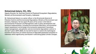
- 1. Muhammad Askary, SSi., MSc Deputy Director for Sources Control of Peatland Ecosystem Degradation, Ministry of Environment and Forestry, Indonesia Mr. Muhammad Askary is a senior officer in the Directorate General of Pollution Control and Environmental Degradation, Ministry of Environment and Forestry, Indonesia. He has spent 29 years of his career in the field of Environmental Protection and Management, both in policy development and technical implementation, including environmental laboratory, environmental impact assessment and strategic environmental assessment, hazardous waste management, and pollution and environmental degradation control. In the last 7 years (2015-2022), he has led his team to restore the hydrological function of more than 3,6 million hectares of degraded peatlands ecosystem in Indonesia which significantly contributed in alleviating global climate changes.
- 2. Government Peatland Knowledge Platform Sharing of Indonesia’s experience in peatland restoration Muhammad Askary Deputy Director for Sources Control of Peatland Ecosystem Degradation, Ministry of Environment and Forestry, Indonesia
- 4. The total global peatland ecosystem in the world is around 4.23 million km2, which corresponds 2.83% of the Earth’s land surface: spread in Asia (38.4%) and North America (31.6%, mostly Canada & Alaska), European peatlands make up 12.5%, followed by South America (11.5%), Africa (4.4%), and Australasia and Oceania (1.6%). ( Source: Xu et al, 2018) Peatland Ecosystem has significant role on the world environmental sustainability and climate stability Countries contribution in individual, bilateral and multilateral collaboration is essential for global achievement and beneficiaries. Peatland ecosystem is exist in more than 180 countries and covering about 3 percent of the world land and storing nearly 30 percent of its soil carbon including the tropical peatland ecosystem at about 10-16 percent of the global peatland lies in 60 countries. 1.
- 5. BENEFIT: Forestry, Flood control and water supply, Fire risk control, Eco-tourism, The livelihoods of local communities (fisheries, agriculture, plantation), Climate stability, Biodiversity, Education and research.
- 6. DRAINAGE (Poor Water Management) DRY PEAT LAND and FOREST FIRE GHG EMISSION SUBSIDENCE (Land and Water Table) LAND DEPRESSION FLOODS The Challenge: Hydrological Management, Preserve the vegetation and Ecosystem, and improve local Community Livelihoods
- 7. Total : 865 PHU Sumatera : 207 PHU, Sulawesi : 3 PHU, Kalimantan : 190 PHU, Papua : 465 PHU, 13 Total : 865 PHU Sumatera : 207 PHU, Sulawesi : 3 PHU, Kalimantan : 190 PHU, Papua : 465 PHU, MOEF Decree No. SK.129/MENLHK/SETJEN/KUM.1/2/2017 regarding DETERMINATION OF NATIONAL PEAT HYDROLOGICAL UNITY MAP MOEF Decree No. SK.129/MENLHK/SETJEN/KUM.1/2/2017 regarding DETERMINATION OF NATIONAL INDICATIVE MAP OF PEAT ECOSYSTEM FUNCTION
- 8. 12,098,284 ha 24,202,561 Hectares of PHU Peatland Hydrological Unit (PHU) 12,104,277 ha Protection Function Cultivation Function
- 9. 1992 PP No. 57 / 2016 Change over PP No. 71 / 2014 UU No. 24 / 1992 SPATIAL PLANNING Inpres No. 6 / 2013 Indicative Map for Delays on Granting New Permits (PIPIB) Inpres No. 2 / 2007 Acceleration of Rehabilitation and Revitalization of Peatland Development Zone in Central Kalimantan UU No. 32 / 2009 Environmental Protection and Management PP No. 71 Th. 2014 Protection and Management of Peat Ecosystems Inpres No. 8 / 2015 Indicative Map for Delays on Granting New Permits (PIPIB) 1990 1997 2016 2014 2011 2013 2009 2008 2015 2007 2006 2000 PP No. 150 / 2000 Control of Soil Degraded for Biomass Production MOEF Regulation Keppres No. 32 / 1990 Management of Konservation Area PP No. 47 / 1997 National Spatial Planning (RTRWN) UU No. 26/2007 SPATIAL PLANNING PP No. 26/2008 National Spatial Planning (RTRWN) Inpres No. 10 / 2011 Indicative Map for Delays on Granting New Permits National Strategy Peatlands Management MOA Regulation No. 14/2009 Guidelines for the Utilization of Peat Land for Oil Palm Cultivation Peat protection function: Thickness > 3m in the upper river and swamp Standard criteria for peat degradation: Surface water level > 25 cm Peat protection function: min. 30% of the PHU area + Thickness >3m, etc. Criteria of degradation for cultivation function: Surface water level > 0,4 m P.17_2017 Change over P.12_2015 related Development of Industrial Plantation Forest P.16_2017 Technical Guidelines for Restoration of Peat Ecosystem Functions P.15_2017 Procedure of Water Table Measurement at Peat Ecosystems Compliance Point P.14_2017 Procedures for Inventory & Determination of Peat Ecosystem Functions SK.130_2017 Determination Function of Peat Ecosystem Map SK.129_2017 Determination of Peat Hydrological Unity Map P.10_2019 Calculation and Determination of Peatland Dome P.60_2019 Procedure for developing, determining and amending of Peatland Ecosystem Protection and Management Plan SK.246_2020 National Peatland Ecosystem Protection and Management Plan
- 10. NATIONAL LONG TERM PLANNING FOR PROTECTION AND MANAGEMENT OF PEATLAND ECOSYSTEM (2020-2049) GUIDELINES FOR COMPILATION, STIPULATION AND ADDENDUM OF PLANNING FOR PROTECTION AND MANAGEMENT OF PEATLAND ECOSYSTEM STATES OF PEATLAND ECOSYSTEM DEGRADATION [COVERS OF 24 MILLION HECTARES] 10
- 11. HUMAN WEATHER LAND SOIL BIOGEO- PHYSIC SOSIO- ECONOMIC CULTURE ELNINO- RAINFALL- INTENSITY OF SUN RADIATION MAIN CONTRIBUTING FACTORS IN LAND & FOREST FIRE 3 11 2.
- 12. Concept Restore and preserve the water, Restore and preserve the vegetation, Improve local community livelihood, and Law enforcement 12
- 13. Bring back and preserve the water, bring back and preserve the vegetation, and improve local community livelihoods 13 Canal blocking either in concession or community areas Canal blocking construction is to preserve the peatland water and rewetting the areas those prone to forest and land fires. The canal blocking also provides water for fish pond. Rehabilitation of vegetation Rehabilitation of vegetation can be carried out by replanting of local timber tree and/or natural succession. Economic value plants can be applied for rehabilitation of vegetation in community areas. Improve community livelihoods The canal blocking also provides water for fish pond and peatland friendly agriculture production to improve community livelihood
- 14. UNIVERSITY/ LOCAL GOV’T FACILITATOR TRAINING IMAS TK-PPEG RKM IMPROVEMENT OF ECONOMY, SOCIAL & ENVIRONMENT BEHAVIORAL CHANGES (SOCIAL) SELF-SUFFICIENT AND PEATLAND CARE COMMUNITY TK-PPEG=Tim Kerja Perlindungan dan Pengelolaan Ekosistem Gambut IMAS = Indentifikasi Masalah dan Analisis Situasi RKM = Rencana Kerja Masyarakat 14 CONCEPT OF PEATLAND RESTORATION IN COMMUNITY AREAS [SOCIAL TRANSFORMATION] Social mapping Explanation from university Transect walk FGD to establish TK-PPEG Meeting with community Training of facilitators
- 15. FIELD VISIT ON IMPROVEMENT OF PEATLAND WATER MANAGEMENT IN CONCESSION AREAS
- 16. CANAL BLOCKINGS IN TAJUNG SARI VILLAGE, RIAU [27 JULI 2019] LOCATION 2 LOCATION 1 PEAT WATER LEVEL IS RAISED UP IN SURROUNDING AREAS OF CONSTRUCTED CANAL BLOCKING AND NO FIRES [LOOK TO THE WATER LEVEL IN CANALS] 16
- 17. More than 67 commodities has been grown in peatland Corn harvesting with the team of MoEF, IFAD, local gov’t and community Commodities for Livelihood > 20 types of vegetables Harvested in < 8 months > 20 types of crops Harvested 8 - 24 months > 27 types of endemic vegetation Harvested > 24 months t1 t2 t3
- 18. TK-PPEG GOES GLOBAL PRODUCT OF HARD WORK, COMMITMENT AND DEDICATION
- 19. As of 25 April 2022 Industrial Pulpwood Plantation Palm Oil Pantation Total company 73 258 331 Areas of Peatland Ecosystem Restoration(ha) 2,268,755.24 1,429,806.59 3,698,561.82 of compliance point for monitoring of peat water level (unit) Manual: 4,464 Logger: 622 Total: 5,086 Manual: 4,874 Logger: 586 Total: 5,460 Manual: 10,546 Logger: 1,194 Total: 10,546 Rainfall Station(unit) 269 617 886 Constructed canal blockings (unit) Existing: 8,081 Plan: 5,752 Ponds: - Flip gate: 319 Existing: 23,128 Plan: 3,414 Ponds: 542 Flip gate: 1,619 Existing: 31,209 Plan: 9,166 Ponds: 542 Flip gate: 1,938 Rehabilitation and Revegetation of secondary forest (replanting) -- burnt area [ha] 27,251.76 3,953.14 31,204.90 Rehabilitation and Revegetation of secondary forest (ha) 64,799.96 n/a 64,799.96 Natural Succession in secondary forest (ha) 5,943.67 n/a 5,943.67 Peatland Ecosystem Restoration Concession areas estoration of hydrological fuction Rehabilitation of vegetation 49.874,7 hectares have been restored through rewetting, rehabilitation and revegetation, and improve community livelihood. 19 Community area 3.
- 20. DISTRIBUTION OF 222 SELF SUPPORTING VILLAGES FOR PEATLAN PROTECTION AND MANAGEMENT “DESA MANDIRI PEDULI GAMBUT [DMPG]” ACEH 27 VILLAGES 7 DISTRICT IMPLEMENTED IN : • 9 PROVINCE • 38 DISTRICT • 222 VILLAGES INVOLVING 12.676 WORKERS • MAN 8.963 • WOMEN 3.713 DEVELOPED 1.474 units of CANAL BLOCKING REWETTED AREA: 49.874,7 HECTARES REVEGETATION AND IMPROVE COMMUNITY LIVELIHOOD: implementing agroforestry, agrosilvofishery with several agriculture commodity [paludiculture] and forest plant SUMUT 40 VILLAGES 6 DISTRICT WEST KALIMANTAN 4 VILLAGES 3 DISTRICT RIAU 20 VILLAGES 6 DISTRICT JAMBI 12 VILLAGES 2 DISTRICT WEST SUMATERA 6 VILLAGES 3 DISTRICT EAST KALIMANTAN 11 VILLAGES 5 DISTRICT CENTRAL KALIMANTAN 55 VILLAGES 4 DISTRICT. SOUTH KALIMANTAN 4 VILLAGES 2 DISTRICT
- 21. CANAL BACK FILLING TYPE 12 M (LENGTH 250 M) IN FOREST AREA 21 CANAL BLOCKING WITH SPILLWAY IN COMMUNITY AREA
- 22. http://sipalaga.brg.go.id/ ● Peatland Restoration Agency (BRGM) also developed a real time web based water level monitoring called sipalaga.brg.go.id, its produce data and make ALARM SYSTEM hour to hour Peatland Water Level Monitoring System 22 REAL-TIME PEAT GROUND WATER LEVEL IN NON-CONCESSION AREAS
- 23. PEAT GWL BUOY 23 HOW IT WORKS? AUTOMATIC FDRS SIGNBOARD IN COMMUNITY AREAS
- 24. FDRS (FIRE DANGER RATING SYSTEM) FOR PEATLAND WATER MONITORING IN COMMUNITY AREA
- 25. 25 Canal Blocking MANUAL WATER LEVEL MONITORING STATION DATA LOGGER OMBROMETER The SiMATAG-0.4m Daily Water level monitoring in concession area 10.546 units of water level monitoring station (manual: 9,338 units & logger: 1,208 unit) 886 units rainfall monitoring station Coverage: 3,6 MHa SiMATAG-0.4m – PEAT WATER LEVEL MONITORING SYSTEM Minister of Environment and Forestry Launched the SiMATAG-0.4m, APFW 2019
- 26. Capacity for Overlay Data on: -PHU Distribution -Peatland Depth -SiMATAG-0.4m -Hotspot (Terra/Aqua, SNPP, NOAA20, Landsat8) -Canal -Canal Blocking -Vegetation change -Concession Area -7 Days Weather Forecast -Wind Direction -Rainfall, etc. 8 Applications: -Peatland Quality Index -Water Balance -PPEG PLAN -2020-2049 -PROPER -COMPLIANCE AND ENFORCEMENT -GHG EMISSION REDUCTION -EARLY WARNING SYSTEM -WATER LEVEL MONITORING (SiMATAG-0.4m) MULTI LAYER MONITORS OF INTEGRATED SMART WEB BASED OPERATIONAL ROOM [FOR PLANNING, OPERATION, DATA BASE, SURVAILANCE, EARLY WARNING SYSTEM, CALCULATION OF GHG EMISSION, CALCULATION OF WATER BALANCE, etc.]
- 28. Hotspot with a confidence level > 80% in the period 15 – 31 March 2022 occurred outside the KHG and outside the concession area [HTI and Palm Oil Plantation]
- 29. ● The prediction of the next 5 days (until April 11, 2022) for the Drought Code Index that almost the entire PHU area is safe. Several locations with heavy rainfall potential in Kalbar [Kubu Raya: Sungai Raya, Sungai Ambawang, Kuala Mandor-B, Sungai Kakap; Pontianak City: East Pontianak, North Pontianak, Pontianak City, South Pontianak, West Pontianak, Southeast Pontianak; Mempawah: Siantan, Segedong; Hedgehog: Sebangki] ● Prediction for the next 5 days (until April 11, 2022) for the Fire Weather Index that almost all K areas are safe, except for PHU in Pesisir Selatan Regency (WEST SUMATERA), PHU Sungai Mejunto - Aek Selangkanan, Muko Muko Regency (Jambi)
- 30. CO2 emission from peatland Vegetation change Peat Subsidence Peat water manage- ment Land & forest fire 4 contributing factors in CO2 emissions from peatland
- 31. SiMATAG-0.4m WATER BALANCE SiPPEG Source: 2013 Supplement to the 2006 IPCC Guidelines for National Greenhouse Gas Inventories: Wetlands SiPongi 31
- 33. Calculation of CO2 emissions from raising of peat GWL MITIGATION ACTION CONTRIBUTOR BASELINE (tCO2eq) ACTION (tCO2eq) MITIGATION (tCO2eq) Peatland restoration (reduction of peat decomposition by construction of rewetting infrastructure) Industrial Forest Plantation 257.140.461,40 85.713.487,13 171.426.974,26 Palm Oil Plantation 140.773.865,23 46.924.621,74 93.849.243,49 Community land 2.508.870,00 1.672.580,00 836.290,00 Total 400.423.196,63 134.310.688,88 266.112.507,75 Total CO2 emission reduction in 2020 is 266,112,507.75 CO2-equivalent CO2 emission = 91 x groundwater depth [R2 = 0,71; n = 8] 33
- 34. 34 1. Indonesia keeps its strong commitment for further achievements in ecosystem restoration, including restoration of peatland ecosystem. 2. Indonesia has set the standard of achievement on peatland restoration through Restoration of Hydrological Function, Revegetation and Natural Succession, involving all parties (government, private sector and local community). 3. Indonesia has restored the Peat Ecosystem of 3,698,561.82 hectares, which is divided into 2,268,755.24 hectares in Industrial Plantation Forest and 1,429,806.59 hectares in Oil Palm Plantation, and 49.874,7 hectares of peatland in community areas. It contributes to CO2 emission reductions for Indonesia in 2020 for about 266,112,507.75 CO2-equivalent [Hoojier, et.al] or 29.243.132,72 CO2-equivalent [Evans, et al]. 4. Indonesia has established The SiMATAG-0.4m and the SIPALAGA which has been internationally recognized as the most massive of ground water peatland monitoring system in the world. The SiPPEG is the latest dynamic platform for Integrated Information System to Monitor, Evaluate, prediction event in the peatland has also established. 5. Indonesia is ready to share its experience in peatland protection and management to other countries as a coherent action on alleviating global climate change. 4.
Notes de l'éditeur
- Keppres 32/1990 Pemerintah pertama kali menetapkan fungsi lindung gambut dengan kriteria ketebalan 3 m yang berada di hulu sungai dan rawa UU 24/1992 dan PP 47/2007 menguatkan ketentuan fungsi lindung gambut dengan kriteria ketebalan 3 m yang berada di hulu sungai dan rawa Strategi Nasional Pengelolaan Lahan Gambut KLH mengeluarkan paying kebijakan yang bersifat tidak mengikat sebagai acuan bagi para pihak dalam pengelolaan lahan gambut berupa strategi nasional Pada tahun 1997, Presiden Soeharto mengeluarkan inpres tentang pengembangan pertanian lahan gambut sejuta hektar di Kalimantan Tengah dengan tujuan untuk mempertahankan swasembada pangan namun pada kenyataannya kurang berhasil PP 150/2000 menetapkan kriteria kerusakan tanah di lahan basah dengan ketentuan tinggi muka air sebesar lebih dari 25 cm Pada tahun 2007 dan 2008, pemerintah melakukan revisi UU Tata Ruang dan PP RTRWN yang menetapkan kembali bahwa kriteria fungsi lindung gambut dengan kriteria ketebalan 3 m yang berada di hulu sungai dan rawa Presiden SBY mengeluarkan Inpres No. 2/2007 dengan mengerahkan semua sector dibawah koordinasi Menko Perekonomian dan Bappenas untuk melakukan pemulihan melalui percepatan rehabilitasi dan revitalisasi kawasan pengembangan lahan gambut di Kalimantan Tengah selama 5 tahun (Tahun 2011) namun hasilnya kurang memuaskan UU 32/2009 mengamanatkan penetapan kriteria baku kerusakan lingkungan dari sumberdaya alam yang salah satunya ekosistem gambut Kementan telah mengeluarkan kebijakan yaitu Permentan No. 12/2009 tentang Pedoman Pemanfaatan Lahan Gambut untuk Budidaya Kelapa Sawit Mengingat kebakaran lahan gambut terus berlangsung maka pemerintah telah mengeluarkan Inpres No. 10/2011 untuk melakukan penundaan izin baru pada hutan alam primer dan lahan gambut berlaku selama 2 tahun dan diperpanjang dengan Inpres No. 6/2013 dan Inpres No. 8/2015 yang akan berakhir pada bulan Mei 2017. Berkenaan dengan pengelolaan ekosistem gambut, pada tahun 2014 terjadi perubahan paradigma baru dalam perlindungan dan pengelolaan ekosistem gambut yang berbasis pada kesatuan hidrologis gambut atau ekosistem gambut dengan dikeluarkannya PP 71/2014 PP 71/2014 lebih lanjut diperkuat dengan PP 57/2016 terutama dalam aspek pencegahan dan pemulihan kerusakan ekosistem gambut Sampai saat ini telah dikeluarkan peraturan pelaksana seperti Permen No. 14/2017, Permen No. 15/2017, Permen No. 16/2017, Permen No. 17/2017, SK 129/2017 dan SK 130/2017
- As of September 2021, Indonesia has restored the peatland hydrological function for 3,6 million hectares in the concession areas. This restoration including installment of more than 10 thousand compliance point for monitoring of peat ground water level, as requested by Indonesia law, where the peat ground water level must not exceed 0.4 m below peat surface. The restoration activities also have constructed for mote than 30 thousand canal blockings, and about 10 thousands will be constructed in near future. For vegetation rehabilitation, the concession holders have restored mote than 100 thousands hectares, including replanting and natural succession. The restoration of peatland ecosystem function also carried out in the community areas. Until 2021, the restoration has achieved for more than 45 thousands hectares.
- Indonesia has taken further action trough establishment of real-time monitoring system to monitor peatland ground water level in non-concession areas. This system has been installed in 7 provinces prone land and forest fire, including Riau, South Sumatera, Jambi in Sumatera, West, Central and South Kalimantan in Kalimantan, and Papua province.
- Based on 2013 Supplement to the 2006 IPCC Guidelines for National Greenhouse Gas Inventories, there are three sources of CO2 emission from peatland. Indonesia has developed several subsystems to support this formula. For the C emission-onsite, it will be supported by the SIMATAG-0,4m. For C emission of dissolved organic carbon, it will be supported by Water Balance Application, and for the C emission from burning, it will be supported by SiPONGI. Nowadays, Indonesia still apply the tier-1 approach to calculate its achievement of CO2 emission reduction in peatland, including from raising of peat ground water level. However, we want to achieve more to the tier-2 or tier-3 methodology.