Geospatial intelligence satellite applications catapult pdf - july 23 2019
DG southern mapping
1. Corporate (U.S.) 303.684.4561 or 800.496.1225 | London +44.20.8899.6801 | Singapore +65.6389.4851www.digitalglobe.com
DigitalGlobe Imagery Expedites Mineral Exploration in Africa
Company Information
Established in 2006, DigitalGlobe partner
Southern Mapping Company is an aerial
surveying company that provides topographic
surveys and mapping for a variety of
industries and sectors. These include civil
engineering and infrastructure development,
mineral explorations and mine management,
environmental planning and rehabilitation, and
urban and agricultural planning.
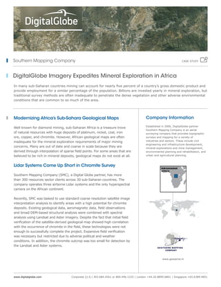
SUB-SAHARAN
AFRICA
Southern Mapping Company
In many sub-Saharan countries mining can account for nearly five percent of a country’s gross domestic product and
provide employment for a similar percentage of the population. Billions are invested yearly in mineral exploration, but
traditional survey methods are often inadequate to penetrate the dense vegetation and other adverse environmental
conditions that are common to so much of the area.
Modernizing Africa’s Sub-Sahara Geological Maps
Well known for diamond mining, sub-Saharan Africa is a treasure trove
of natural resources with huge deposits of platinum, nickel, coal, iron
ore, copper, and chromite. However, African geological maps are often
inadequate for the mineral exploration requirements of major mining
concerns. Many are out of date and coarse in scale because they are
derived through interpolation of sparse field points. For some areas that are
believed to be rich in mineral deposits, geological maps do not exist at all.
Lidar Systems Come Up Short in Chromite Survey
Southern Mapping Company (SMC), a Digital Globe partner, has more
than 300 resources sector clients across 30 sub-Saharan countries. The
company operates three airborne Lidar systems and the only hyperspectral
camera on the African continent.
Recently, SMC was tasked to use standard coarse resolution satellite image
interpretation analysis to identify areas with a high potential for chromite
deposits. Existing geological data, aeromagnetic data, field observations
and broad DEM-based structural analysis were combined with spectral
analysis using Landsat and Aster imagery. Despite the fact that initial field
verification of the satellite-derived geological map showed high correlation
with the occurrence of chromite in the field, these technologies were not
enough to successfully complete the project. Expansive field verification
was necessary but restricted due to adverse political and weather
conditions. In addition, the chromite outcrop was too small for detection by
the Landsat and Aster systems.
CASE STUDY
www.geoserve.nl
2. Corporate (U.S.) 303.684.4561 or 800.496.1225 | London +44.20.8899.6801 | Singapore +65.6389.4851www.digitalglobe.com
Industry
• Agriculture
• Environmental Services
• Metals & Mining
• Oil & Gas
• Government
Uses
• Mapping
• Cadastral
• Global Elevation Data
• Detailed Elevation Modeling
• Hydro Enforcement
• Road Flattening
• Contouring
• Shaded Relief
CS-SMAPCO 04/13
The chromite outcrop was mapped remotely, enabling the project to
be completed despite adverse developments in the political climate,
weather conditions and the unique characteristics of this outcrop.
Able to quickly complete a chromite survey stalled due to the
limitations of the coarse scale imagery produced by the Lidar
systems originally deployed for the project.
Identify areas with a high potential to host chromite in sub-Saharan
Africa where potentially chromite-rich areas are often covered under
dense vegetation and other conditions that impede accuracy.
Challenge
Solution
Results
Satellite Imagery Ideal for Mineral Exploration
SMC could go no further on the survey with the existing capabilities
and the project was halted until DigitalGlobe’s WorldView-2 satellite
was deployed. The high-resolution imagery of WorldView-2 successfully
mapped the chromite outcrop with extreme accuracy, allowing the
project to be completed successfully.
“We were at a virtual standstill with the project,” explains Alex
Fortescue, SMC’s remote sensing and GIS manager. “DigitalGlobe’s
multispectral satellite imagery made it possible to generate spectral
reflectance maps which often show more detail than existing geological
maps for optimized field exploration. In this case, it proved impossible
to complete the survey without DigitalGlobe’s high-resolution imagery.”
Leaving Old Technology Behind
With clients demanding projects be completed faster, more accurately
and more cost effectively, Southern Mining is looking forward to the
launch of DigitalGlobe’s WorldView-3 satellite, which will have the eight
visible near-infrared bands that are already imaged by WorldView-2 as
well as eight short-wave infra red bands at 3.75m resolution.
“We believe the enhanced spectral and spatial resolution of the WorldView-3 will revolutionize
the remote sensing mineral exploration market. It will render coarse scale geological maps
completely obsolete and allow us to deliver unprecedented accuracy to our clients in a rapid,
cost-effective manner.”
ALEX FORTESCUE, SMC’S REMOTE SENSING AND GIS MANAGER
Southern Mapping Company CASE STUDY