SlideShare une entreprise Scribd logo
1  sur  17
REMOTE SENSING AND GIS FOR REGIONAL PLANNING


1.0    INTRODUCTION

Regional planning is a sub-national planning in which economic and social activities
are coordinated in space. In fact, it acts as a link between local planning and national
planning. The concept of regional planning in India has been in practice since the
beginning of the planning era. However, the implementation of regional plans has
mainly remained at policy formulation level for development except in case of
regional plans for city regions like Delhi, Mumbai, Calcutta, etc., that have become
operational. In a multi-tiered planning process, district at the micro level is a viable
unit of planning in which both urban and rural components are taken care of in an
integrated manner. In fact, district planning is an area based sub-state regional
planning within the framework of national/state plans in which detailed programmes
of development, suiting the needs of the district with physical and financial
implications are identified.

Further, increasing emphasis is being laid on scientific management of natural
resources in a manner that ensures its optimal utilization keeping in view
conservation, environmental and socio -economic needs at district/regional level. It is
necessary to develop land use systems that are both economically viable in the short-
run and also environmentally friendly in the long run. Besides, the need for increasing
food production to feed the increasing population, the urgency of meeting fuel, fodder
and timber cannot be under estimated. High population growth put heavy demands on
natural resources and the production system. There is land, which is not suitable for
cultivation, brought under cultivation resulting in further degradation.

During recent years few attempts have been made for assessment and management of
natural resources by integrated approach using soil, land, water and socio-economic
conditions of the area by the multi-disciplinary research and extension teams. A team
of specialists aiming at a task to be transacted into project work is conducting
integrated surveys. The integration of resource data gathered by various specialists in
the areas of geology, geomorphology, soil, forests, wastelands, land use, groundwater,
etc. can lead to identification of homogeneous land units having unique combinations
of characteristics and hence specific suitability in terms of scientific land utilization to
increase the productivity without resulting in degradation of the environment and
resources.

As a consequence of this, a new awareness about the man-environment relationships
has come into existence. On the other hand, one is able to realize that in planning
programs at various levels, especially in developing countries, more emphasis is now
laid on ‘Sustainable Resource Development Planning’ with integrated multi-
disciplinary approach at regional scale. In order to effect priority to plan integrated
sustainable and effective utilization of natural resources, watershed approach
compared to district / region has assumed special significance in recent years for
formulation of regional plans. Watershed is a natural entity having homogeneity in
geomorphic process. Thus, regional planning on watershed basis needs detail


                                                                                        229
information on land and water resources as well as socio -economic conditions
prevailing in the region.

2.0    NEED FOR STUDY OF RESOURCES AT REGIONAL LEVEL

Aerial variations are very common in the distribution of resources, their development,
and consumption pattern. This is being further intensified by the spatial variation in
the utilization of resources found both at macro as well micro levels. Therefore, it is
essential for planners to perceive the spatial pattern of resource distribution,
utilization and conservation to have a rational approach on res ource planning and
appraisal. No doubt, the ultimate aim of such study is to know about the nature and
causes of poverty, backwardness or under-development and to formulate policy
guidelines along which development might logically be pursued. In the process of
analysis, the foremost aim is to identify the practical problems that arise from the
existence in a specific area setting of a unique combination of natural and human
resources. All these arguments clearly indicate the urgent need for more knowledge
about the natural resources in developing countries. Without such information all
development schemes can be undertaken only with a risk of failure. It is a fact that
resources are considered important factor in planning and decision-making.

3.0    DATA NEEDS FOR REGIONAL PLANNING

For effective planning and development exercises at regional level, variety of data on
physical, demography, economic and social aspects are required and integrated.
Keeping in view of the scope and content of plan and from overall development needs
of the region, data needs for the regional planning can broadly be grouped into
following data sets:

A)     Resource data in terms of area, land use, cropping area, water bodies &
       drainage, soil, mineral resources, etc.,
B)     Demographic data relating to population, sex ratio, age structure, urban &
       rural population, scheduled castes & scheduled tribe population, occupational
       structure, migration, etc.,
C)     Agro-economic data comprising information about cropped & irrigated area,
       agricultural production, land holdings, livestock population, etc.,
D)     Socio-economic activities relating to industrial, fishing activities, tourism
       development as well as beneficiary of various schemes and programmes of
       development,
E)     Infrastructure data relating to availability and level of various facilities,
       utilities & services such as education, health, power, transport network,
       drinking water supply, drainage, etc.

The above information for each sector may be categorized into 3 types as follows:

i)     Information related to the present state of development / resources for each
       sector, that would be derived as resource availability themes – indicators of
       development
ii)    Information related to projected needs of the plan period
iii)   Information related to the ‘gaps’ in each sector


                                                                                    230
Based on these three aspects, the plan for future development can be decided upon in
the overall context of the national/state/regional plan guidelines.

4.0    BASIC SPATIAL UNIT FOR REGIONAL PLANNING

Conventionally, the regional planning process at various levels of planning employed
standard areal/spatial units mainly due to convenience of data availability and to
facilitate computation and management of data for inference. The planning unit i.e.
the basic spatial unit (BSU) to be selected at various levels in regional planning
exercise is shown below. The total canvas of the sectoral approach for the regional
planning involves many sectors and is a major continuous activity. The constraints of
data availability have also been a major aspect in the project formulation.


LEVEL               OF PLANNING REGION                    BASIC       SPATIAL
PLANNING                                                  UNIT
Macro                     National/Sub-National           State/District
Meso                      State/Intra-State/Region        District/Taluk/Block
Micro                     District/Taluk/Block/Waters     Panchayat/Village
                          hed


5.0    INTEGRATION OF VILLAGE BOUNDARIES

One of the important aspects of integrated regional and area-level planning for
districts/regions/watershed is the combined analysis of the tabular socio-economic
data with the thematic natural resources data. These two discrete datasets have
different characteristics. The socio-economic and developmental data is mainly
collected by the Census, available on a village basis. This dataset is arranged on a
village-taluk-district hierarchy and is mainly tabular. As against this, the thematic data
on natural resources is based on a spatial framework that follows the SOI
topographical mapping system. An integrated planning exercise would require
integrating these data sets to derive meaningful plan inputs. The integration would be
to:

a)     Merge the attributes of the village and the natural resources for generating
       plan scenarios
b)     Spatial representation of the non-spatial tabular attributes of the village
c)     Generate village/taluk/district level information of natural resources for
       tabular updation

6.0    SPATIAL DATA ELEMENTS

In order to obtain the information sets, different types of input data sets have been
identified. These input data would be mainly thematic maps. The primary elements of
the spatial thematic database are given below:

a)     Administrative map showing the boundaries of district/taluk/village for the
       study area


                                                                                      231
b)     Drainage Map showing details of drainage
c)     Transport Network map showing the details of railways, road/highway, etc.
d)     Slope map
e)     Land use / land cover Map
f)     Soil Map
g)     Ground water potential map
h)     Hydrogeomorphologica l map

7.0    ROLE OF REMOTE SENSING AND GIS FOR INTEGRATED
       REGIONAL PLANNING

Remote sensing and GIS as tools have got very significant role to play in the
integrated regional planning. Remote sensing data products both aerial photos and
satellite imageries give information about different resources depending upon level,
extent and accuracy of information required for the region. Having the capability of
giving repetitive coverage, it is also helpful to record the extent of resources, their
levels of utiliza tion, environmental impact, etc. Geographical Information System
(GIS) has become a versatile tool for mapping these resources and linking one
information with others for integrated planning purposes. A common geographical
unit, a common scales provided by GIS and Remote Sensing has necessitated for
integrated planning and development. Remote Sensing and GIS can play important
role in.

i)     Identification and mapping and estimation of resources
ii)    Conservation development and management of resources
iii)   Monitoring environmental problems due to unscientific exploitation of
               resources
iv)    Integration of resources for balanced regional development.

8.0    CASE STUDY: UPPER BETWA WATERSHED, OBAIDULLAH GANJ
       BLOCK, RAISEN DISTRICT (M.P)

To study the integrated resource planning for regional sustainable development, the
upper Betwa watershed in Obaidullahganj block of Raisen district, Madhya Pradesh,
India has been selected. The Raisen district is situated in the central part of Madhya
Pradesh and falls under central plateau and hill region. The district lies mostly on the
plateau and partly in the Narmada valley. The study area lies between 22o 52` to 23o 7`
North latitude and between 77o 20` to 77o 47` East longitude covering an area of 68400
ha., which is 45% of the total g  eographical area of the Obaidullahganj block. The
watershed forming the upper part of river of Betwa hence it is named as upper Betwa
watershed (2G2C7). The northern boundary of the watershed cuts at confluence of
river Kaliasot near Mandideep town of Oba dullahganj block. The area bounded in the
Northwest by Sehore and Bhopal district, in the south by Sehore, in the east by
Goharganj tehsil of Raisen district. The area is well connected by rail and road
transport. The upper Betwa watershed comprises of 126 villages. Majority of the
population is engaged in agriculture sector. The land holding varies in size. The area
is ecologically fragile and prone to unstable productivity levels. Crop production is
carried out in an unbalanced manner that accelerates the run-off, soil erosion and
other degradation process causing damage to the natural ecosystem. The watershed
approach aims to optimize the use of land, water and vegetation in an integrated


                                                                                    232
manner for curtailing soil erosion, improving water availability and increasing
vegetative cover on a sustained basis. A development strategy based on integrated
management of land and water for sustainable development in context to resource
management to achieve economic and sustained agricultural production and to meet a
diverse requirement of farm household while preserving the resource base.

8.1    METHODOLOGY

A detail database on natural resources, terrain condition, socio-economic status and
demography is generated to facilitate integrated spatial analysis. Various theme based
aspect maps prepared for the study are drainage, watershed and surface water bodies,
hydrogeomorphological, slope, soil, land use/land cover, transport network,
settlement location, etc. The sequence of activities adopted for this study is described
in methodology chart (Fig. 1). In the present study, Integrated Land and Water
Information System version 1.4 (ILWIS) has been used, which is a raster based GIS
package for creation, organization, storage, retrieval, analysis, display, and query and
for making cartographic outputs in the form of maps and generation of statistical
tabular report.


                                                                                    233
OBJECTIVES
                           Economic Growth, Basic Needs, Ecological Balance


                                  INFORMATION NEED


NATURAL / PHYSICAL               CONTEMPORARY                     SOCIO -ECONOMIC &
RESOURCES                        TECHNOLGY                        D EMOGRAPHIC DATA
• Soil                           • Agriculture
• Geology                        • Water Management               SPATIAL ANALYSIS
• Geomorphology                  • Water Harvesting               OF
• Groundwater                    • Groundwater                    SOCIO -ECONOMIC
• Land use/Land cover               Exploration                   DATA
• Rainfall & Climate             • Animal Husbandary
• Drainage                       • Fisheries                      •   Social Profile
• Watershed                      • Mineral Exploration            •   Demographic Profile
• Slope map                      • Housing & Construction         •   Cultural Profile
• Transportation Network         • Energy & Power Engg.           •   Economic Status
  & Settlements                  • Health & Sanitation


 THEMATIC MAP INFORMATION                              PEOPLES/          PROGRAMMES
                                                       NEEDS             REGION
                                                                         IDENTIFICATION
  INFORMATION OF MULTI-                                •    Socially Backward Areas/People
  THEMATIC INFORMATION                                 •    Economically Backward Areas
(Composite Land Development Unit)                      •    Areas lacking basic amenities


             NATURAL/PHYSICAL RESOURCE BASED DEVELOPMENT PLAN
                           POSSIBILITY RESOURCE REGIONS


               RESOURCES MANAGEMENT SITE ACTION PLANS


                                    IMPLEMENTATION


                                      EVALUATION


                                  Fig. 1 Methodology Flow Chart


                                                                                       234
8.2     DATA SOURCE
The primary source of data used in the present study includes IRS-1B LISS II
geocoded data of the year 1994 and Landsat TM data of Path 145-44 for the year
1988, Survey of India (SOI) topographical map on 1:50,000 scale and other collateral
data in the form of report.

8.3    DATA BASE CREATION

Various thematic maps were prepared by visual interpretation of the satellite images
& after data collected from ground survey. These thematic maps were digitized &
converted into digital form using ILWIS 1.41 software. Various attribute data were
also attached to these maps (like village wise census information etc.). ILWIS GIS
package provides a combination of the different parameters of criterion-based analysis
by weighted index method and Binary method for change detection between sets of
two different map attributes. The most significant disadvantage of the system is that it
would not provide symbols for cartographic representation of maps. Maps can be
presented

i)     Location map of study area (Fig. 2)
j)     Drainage Map showing details of drainage (Fig. 3)
k)     Transport Network map showing the details of railways, road/highway, etc.
       (Fig. 4)
l)     Slope map (Fig. 5)
m)     Land use / land cover Map (Fig. 6 & 7)
n)     Soil Map (Fig. 8)
o)     Ground water potential map; (Fig. 9)
p)     Hydrogeomorphological map. (Fig. 10)

Various information generated in the form of thematic maps and during field
observation has been integrated in a GIS environment using ILWIS s/w. Following
sectoral development plans are prepared for the region.

•      Agriculture resource development
•      Water resource development

8.4    AGRICULTURE RESOURCES DEVELOPMENT

The databases generated earlier are used for preparation of integrated resource
development plan. The objective of this study is to develop an alternative system
based on cropping pattern, which fulfill the aspiration of farmer besides producing
enough to feed the burgeon population. The system aims at enhancing the
productivity per unit of land and water without endangering ecological balance. The
following themes were integrated for the above purpose.

•      Land use/land cover
•      Hydro-geomorphology
•      Soil
•      Drainage density
•      Groundwater potential
•      Water resources development


                                                                                    235
The thematic factor for measuring agriculture development is mainly dependent upon
the factors, which directly related to agriculture. These factors are termed as
indicators for agricultural development. There are number of inter-related parameters
considered for preparation of agriculture resource development. These indicators are
termed as composite land development unit (CLDU). The method is a composite
function of its indicators like soil suitability, groundwater potential, existing cropping
pattern and proposed water harvesting structure, etc. GIS integration was carried out
for each of the value associated with the type of activity to be taken up on a parcel of
land for sustainable agriculture activity. The integration of these parameters with land
use, groundwater, and soil capability would provide a total picture of the aspect
related to land development planning based on following criteria:

1.      Categorization of agriculture development into different gr oup
2.      Area requiring different conservation measures
3.      Land having high capability, very good to good groundwater potential mainly
        in agriculture land
4.      The land that are not suited for agriculture development and have some limited
        parameters.     The development is based towards arresting the further
        degradation to get better economic return.

8.4.1   AGRICULTURE SENARIO

The agriculture is the main occupation of the people in the region. Due to variability
in the fertility of soil, irrigation practices, and depth of water table disparities are
noticeable in the cropping pattern. The variations every year largely depend upon
rainfall. Net area sown is 28291.16, which is 41.36% of the total geographic area.
The gross cropped area is much higher accounting 69.74%. The area under fallow is
about 1.45%. The category wise distribution of agricultural land is present in Table
No.1. The irrigation facility has been greatly developed in NW and NE of the
watershed. Dahod and Ratapani are the two      -measure reservoir from where the canal is
distributed. The area around Imaliya Gondi, Norganj, Dhaod, Goharganj and Tamot
are well developed in terms of irrigation facility. Taking Rural and Urban area as a
whole higher participation rate with respect to cultivation is observed in
Obaidullahganj, Tamot and nearby Dhaod settlement. These areas are falling in VIth
class having cultivator more than 300 persons (Fig. 11). A large number of villages
have cultivators between less than 50 – 100 persons. However in the case of
agriculture labour Obaidullahganj and Tamot are falling in highest category having
labourer more than 400 persons. These trends indicates that Obaidullahganj and
nearby settlement are the core areas from where the agricultural activity are being
governed. The main workers are those who have worked during major part of the
year. An agriculture labour has no risk in the cultivation and he doesn’t have any right
to land on which he works. Nearly 50% of the cropped area is under wheat. The next
most important crop is soyabean and gram covering 30% and 15% of the cropped area
respectively. Other crops are Til, Tur pulse and paddy. Good fertile soil cover and
good to moderate ground water potential characterize the area. The rainfall is erratic
and rainy days are very few res ulting into crops failure and low crop yield. The
agriculture is not economically viable to sustain economically. An integrated farming
system based on livestock and appropriate combination on different land holding
support a variety of non-farm activities. Such farming system provides food and


                                                                                      236
economic security to the rural work force. The following activities are recommended
for agriculture resource development (Fig. 12):

•      In-situ soil and moisture conservation
•      Double cropping with water management
•      Soil moisture conservation with vegetative barriers
•      Agro-horticulture
•      Agro-forestry
•      Horticulture plantation
•      Horticulture/Agro-horticulture
•      Vegetable cultivation
•      Farm forestry
•      Plantation for farmbund

          Table No. 1: CATEGORIWISE DISTRIBUTION OF CROPLAND

            Sl.no.      Category            Area in Ha.      Percentage to
                                                               total area

                      CROPLAND              (27602.75)          (96.13)

             1.1          Kharif              3230.75            11.25

             1.2           Rabi               4613.50            16.06

             1.3      Rabi + Kharif          19416.75            67.65

             1.4          Fallow              3415.75             1.19

                     CROPLAND IN             (1109.50)           (3.86)
                       FOREST
             2.1     Kharif in Forest         443.25              1.54

             2.2      Rabi in Forest          587.00              2.00

             2.3       Fallow land             79.25              0.27

                                             28712.25           100.00


                                                                                237
8.5    WATER RESOURCES DEVELOPMENT

The purpose of this study is to generate the site-specific action plan by integrating
natural resource information with other collateral and socio-economic information for
water resources development and soil conservation activities. This action plan would
indicate the suggestive measures for optimal utilization of present water resources for
sustainable development in the watershed. In the present analysis, the following
thematic information were integrated for groundwater prospective zone demarcation:

•      Hydro-geomorphological map showing different landforms and lineaments
       influencing groundwater movement and occurrences.
•      Land use/land cover map (since land use/land cover types will be influenced
       by the groundwater availability of the region).
•      Hydrological data obtained from field (like pre -monsoon and post-monsoon
       water level, fluctuation, yield of the tube well (gph).

The problem related to water resources development and conservation activities are:

i)     Scarcity of water for domestic and irrigation purpose.
ii)    Degradation of vegetative cover due to biotic presence.
iii)   Lake of awareness among the farmers regarding availability of water
       resources, mode of exploitation and adverse effects of over exploitations, etc.
iv)    The capacity of existing tanks has reduced due to siltation.

The ground water potential zone map for the watershed has been made based on
lithology, lineament, geomorphology, regional hydrology, and field parameters such
as water table, seasonal fluctuation, etc. The area has been divided into four potential
zones, such as good to very good, good to moderate, moderate to poor and poor.
Construction of water harvesting structures such as Nala bunds, check dams, stop
dams, trenches/pits, percolation tanks, boulder bund, sub-surface dyke, desiltation of
tanks are proposed in action plan to provide water to agricultural field, horticulture,
forest plantation and also for drinking water supply. The proposed water harvesting
structures (fig. 13) will lead to:

•      Increase in soil moisture
•      To reduce the run-off and soil erosion
•      Increase in groundwater level
•      Desiltification of existing tanks would increase the stor age capacity of the
       tanks.

After identification of problem of ground water development in the study area, site-
specific action plan should be evolved. The groundwater availability occurs in
shallow aquifers and is mostly tapped by open dug wells. The existing dug well can
also be converted to dug cum bore wells to enhance the exploitation of groundwater.
The areas suitable for shallow tube well and dug cum bore well have been proposed in
the water resources development map.


                                                                                    238
9.0    CONCLUSION

To sustain and enhance productivity of land management technique related to
conservation and utilization of rainwater and soil resource are most important. It is
desirable to use the land as per its inherent capability to optimize potential with
minimum cost and damage. Adaptation of improved practices will reduce the risk of
total crop failure and to bring greater stability to production. Depending upon the land
use capability class and other resource combination, the land should put under arable
crop, agro forestry, agro-horticulture, farm forestry and horticultural activity. The
following observation we made from the study:

a)     Present land system and the constraints under which farmer are operating can
       be diagnosed to improve the existing land use pattern rather than
       transformation of land use.
b)     Appropriate soil conservation and management practices play a key roll to
       maintain over all productivity in a watershed.
c)     Suitable crop and their varieties matching with rain fall distribution and soil
       moisture condition could be selected for agro-horticulture practices.
d)     Bunding of fields is required to improve conservation of surface run-off
       during rainy season.
e)     Inter-cropping, mixed cropping and agriculture live stock practice should be
       adopted to sustain crop production.
 f)    Motivation of people is required to switch over to intensive farming system.
g)     Specific studies should be taken up to demonstrate the various activities on
       Govt. lands and later to transfer the knowledge to local farmer.
h)     Nala bunds, check dams, stop dams and other water harvesting structures
       should be constructed to stop further soil erosion to conserve soil moisture and
       to raise the water table of the area.

Based on the assessment and integration of resources, action plans for sustainable
development of land and water resources are drawn. District authorities under the
guidance of the State Government should undertake implementation of the action
plan. Expert committees can be constituted for the purpose to review the day-to-day
implementation of action plans.

REFERENCES:

Katare, K.V., Khare, K.A., Tanwar, B., Bharadwaj, P.S. (1997), Integrated Resource
Development for Sustainable report in Upper Betwa Watershed Obaidullahganj Block
Raisen Distt., Unpublished Report submitted for P.G. Diploma Course in HUSAG
Div., of IIRS.
ILWIS 1.41 User mannual, ILWIS Deptt. ITC, The Netherlands
Lillesand, T.M. and Kiefar, R.W., 1994. Remote Sensing & image interpretation.
John Wiley & Sons, Inc.
IMSD – Technical Guidelines 1988, All India Soil & Land use Survey, New Delhi.
Manual of Nation wide Land use / Land cover Mapping, 1989, Vol. Part. I, NRSA,
Hyderabad.


                                                                                    239
MADHYA PRADESH


                                              RAIS EN DISTRICT


          OBAIDULLAH GANJ BLOCK
                                                  UPPER BETWA WATERSHED
                                                  (OBAIDULLAH GANJ BLOCK)


                             Fig.2 Location map


DRAINAGE AND SURFACE WATERBODIES MAP
UPPER BETWA WATERSHED, OBAIDULLAHGANJ BLOCK, RAISEN DISTRICT


                                                                            N


     LEGEND
      RIVER

      STREAMS
      WATERBODY
                                                  0                         8
                              Fig.3                                         Kms


                                                                             240
TRANSPORT NETWORK MAP
UPPER BETWA WATERSHED, OBAIDULLAHGANJ BLOCK, RAISEN DISTRICT


                                                         N


 LEGEND

    METTALED ROAD

    UNMETALLED ROAD

    FOOTPATH
    RAILWAY LINE


                                      0                 8 Kms

                          Fig.4


SLOPE MAP
UPPER BETWA WATERSHED, OBAIDULLAHGANJ BLOCK, RAISEN DISTRICT


 LEGEND                                                 N
    <1

    1-3

    3-5

    5-10

    10-15

    15-35

     35-50
                                          0              8
     >50                                                 Kms
                           Fig.5


                                                             241
LANDUSE LANDCOVER MAP (1988)
UPPER BETWA WATERSHED, OBAIDULLAHGANJ BLOCK, RAISEN
DISTRICT


                                                         N
   LEGEND
   TOWN
   VILLAGE
   IND. WITH PLANTATION
   IND. WITHOUT PLANTATION
   AGRICULTURE
   DENSE FOREST
   OPEN/ DEGRADED FOREST
   SCRUB FOREST
   FOREST PLANTATION
   CROP LAND IN FOREST
   LAND WITH SCRUB
   LAND WITHOUT SCRUB                     0           8 Kms
   STONY WASTE
   WATERBODY                     Fig.6


LANDUSE/LANDCOVER MAP (1994)
UPPER BETWA WATERSHED, OBAIDULLAHGANJ BLOCK, RAISEN
DISTRICT
  LEGEND
  KHARIF CROP
  RABI CROP
  DOUBLE CROP
  FALLOW LAND                                           N
  KHARIF IN FOREST
  RABI IN FOREST
  DOUBLE CROP IN FOREST
  FALLOW IN FOREST
  DENSE FOREST
  OPEN/ DEGRADED FOREST
  SCRUB FOREST
  FOREST PLANTATION
  LAND WITH SCRUB
  LAND WITHOUT SCRUB
  WATERLOGGED LAND
  STONY WASTE
  BRICK KILN
  TANK/RESERVOIR
  TOWN / CITY                              0          8 Kms
  VILLAGE
  IND. WITH DENSE PLANTATION    Fig.7
  IND. WITH SPARSE PLANTATION


                                                         242
SOIL MAP
 UPPER BETWA WATERSHED, OBAIDULLAHGANJ BLOCK, RAISEN
 DISTRICT


                                                          N


  LEG END
    VALLEY FILL
    TYPIC HAPLUSTERTS
    FINE VERTIC USTOCHREPTS
    FINE TYPIC HAPLUSTALFS
    LOAMY SKELTAL HAPLUSTOLL
    TYPIC HAPLUSTALFS
    TYPIC USTOCHREPTS
    LITHIC USTORTHANTS                          0            8
    WATER BODY                                               Kms
                                    Fig.8


GROUND WATER POTENTIAL MAP
UPPER BETWA WATERSHED, OBAIDULLAHGANJ BLOCK, RAISEN DISTRICT


                                                         N


LEGEND
   VERY GOOD TO GOOD
   GOOD TO MODERATE

   MODERATE TO POOR
   POOR

   WATERBODY
   GOOD AT LINEAMENT INTERSECTION           0            8
                                                         Kms
                                    Fig.9


                                                              243
HYDROGEOMORPHOLOGICAL MAP
UPPER BETWA WATERSHED, OBAIDULLAHGANJ BLOCK, RAISEN
DISTRICT


                                                      N


LEGEND
   GOOD -GOOD
   GOOD -MODERATE
   MODERATE-POOR
   MODERATE-POOR
   POOR
   VERY POOR
   WATERBODY                         0                8
   LINEAMENT                                          Kms
   ESCARPMENT             Fig.10
   DIP SLOPE


 VILLAGEWISE DISTRIBUTION OF AGRI. LABOURERS
 (1991)
 UPPER BETWA WATERSHED OBAIDULLAHGANJ BLOCK, RAISEN
 DISTRICT

                                                      N


  LEGEND
    < 50
    50-100
    100-150

    150-200
    200-400                           0               8 Kms
    >400
                          Fig.11


                                                          244
AGRICULTURE RESOURCE DAVELOPMENT MAP
UPPER BETWA WATERSHED, OBAIDULLAHGANJ BLOCK, RAISEN
DISTRICT
  LEGEND
   HORTICULTURE
   AGROFORESTRY
   PLANTATION                                             N
   AGROHORTICULTURE
   VEGETABLE CULTIVATION

   FARM FORESTRY
   PLANTATION ON FARM BUNDS
   NO ACTION NEEDED
   WASTELAND
   FOREST LAND
   SOIL/MOISTURE CONSR- PRESENT SYSTEM
  DOUBLE CROP PING WITH WATER MANAGEMENT
   SOIL/MOISTURE CONSR-VEGETATIVE BARRIER
                                                      0   8
                                             Fig.12       Kms


WATER RESOURCE DEVELOPMENT MAP
UPPER BETWA WATERSHED, OBAIDULLAHGANJ BLOCK, RAISEN
DISTRICT

                                                          N


 LEGEND
     NALA BUND
     CHECK DAM
      BOULDER BUND
      SUB-SURFACE DYKE
      STOP DAM
    PERCOLATION TANK
   TANKS FOR DESILTIFICATION
   SUITABLE FOR PITTING
                                                      0   8 Kms
   SUITABLE FOR DUG / BORE WELL
   SUITABLE FOR SHALLOW TUBE WELL
                                         Fig.13


                                                              245

Contenu connexe

Tendances

Applications of GIS in Public Health Engineering
Applications of GIS in Public Health EngineeringApplications of GIS in Public Health Engineering
Applications of GIS in Public Health EngineeringVignesh Sekar
 
Introduction to GIS
Introduction to GISIntroduction to GIS
Introduction to GISJoey Li
 
Vector data model
Vector data model Vector data model
Vector data model Pramoda Raj
 
Data base management system
Data base management systemData base management system
Data base management systemPramoda Raj
 
Application of gis in urban planning
Application of gis in urban planningApplication of gis in urban planning
Application of gis in urban planningWESLEY MELI
 
What is Geography Information Systems (GIS)
What is Geography Information Systems (GIS)What is Geography Information Systems (GIS)
What is Geography Information Systems (GIS)John Lanser
 
Basic of gis concept and theories
Basic of gis concept and theoriesBasic of gis concept and theories
Basic of gis concept and theoriesMohsin Siddique
 
Surface Analysis in GIS
Surface Analysis in GISSurface Analysis in GIS
Surface Analysis in GISRituSaha3
 
Application of gis & rs in urban planning
Application of gis & rs in urban planning Application of gis & rs in urban planning
Application of gis & rs in urban planning sathish1446
 
Applications of RS and GIS in Urban Planning by Rakshith m murthy
Applications of RS and GIS in Urban Planning by Rakshith m murthyApplications of RS and GIS in Urban Planning by Rakshith m murthy
Applications of RS and GIS in Urban Planning by Rakshith m murthys0l0m0n7
 
GIS and Mapping Software Introduction
GIS and Mapping Software IntroductionGIS and Mapping Software Introduction
GIS and Mapping Software IntroductionMEASURE Evaluation
 
Theoretical framework for gis
Theoretical framework for gisTheoretical framework for gis
Theoretical framework for gissrinivas2036
 
An introduction to geographic information systems (gis) m goulbourne 2007
An introduction to geographic information systems (gis)   m goulbourne 2007An introduction to geographic information systems (gis)   m goulbourne 2007
An introduction to geographic information systems (gis) m goulbourne 2007Michelle Goulbourne @ DiaMind Health
 

Tendances (20)

Urban planing & gis
Urban planing & gisUrban planing & gis
Urban planing & gis
 
Applications of GIS in Public Health Engineering
Applications of GIS in Public Health EngineeringApplications of GIS in Public Health Engineering
Applications of GIS in Public Health Engineering
 
Geographical Information System (GIS)
Geographical Information System (GIS)Geographical Information System (GIS)
Geographical Information System (GIS)
 
Introduction to GIS
Introduction to GISIntroduction to GIS
Introduction to GIS
 
Vector data model
Vector data model Vector data model
Vector data model
 
Data base management system
Data base management systemData base management system
Data base management system
 
GIS Data Types
GIS Data TypesGIS Data Types
GIS Data Types
 
Application of gis in urban planning
Application of gis in urban planningApplication of gis in urban planning
Application of gis in urban planning
 
What is Geography Information Systems (GIS)
What is Geography Information Systems (GIS)What is Geography Information Systems (GIS)
What is Geography Information Systems (GIS)
 
Functions of GIS
Functions of GISFunctions of GIS
Functions of GIS
 
Basic of gis concept and theories
Basic of gis concept and theoriesBasic of gis concept and theories
Basic of gis concept and theories
 
Surface Analysis in GIS
Surface Analysis in GISSurface Analysis in GIS
Surface Analysis in GIS
 
Introduction to GIS
Introduction to GISIntroduction to GIS
Introduction to GIS
 
Application of gis & rs in urban planning
Application of gis & rs in urban planning Application of gis & rs in urban planning
Application of gis & rs in urban planning
 
Spatial data for GIS
Spatial data for GISSpatial data for GIS
Spatial data for GIS
 
Applications of RS and GIS in Urban Planning by Rakshith m murthy
Applications of RS and GIS in Urban Planning by Rakshith m murthyApplications of RS and GIS in Urban Planning by Rakshith m murthy
Applications of RS and GIS in Urban Planning by Rakshith m murthy
 
GIS and Mapping Software Introduction
GIS and Mapping Software IntroductionGIS and Mapping Software Introduction
GIS and Mapping Software Introduction
 
Theoretical framework for gis
Theoretical framework for gisTheoretical framework for gis
Theoretical framework for gis
 
Introduction to gis
Introduction to gisIntroduction to gis
Introduction to gis
 
An introduction to geographic information systems (gis) m goulbourne 2007
An introduction to geographic information systems (gis)   m goulbourne 2007An introduction to geographic information systems (gis)   m goulbourne 2007
An introduction to geographic information systems (gis) m goulbourne 2007
 

En vedette

Iirs lecture space inputs to disaster management in india
Iirs lecture space inputs to disaster management in indiaIirs lecture space inputs to disaster management in india
Iirs lecture space inputs to disaster management in indiaTushar Dholakia
 
Iirs lecure notes for Remote sensing –An Overview of Decision Maker
Iirs lecure notes for Remote sensing –An Overview of Decision MakerIirs lecure notes for Remote sensing –An Overview of Decision Maker
Iirs lecure notes for Remote sensing –An Overview of Decision MakerTushar Dholakia
 
electrification in gated structure
electrification in gated structureelectrification in gated structure
electrification in gated structureTushar Dholakia
 
Iirs Institutions-Geospatial services in India
Iirs Institutions-Geospatial services in IndiaIirs Institutions-Geospatial services in India
Iirs Institutions-Geospatial services in IndiaTushar Dholakia
 
effective use of consultant
effective use of consultanteffective use of consultant
effective use of consultantTushar Dholakia
 
Operational Remote sensing Applications
Operational Remote sensing ApplicationsOperational Remote sensing Applications
Operational Remote sensing ApplicationsTushar Dholakia
 
Agriculture of Gujarat State- Green Revolution
Agriculture of Gujarat State- Green RevolutionAgriculture of Gujarat State- Green Revolution
Agriculture of Gujarat State- Green RevolutionTushar Dholakia
 
Design Aspects of Gates of Dam
Design Aspects of Gates of DamDesign Aspects of Gates of Dam
Design Aspects of Gates of DamTushar Dholakia
 
Various types of gates, their important components
Various types of gates, their important componentsVarious types of gates, their important components
Various types of gates, their important componentsIEI GSC
 
Drip irrigation............
Drip irrigation............Drip irrigation............
Drip irrigation............Bhupesh Katriya
 

En vedette (14)

Iirs lecture space inputs to disaster management in india
Iirs lecture space inputs to disaster management in indiaIirs lecture space inputs to disaster management in india
Iirs lecture space inputs to disaster management in india
 
Iirs rstechnologypdf
Iirs rstechnologypdfIirs rstechnologypdf
Iirs rstechnologypdf
 
Iirs lecure notes for Remote sensing –An Overview of Decision Maker
Iirs lecure notes for Remote sensing –An Overview of Decision MakerIirs lecure notes for Remote sensing –An Overview of Decision Maker
Iirs lecure notes for Remote sensing –An Overview of Decision Maker
 
automation of gates
automation of gatesautomation of gates
automation of gates
 
electrification in gated structure
electrification in gated structureelectrification in gated structure
electrification in gated structure
 
Iirs Institutions-Geospatial services in India
Iirs Institutions-Geospatial services in IndiaIirs Institutions-Geospatial services in India
Iirs Institutions-Geospatial services in India
 
effective use of consultant
effective use of consultanteffective use of consultant
effective use of consultant
 
Operational Remote sensing Applications
Operational Remote sensing ApplicationsOperational Remote sensing Applications
Operational Remote sensing Applications
 
Agriculture of Gujarat State- Green Revolution
Agriculture of Gujarat State- Green RevolutionAgriculture of Gujarat State- Green Revolution
Agriculture of Gujarat State- Green Revolution
 
Design Aspects of Gates of Dam
Design Aspects of Gates of DamDesign Aspects of Gates of Dam
Design Aspects of Gates of Dam
 
Various types of gates, their important components
Various types of gates, their important componentsVarious types of gates, their important components
Various types of gates, their important components
 
Drip irrigation
Drip irrigationDrip irrigation
Drip irrigation
 
Drip irrigation............
Drip irrigation............Drip irrigation............
Drip irrigation............
 
Drip irrigation
Drip irrigationDrip irrigation
Drip irrigation
 

Similaire à Iirs lecturers & gis for regional planning

JFM-5 Micro Planning.pptx
JFM-5 Micro Planning.pptxJFM-5 Micro Planning.pptx
JFM-5 Micro Planning.pptxKanmaniT5
 
NSDF_SANBI CONFERENCE 3 AUG.pptx
NSDF_SANBI CONFERENCE 3 AUG.pptxNSDF_SANBI CONFERENCE 3 AUG.pptx
NSDF_SANBI CONFERENCE 3 AUG.pptxSheena Satikge
 
Sustainable Land Management: shielding the agriculture land with flood manage...
Sustainable Land Management: shielding the agriculture land with flood manage...Sustainable Land Management: shielding the agriculture land with flood manage...
Sustainable Land Management: shielding the agriculture land with flood manage...Shamsuddin Ahmed
 
XIIa - Sudan Soil Information System (SUSIS)
XIIa - Sudan Soil Information System (SUSIS)XIIa - Sudan Soil Information System (SUSIS)
XIIa - Sudan Soil Information System (SUSIS)Soils FAO-GSP
 
ASSESSMENT OF URBAN DYNAMICS IN LAND USE AND DEMOGRPAHY USING GIS TECHNIQUES
ASSESSMENT OF URBAN DYNAMICS IN LAND USE AND DEMOGRPAHY USING GIS TECHNIQUESASSESSMENT OF URBAN DYNAMICS IN LAND USE AND DEMOGRPAHY USING GIS TECHNIQUES
ASSESSMENT OF URBAN DYNAMICS IN LAND USE AND DEMOGRPAHY USING GIS TECHNIQUESIRJET Journal
 
Role of agroinformatics in watershed management
Role of agroinformatics in watershed managementRole of agroinformatics in watershed management
Role of agroinformatics in watershed managementshashi bijapure
 
IRJET- Landuse, Landcover and Urban Development of Coimbatore North Zone for ...
IRJET- Landuse, Landcover and Urban Development of Coimbatore North Zone for ...IRJET- Landuse, Landcover and Urban Development of Coimbatore North Zone for ...
IRJET- Landuse, Landcover and Urban Development of Coimbatore North Zone for ...IRJET Journal
 
UPDATED-LAND-USE-PLANNING-REPORT.pptx
UPDATED-LAND-USE-PLANNING-REPORT.pptxUPDATED-LAND-USE-PLANNING-REPORT.pptx
UPDATED-LAND-USE-PLANNING-REPORT.pptxIvanaJoyceVillalobos
 
Comprehensive planning atty. dagnalan, en.p.
Comprehensive planning atty. dagnalan, en.p.Comprehensive planning atty. dagnalan, en.p.
Comprehensive planning atty. dagnalan, en.p.Primum Nocere
 
Overview - Bangalore Metropolitan Region
Overview - Bangalore Metropolitan RegionOverview - Bangalore Metropolitan Region
Overview - Bangalore Metropolitan RegionAman Kudesia
 
Regional planning ppt
Regional planning pptRegional planning ppt
Regional planning pptshradha arun
 
Enhanced clu pandzo_llmh_
Enhanced clu pandzo_llmh_Enhanced clu pandzo_llmh_
Enhanced clu pandzo_llmh_Primum Nocere
 
Planning History Theory Study Notes
Planning History Theory Study NotesPlanning History Theory Study Notes
Planning History Theory Study NotesYash Shah
 

Similaire à Iirs lecturers & gis for regional planning (20)

Ijetr021220
Ijetr021220Ijetr021220
Ijetr021220
 
Ijetr021220
Ijetr021220Ijetr021220
Ijetr021220
 
JFM-5 Micro Planning.pptx
JFM-5 Micro Planning.pptxJFM-5 Micro Planning.pptx
JFM-5 Micro Planning.pptx
 
GIS and Remote Sensing
GIS and Remote SensingGIS and Remote Sensing
GIS and Remote Sensing
 
NSDF_SANBI CONFERENCE 3 AUG.pptx
NSDF_SANBI CONFERENCE 3 AUG.pptxNSDF_SANBI CONFERENCE 3 AUG.pptx
NSDF_SANBI CONFERENCE 3 AUG.pptx
 
Sustainable Land Management: shielding the agriculture land with flood manage...
Sustainable Land Management: shielding the agriculture land with flood manage...Sustainable Land Management: shielding the agriculture land with flood manage...
Sustainable Land Management: shielding the agriculture land with flood manage...
 
XIIa - Sudan Soil Information System (SUSIS)
XIIa - Sudan Soil Information System (SUSIS)XIIa - Sudan Soil Information System (SUSIS)
XIIa - Sudan Soil Information System (SUSIS)
 
ASSESSMENT OF URBAN DYNAMICS IN LAND USE AND DEMOGRPAHY USING GIS TECHNIQUES
ASSESSMENT OF URBAN DYNAMICS IN LAND USE AND DEMOGRPAHY USING GIS TECHNIQUESASSESSMENT OF URBAN DYNAMICS IN LAND USE AND DEMOGRPAHY USING GIS TECHNIQUES
ASSESSMENT OF URBAN DYNAMICS IN LAND USE AND DEMOGRPAHY USING GIS TECHNIQUES
 
Judyyyy
JudyyyyJudyyyy
Judyyyy
 
Role of agroinformatics in watershed management
Role of agroinformatics in watershed managementRole of agroinformatics in watershed management
Role of agroinformatics in watershed management
 
IRJET- Landuse, Landcover and Urban Development of Coimbatore North Zone for ...
IRJET- Landuse, Landcover and Urban Development of Coimbatore North Zone for ...IRJET- Landuse, Landcover and Urban Development of Coimbatore North Zone for ...
IRJET- Landuse, Landcover and Urban Development of Coimbatore North Zone for ...
 
UPDATED-LAND-USE-PLANNING-REPORT.pptx
UPDATED-LAND-USE-PLANNING-REPORT.pptxUPDATED-LAND-USE-PLANNING-REPORT.pptx
UPDATED-LAND-USE-PLANNING-REPORT.pptx
 
Comprehensive planning atty. dagnalan, en.p.
Comprehensive planning atty. dagnalan, en.p.Comprehensive planning atty. dagnalan, en.p.
Comprehensive planning atty. dagnalan, en.p.
 
Regional plan
Regional plan Regional plan
Regional plan
 
Overview - Bangalore Metropolitan Region
Overview - Bangalore Metropolitan RegionOverview - Bangalore Metropolitan Region
Overview - Bangalore Metropolitan Region
 
Regional planning ppt
Regional planning pptRegional planning ppt
Regional planning ppt
 
Lecture 2.pptx
Lecture 2.pptxLecture 2.pptx
Lecture 2.pptx
 
Enhanced clu pandzo_llmh_
Enhanced clu pandzo_llmh_Enhanced clu pandzo_llmh_
Enhanced clu pandzo_llmh_
 
Planning History Theory Study Notes
Planning History Theory Study NotesPlanning History Theory Study Notes
Planning History Theory Study Notes
 
Regional Physical Framework Plan, 2004 2030 of SOCCSKSARGEN
Regional Physical Framework Plan, 2004 2030 of SOCCSKSARGENRegional Physical Framework Plan, 2004 2030 of SOCCSKSARGEN
Regional Physical Framework Plan, 2004 2030 of SOCCSKSARGEN
 

Plus de Tushar Dholakia

Iirs overview -Remote sensing and GIS application in Water Resources Management
Iirs overview -Remote sensing and GIS application in Water Resources ManagementIirs overview -Remote sensing and GIS application in Water Resources Management
Iirs overview -Remote sensing and GIS application in Water Resources ManagementTushar Dholakia
 
Iirs Artificial Naural network based Urban growth Modeling
Iirs Artificial Naural network based Urban growth ModelingIirs Artificial Naural network based Urban growth Modeling
Iirs Artificial Naural network based Urban growth ModelingTushar Dholakia
 
Iirs remote sensing data policy (RSDP)
Iirs remote sensing data policy (RSDP)Iirs remote sensing data policy (RSDP)
Iirs remote sensing data policy (RSDP)Tushar Dholakia
 
Iirs Role of Remote sensing and GIS in Ground water studies
Iirs Role of Remote sensing and GIS in Ground water studiesIirs Role of Remote sensing and GIS in Ground water studies
Iirs Role of Remote sensing and GIS in Ground water studiesTushar Dholakia
 
Iirs Remote sensing and GIS application in Agricultur- Indian Experience
Iirs Remote sensing and GIS application in Agricultur- Indian ExperienceIirs Remote sensing and GIS application in Agricultur- Indian Experience
Iirs Remote sensing and GIS application in Agricultur- Indian ExperienceTushar Dholakia
 
Iirs Remote sensing application in Urban Planning
Iirs Remote sensing application in Urban PlanningIirs Remote sensing application in Urban Planning
Iirs Remote sensing application in Urban PlanningTushar Dholakia
 
Iirs- Opensources software solutions and Data services for Domain
Iirs- Opensources software solutions and Data services for DomainIirs- Opensources software solutions and Data services for Domain
Iirs- Opensources software solutions and Data services for DomainTushar Dholakia
 
LARGE SCALE INSTALLATION OF SUBSURFACE DRAINAGE SYSTEM
LARGE SCALE INSTALLATION OF SUBSURFACE DRAINAGE SYSTEM LARGE SCALE INSTALLATION OF SUBSURFACE DRAINAGE SYSTEM
LARGE SCALE INSTALLATION OF SUBSURFACE DRAINAGE SYSTEM Tushar Dholakia
 
Panam Project Presentation
Panam Project PresentationPanam Project Presentation
Panam Project PresentationTushar Dholakia
 
Scope and prospects of micro irrigation
Scope and prospects of micro irrigationScope and prospects of micro irrigation
Scope and prospects of micro irrigationTushar Dholakia
 
Rule level & gate operation
Rule level & gate operationRule level & gate operation
Rule level & gate operationTushar Dholakia
 
Micro Irrigation in Gujarat
Micro Irrigation in Gujarat Micro Irrigation in Gujarat
Micro Irrigation in Gujarat Tushar Dholakia
 
Dam safety & Safety Devices
Dam safety & Safety DevicesDam safety & Safety Devices
Dam safety & Safety DevicesTushar Dholakia
 
Sectoral Allocation & Pricing of Ground Water
Sectoral Allocation & Pricing of Ground WaterSectoral Allocation & Pricing of Ground Water
Sectoral Allocation & Pricing of Ground WaterTushar Dholakia
 
trouble shooting and remedy of Dam Gates
trouble shooting and remedy of Dam Gatestrouble shooting and remedy of Dam Gates
trouble shooting and remedy of Dam GatesTushar Dholakia
 

Plus de Tushar Dholakia (20)

Iirs overview -Remote sensing and GIS application in Water Resources Management
Iirs overview -Remote sensing and GIS application in Water Resources ManagementIirs overview -Remote sensing and GIS application in Water Resources Management
Iirs overview -Remote sensing and GIS application in Water Resources Management
 
Iirs Artificial Naural network based Urban growth Modeling
Iirs Artificial Naural network based Urban growth ModelingIirs Artificial Naural network based Urban growth Modeling
Iirs Artificial Naural network based Urban growth Modeling
 
Iirs district plan1
Iirs district plan1Iirs district plan1
Iirs district plan1
 
Iirs remote sensing data policy (RSDP)
Iirs remote sensing data policy (RSDP)Iirs remote sensing data policy (RSDP)
Iirs remote sensing data policy (RSDP)
 
Iirs Role of Remote sensing and GIS in Ground water studies
Iirs Role of Remote sensing and GIS in Ground water studiesIirs Role of Remote sensing and GIS in Ground water studies
Iirs Role of Remote sensing and GIS in Ground water studies
 
Iirs gps dmc 2010
Iirs gps dmc 2010Iirs gps dmc 2010
Iirs gps dmc 2010
 
Iirs - Overview of GIS
Iirs - Overview of GISIirs - Overview of GIS
Iirs - Overview of GIS
 
Iirs Remote sensing and GIS application in Agricultur- Indian Experience
Iirs Remote sensing and GIS application in Agricultur- Indian ExperienceIirs Remote sensing and GIS application in Agricultur- Indian Experience
Iirs Remote sensing and GIS application in Agricultur- Indian Experience
 
Iirs Remote sensing application in Urban Planning
Iirs Remote sensing application in Urban PlanningIirs Remote sensing application in Urban Planning
Iirs Remote sensing application in Urban Planning
 
Iirs- Opensources software solutions and Data services for Domain
Iirs- Opensources software solutions and Data services for DomainIirs- Opensources software solutions and Data services for Domain
Iirs- Opensources software solutions and Data services for Domain
 
Nashik photos
Nashik photosNashik photos
Nashik photos
 
LARGE SCALE INSTALLATION OF SUBSURFACE DRAINAGE SYSTEM
LARGE SCALE INSTALLATION OF SUBSURFACE DRAINAGE SYSTEM LARGE SCALE INSTALLATION OF SUBSURFACE DRAINAGE SYSTEM
LARGE SCALE INSTALLATION OF SUBSURFACE DRAINAGE SYSTEM
 
Panam Project Presentation
Panam Project PresentationPanam Project Presentation
Panam Project Presentation
 
Scope and prospects of micro irrigation
Scope and prospects of micro irrigationScope and prospects of micro irrigation
Scope and prospects of micro irrigation
 
Rule level & gate operation
Rule level & gate operationRule level & gate operation
Rule level & gate operation
 
Irrigation Efficiency
Irrigation EfficiencyIrrigation Efficiency
Irrigation Efficiency
 
Micro Irrigation in Gujarat
Micro Irrigation in Gujarat Micro Irrigation in Gujarat
Micro Irrigation in Gujarat
 
Dam safety & Safety Devices
Dam safety & Safety DevicesDam safety & Safety Devices
Dam safety & Safety Devices
 
Sectoral Allocation & Pricing of Ground Water
Sectoral Allocation & Pricing of Ground WaterSectoral Allocation & Pricing of Ground Water
Sectoral Allocation & Pricing of Ground Water
 
trouble shooting and remedy of Dam Gates
trouble shooting and remedy of Dam Gatestrouble shooting and remedy of Dam Gates
trouble shooting and remedy of Dam Gates
 

Dernier

Choosing the Right CBSE School A Comprehensive Guide for Parents
Choosing the Right CBSE School A Comprehensive Guide for ParentsChoosing the Right CBSE School A Comprehensive Guide for Parents
Choosing the Right CBSE School A Comprehensive Guide for Parentsnavabharathschool99
 
Influencing policy (training slides from Fast Track Impact)
Influencing policy (training slides from Fast Track Impact)Influencing policy (training slides from Fast Track Impact)
Influencing policy (training slides from Fast Track Impact)Mark Reed
 
ACC 2024 Chronicles. Cardiology. Exam.pdf
ACC 2024 Chronicles. Cardiology. Exam.pdfACC 2024 Chronicles. Cardiology. Exam.pdf
ACC 2024 Chronicles. Cardiology. Exam.pdfSpandanaRallapalli
 
How to Add Barcode on PDF Report in Odoo 17
How to Add Barcode on PDF Report in Odoo 17How to Add Barcode on PDF Report in Odoo 17
How to Add Barcode on PDF Report in Odoo 17Celine George
 
Karra SKD Conference Presentation Revised.pptx
Karra SKD Conference Presentation Revised.pptxKarra SKD Conference Presentation Revised.pptx
Karra SKD Conference Presentation Revised.pptxAshokKarra1
 
4.18.24 Movement Legacies, Reflection, and Review.pptx
4.18.24 Movement Legacies, Reflection, and Review.pptx4.18.24 Movement Legacies, Reflection, and Review.pptx
4.18.24 Movement Legacies, Reflection, and Review.pptxmary850239
 
Virtual-Orientation-on-the-Administration-of-NATG12-NATG6-and-ELLNA.pdf
Virtual-Orientation-on-the-Administration-of-NATG12-NATG6-and-ELLNA.pdfVirtual-Orientation-on-the-Administration-of-NATG12-NATG6-and-ELLNA.pdf
Virtual-Orientation-on-the-Administration-of-NATG12-NATG6-and-ELLNA.pdfErwinPantujan2
 
HỌC TỐT TIẾNG ANH 11 THEO CHƯƠNG TRÌNH GLOBAL SUCCESS ĐÁP ÁN CHI TIẾT - CẢ NĂ...
HỌC TỐT TIẾNG ANH 11 THEO CHƯƠNG TRÌNH GLOBAL SUCCESS ĐÁP ÁN CHI TIẾT - CẢ NĂ...HỌC TỐT TIẾNG ANH 11 THEO CHƯƠNG TRÌNH GLOBAL SUCCESS ĐÁP ÁN CHI TIẾT - CẢ NĂ...
HỌC TỐT TIẾNG ANH 11 THEO CHƯƠNG TRÌNH GLOBAL SUCCESS ĐÁP ÁN CHI TIẾT - CẢ NĂ...Nguyen Thanh Tu Collection
 
AMERICAN LANGUAGE HUB_Level2_Student'sBook_Answerkey.pdf
AMERICAN LANGUAGE HUB_Level2_Student'sBook_Answerkey.pdfAMERICAN LANGUAGE HUB_Level2_Student'sBook_Answerkey.pdf
AMERICAN LANGUAGE HUB_Level2_Student'sBook_Answerkey.pdfphamnguyenenglishnb
 
Field Attribute Index Feature in Odoo 17
Field Attribute Index Feature in Odoo 17Field Attribute Index Feature in Odoo 17
Field Attribute Index Feature in Odoo 17Celine George
 
MULTIDISCIPLINRY NATURE OF THE ENVIRONMENTAL STUDIES.pptx
MULTIDISCIPLINRY NATURE OF THE ENVIRONMENTAL STUDIES.pptxMULTIDISCIPLINRY NATURE OF THE ENVIRONMENTAL STUDIES.pptx
MULTIDISCIPLINRY NATURE OF THE ENVIRONMENTAL STUDIES.pptxAnupkumar Sharma
 
INTRODUCTION TO CATHOLIC CHRISTOLOGY.pptx
INTRODUCTION TO CATHOLIC CHRISTOLOGY.pptxINTRODUCTION TO CATHOLIC CHRISTOLOGY.pptx
INTRODUCTION TO CATHOLIC CHRISTOLOGY.pptxHumphrey A Beña
 
THEORIES OF ORGANIZATION-PUBLIC ADMINISTRATION
THEORIES OF ORGANIZATION-PUBLIC ADMINISTRATIONTHEORIES OF ORGANIZATION-PUBLIC ADMINISTRATION
THEORIES OF ORGANIZATION-PUBLIC ADMINISTRATIONHumphrey A Beña
 
Like-prefer-love -hate+verb+ing & silent letters & citizenship text.pdf
Like-prefer-love -hate+verb+ing & silent letters & citizenship text.pdfLike-prefer-love -hate+verb+ing & silent letters & citizenship text.pdf
Like-prefer-love -hate+verb+ing & silent letters & citizenship text.pdfMr Bounab Samir
 
Global Lehigh Strategic Initiatives (without descriptions)
Global Lehigh Strategic Initiatives (without descriptions)Global Lehigh Strategic Initiatives (without descriptions)
Global Lehigh Strategic Initiatives (without descriptions)cama23
 
AUDIENCE THEORY -CULTIVATION THEORY - GERBNER.pptx
AUDIENCE THEORY -CULTIVATION THEORY -  GERBNER.pptxAUDIENCE THEORY -CULTIVATION THEORY -  GERBNER.pptx
AUDIENCE THEORY -CULTIVATION THEORY - GERBNER.pptxiammrhaywood
 
Barangay Council for the Protection of Children (BCPC) Orientation.pptx
Barangay Council for the Protection of Children (BCPC) Orientation.pptxBarangay Council for the Protection of Children (BCPC) Orientation.pptx
Barangay Council for the Protection of Children (BCPC) Orientation.pptxCarlos105
 
Earth Day Presentation wow hello nice great
Earth Day Presentation wow hello nice greatEarth Day Presentation wow hello nice great
Earth Day Presentation wow hello nice greatYousafMalik24
 

Dernier (20)

Choosing the Right CBSE School A Comprehensive Guide for Parents
Choosing the Right CBSE School A Comprehensive Guide for ParentsChoosing the Right CBSE School A Comprehensive Guide for Parents
Choosing the Right CBSE School A Comprehensive Guide for Parents
 
YOUVE GOT EMAIL_FINALS_EL_DORADO_2024.pptx
YOUVE GOT EMAIL_FINALS_EL_DORADO_2024.pptxYOUVE GOT EMAIL_FINALS_EL_DORADO_2024.pptx
YOUVE GOT EMAIL_FINALS_EL_DORADO_2024.pptx
 
Influencing policy (training slides from Fast Track Impact)
Influencing policy (training slides from Fast Track Impact)Influencing policy (training slides from Fast Track Impact)
Influencing policy (training slides from Fast Track Impact)
 
ACC 2024 Chronicles. Cardiology. Exam.pdf
ACC 2024 Chronicles. Cardiology. Exam.pdfACC 2024 Chronicles. Cardiology. Exam.pdf
ACC 2024 Chronicles. Cardiology. Exam.pdf
 
How to Add Barcode on PDF Report in Odoo 17
How to Add Barcode on PDF Report in Odoo 17How to Add Barcode on PDF Report in Odoo 17
How to Add Barcode on PDF Report in Odoo 17
 
Karra SKD Conference Presentation Revised.pptx
Karra SKD Conference Presentation Revised.pptxKarra SKD Conference Presentation Revised.pptx
Karra SKD Conference Presentation Revised.pptx
 
4.18.24 Movement Legacies, Reflection, and Review.pptx
4.18.24 Movement Legacies, Reflection, and Review.pptx4.18.24 Movement Legacies, Reflection, and Review.pptx
4.18.24 Movement Legacies, Reflection, and Review.pptx
 
Virtual-Orientation-on-the-Administration-of-NATG12-NATG6-and-ELLNA.pdf
Virtual-Orientation-on-the-Administration-of-NATG12-NATG6-and-ELLNA.pdfVirtual-Orientation-on-the-Administration-of-NATG12-NATG6-and-ELLNA.pdf
Virtual-Orientation-on-the-Administration-of-NATG12-NATG6-and-ELLNA.pdf
 
HỌC TỐT TIẾNG ANH 11 THEO CHƯƠNG TRÌNH GLOBAL SUCCESS ĐÁP ÁN CHI TIẾT - CẢ NĂ...
HỌC TỐT TIẾNG ANH 11 THEO CHƯƠNG TRÌNH GLOBAL SUCCESS ĐÁP ÁN CHI TIẾT - CẢ NĂ...HỌC TỐT TIẾNG ANH 11 THEO CHƯƠNG TRÌNH GLOBAL SUCCESS ĐÁP ÁN CHI TIẾT - CẢ NĂ...
HỌC TỐT TIẾNG ANH 11 THEO CHƯƠNG TRÌNH GLOBAL SUCCESS ĐÁP ÁN CHI TIẾT - CẢ NĂ...
 
AMERICAN LANGUAGE HUB_Level2_Student'sBook_Answerkey.pdf
AMERICAN LANGUAGE HUB_Level2_Student'sBook_Answerkey.pdfAMERICAN LANGUAGE HUB_Level2_Student'sBook_Answerkey.pdf
AMERICAN LANGUAGE HUB_Level2_Student'sBook_Answerkey.pdf
 
Field Attribute Index Feature in Odoo 17
Field Attribute Index Feature in Odoo 17Field Attribute Index Feature in Odoo 17
Field Attribute Index Feature in Odoo 17
 
MULTIDISCIPLINRY NATURE OF THE ENVIRONMENTAL STUDIES.pptx
MULTIDISCIPLINRY NATURE OF THE ENVIRONMENTAL STUDIES.pptxMULTIDISCIPLINRY NATURE OF THE ENVIRONMENTAL STUDIES.pptx
MULTIDISCIPLINRY NATURE OF THE ENVIRONMENTAL STUDIES.pptx
 
INTRODUCTION TO CATHOLIC CHRISTOLOGY.pptx
INTRODUCTION TO CATHOLIC CHRISTOLOGY.pptxINTRODUCTION TO CATHOLIC CHRISTOLOGY.pptx
INTRODUCTION TO CATHOLIC CHRISTOLOGY.pptx
 
THEORIES OF ORGANIZATION-PUBLIC ADMINISTRATION
THEORIES OF ORGANIZATION-PUBLIC ADMINISTRATIONTHEORIES OF ORGANIZATION-PUBLIC ADMINISTRATION
THEORIES OF ORGANIZATION-PUBLIC ADMINISTRATION
 
Like-prefer-love -hate+verb+ing & silent letters & citizenship text.pdf
Like-prefer-love -hate+verb+ing & silent letters & citizenship text.pdfLike-prefer-love -hate+verb+ing & silent letters & citizenship text.pdf
Like-prefer-love -hate+verb+ing & silent letters & citizenship text.pdf
 
Global Lehigh Strategic Initiatives (without descriptions)
Global Lehigh Strategic Initiatives (without descriptions)Global Lehigh Strategic Initiatives (without descriptions)
Global Lehigh Strategic Initiatives (without descriptions)
 
FINALS_OF_LEFT_ON_C'N_EL_DORADO_2024.pptx
FINALS_OF_LEFT_ON_C'N_EL_DORADO_2024.pptxFINALS_OF_LEFT_ON_C'N_EL_DORADO_2024.pptx
FINALS_OF_LEFT_ON_C'N_EL_DORADO_2024.pptx
 
AUDIENCE THEORY -CULTIVATION THEORY - GERBNER.pptx
AUDIENCE THEORY -CULTIVATION THEORY -  GERBNER.pptxAUDIENCE THEORY -CULTIVATION THEORY -  GERBNER.pptx
AUDIENCE THEORY -CULTIVATION THEORY - GERBNER.pptx
 
Barangay Council for the Protection of Children (BCPC) Orientation.pptx
Barangay Council for the Protection of Children (BCPC) Orientation.pptxBarangay Council for the Protection of Children (BCPC) Orientation.pptx
Barangay Council for the Protection of Children (BCPC) Orientation.pptx
 
Earth Day Presentation wow hello nice great
Earth Day Presentation wow hello nice greatEarth Day Presentation wow hello nice great
Earth Day Presentation wow hello nice great
 

Iirs lecturers & gis for regional planning

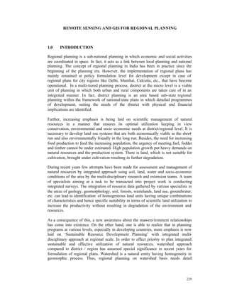
  • 1. REMOTE SENSING AND GIS FOR REGIONAL PLANNING 1.0 INTRODUCTION Regional planning is a sub-national planning in which economic and social activities are coordinated in space. In fact, it acts as a link between local planning and national planning. The concept of regional planning in India has been in practice since the beginning of the planning era. However, the implementation of regional plans has mainly remained at policy formulation level for development except in case of regional plans for city regions like Delhi, Mumbai, Calcutta, etc., that have become operational. In a multi-tiered planning process, district at the micro level is a viable unit of planning in which both urban and rural components are taken care of in an integrated manner. In fact, district planning is an area based sub-state regional planning within the framework of national/state plans in which detailed programmes of development, suiting the needs of the district with physical and financial implications are identified. Further, increasing emphasis is being laid on scientific management of natural resources in a manner that ensures its optimal utilization keeping in view conservation, environmental and socio -economic needs at district/regional level. It is necessary to develop land use systems that are both economically viable in the short- run and also environmentally friendly in the long run. Besides, the need for increasing food production to feed the increasing population, the urgency of meeting fuel, fodder and timber cannot be under estimated. High population growth put heavy demands on natural resources and the production system. There is land, which is not suitable for cultivation, brought under cultivation resulting in further degradation. During recent years few attempts have been made for assessment and management of natural resources by integrated approach using soil, land, water and socio-economic conditions of the area by the multi-disciplinary research and extension teams. A team of specialists aiming at a task to be transacted into project work is conducting integrated surveys. The integration of resource data gathered by various specialists in the areas of geology, geomorphology, soil, forests, wastelands, land use, groundwater, etc. can lead to identification of homogeneous land units having unique combinations of characteristics and hence specific suitability in terms of scientific land utilization to increase the productivity without resulting in degradation of the environment and resources. As a consequence of this, a new awareness about the man-environment relationships has come into existence. On the other hand, one is able to realize that in planning programs at various levels, especially in developing countries, more emphasis is now laid on ‘Sustainable Resource Development Planning’ with integrated multi- disciplinary approach at regional scale. In order to effect priority to plan integrated sustainable and effective utilization of natural resources, watershed approach compared to district / region has assumed special significance in recent years for formulation of regional plans. Watershed is a natural entity having homogeneity in geomorphic process. Thus, regional planning on watershed basis needs detail 229
  • 2. information on land and water resources as well as socio -economic conditions prevailing in the region. 2.0 NEED FOR STUDY OF RESOURCES AT REGIONAL LEVEL Aerial variations are very common in the distribution of resources, their development, and consumption pattern. This is being further intensified by the spatial variation in the utilization of resources found both at macro as well micro levels. Therefore, it is essential for planners to perceive the spatial pattern of resource distribution, utilization and conservation to have a rational approach on res ource planning and appraisal. No doubt, the ultimate aim of such study is to know about the nature and causes of poverty, backwardness or under-development and to formulate policy guidelines along which development might logically be pursued. In the process of analysis, the foremost aim is to identify the practical problems that arise from the existence in a specific area setting of a unique combination of natural and human resources. All these arguments clearly indicate the urgent need for more knowledge about the natural resources in developing countries. Without such information all development schemes can be undertaken only with a risk of failure. It is a fact that resources are considered important factor in planning and decision-making. 3.0 DATA NEEDS FOR REGIONAL PLANNING For effective planning and development exercises at regional level, variety of data on physical, demography, economic and social aspects are required and integrated. Keeping in view of the scope and content of plan and from overall development needs of the region, data needs for the regional planning can broadly be grouped into following data sets: A) Resource data in terms of area, land use, cropping area, water bodies & drainage, soil, mineral resources, etc., B) Demographic data relating to population, sex ratio, age structure, urban & rural population, scheduled castes & scheduled tribe population, occupational structure, migration, etc., C) Agro-economic data comprising information about cropped & irrigated area, agricultural production, land holdings, livestock population, etc., D) Socio-economic activities relating to industrial, fishing activities, tourism development as well as beneficiary of various schemes and programmes of development, E) Infrastructure data relating to availability and level of various facilities, utilities & services such as education, health, power, transport network, drinking water supply, drainage, etc. The above information for each sector may be categorized into 3 types as follows: i) Information related to the present state of development / resources for each sector, that would be derived as resource availability themes – indicators of development ii) Information related to projected needs of the plan period iii) Information related to the ‘gaps’ in each sector 230
  • 3. Based on these three aspects, the plan for future development can be decided upon in the overall context of the national/state/regional plan guidelines. 4.0 BASIC SPATIAL UNIT FOR REGIONAL PLANNING Conventionally, the regional planning process at various levels of planning employed standard areal/spatial units mainly due to convenience of data availability and to facilitate computation and management of data for inference. The planning unit i.e. the basic spatial unit (BSU) to be selected at various levels in regional planning exercise is shown below. The total canvas of the sectoral approach for the regional planning involves many sectors and is a major continuous activity. The constraints of data availability have also been a major aspect in the project formulation. LEVEL OF PLANNING REGION BASIC SPATIAL PLANNING UNIT Macro National/Sub-National State/District Meso State/Intra-State/Region District/Taluk/Block Micro District/Taluk/Block/Waters Panchayat/Village hed 5.0 INTEGRATION OF VILLAGE BOUNDARIES One of the important aspects of integrated regional and area-level planning for districts/regions/watershed is the combined analysis of the tabular socio-economic data with the thematic natural resources data. These two discrete datasets have different characteristics. The socio-economic and developmental data is mainly collected by the Census, available on a village basis. This dataset is arranged on a village-taluk-district hierarchy and is mainly tabular. As against this, the thematic data on natural resources is based on a spatial framework that follows the SOI topographical mapping system. An integrated planning exercise would require integrating these data sets to derive meaningful plan inputs. The integration would be to: a) Merge the attributes of the village and the natural resources for generating plan scenarios b) Spatial representation of the non-spatial tabular attributes of the village c) Generate village/taluk/district level information of natural resources for tabular updation 6.0 SPATIAL DATA ELEMENTS In order to obtain the information sets, different types of input data sets have been identified. These input data would be mainly thematic maps. The primary elements of the spatial thematic database are given below: a) Administrative map showing the boundaries of district/taluk/village for the study area 231
  • 4. b) Drainage Map showing details of drainage c) Transport Network map showing the details of railways, road/highway, etc. d) Slope map e) Land use / land cover Map f) Soil Map g) Ground water potential map h) Hydrogeomorphologica l map 7.0 ROLE OF REMOTE SENSING AND GIS FOR INTEGRATED REGIONAL PLANNING Remote sensing and GIS as tools have got very significant role to play in the integrated regional planning. Remote sensing data products both aerial photos and satellite imageries give information about different resources depending upon level, extent and accuracy of information required for the region. Having the capability of giving repetitive coverage, it is also helpful to record the extent of resources, their levels of utiliza tion, environmental impact, etc. Geographical Information System (GIS) has become a versatile tool for mapping these resources and linking one information with others for integrated planning purposes. A common geographical unit, a common scales provided by GIS and Remote Sensing has necessitated for integrated planning and development. Remote Sensing and GIS can play important role in. i) Identification and mapping and estimation of resources ii) Conservation development and management of resources iii) Monitoring environmental problems due to unscientific exploitation of resources iv) Integration of resources for balanced regional development. 8.0 CASE STUDY: UPPER BETWA WATERSHED, OBAIDULLAH GANJ BLOCK, RAISEN DISTRICT (M.P) To study the integrated resource planning for regional sustainable development, the upper Betwa watershed in Obaidullahganj block of Raisen district, Madhya Pradesh, India has been selected. The Raisen district is situated in the central part of Madhya Pradesh and falls under central plateau and hill region. The district lies mostly on the plateau and partly in the Narmada valley. The study area lies between 22o 52` to 23o 7` North latitude and between 77o 20` to 77o 47` East longitude covering an area of 68400 ha., which is 45% of the total g eographical area of the Obaidullahganj block. The watershed forming the upper part of river of Betwa hence it is named as upper Betwa watershed (2G2C7). The northern boundary of the watershed cuts at confluence of river Kaliasot near Mandideep town of Oba dullahganj block. The area bounded in the Northwest by Sehore and Bhopal district, in the south by Sehore, in the east by Goharganj tehsil of Raisen district. The area is well connected by rail and road transport. The upper Betwa watershed comprises of 126 villages. Majority of the population is engaged in agriculture sector. The land holding varies in size. The area is ecologically fragile and prone to unstable productivity levels. Crop production is carried out in an unbalanced manner that accelerates the run-off, soil erosion and other degradation process causing damage to the natural ecosystem. The watershed approach aims to optimize the use of land, water and vegetation in an integrated 232
  • 5. manner for curtailing soil erosion, improving water availability and increasing vegetative cover on a sustained basis. A development strategy based on integrated management of land and water for sustainable development in context to resource management to achieve economic and sustained agricultural production and to meet a diverse requirement of farm household while preserving the resource base. 8.1 METHODOLOGY A detail database on natural resources, terrain condition, socio-economic status and demography is generated to facilitate integrated spatial analysis. Various theme based aspect maps prepared for the study are drainage, watershed and surface water bodies, hydrogeomorphological, slope, soil, land use/land cover, transport network, settlement location, etc. The sequence of activities adopted for this study is described in methodology chart (Fig. 1). In the present study, Integrated Land and Water Information System version 1.4 (ILWIS) has been used, which is a raster based GIS package for creation, organization, storage, retrieval, analysis, display, and query and for making cartographic outputs in the form of maps and generation of statistical tabular report. 233
  • 6. OBJECTIVES Economic Growth, Basic Needs, Ecological Balance INFORMATION NEED NATURAL / PHYSICAL CONTEMPORARY SOCIO -ECONOMIC & RESOURCES TECHNOLGY D EMOGRAPHIC DATA • Soil • Agriculture • Geology • Water Management SPATIAL ANALYSIS • Geomorphology • Water Harvesting OF • Groundwater • Groundwater SOCIO -ECONOMIC • Land use/Land cover Exploration DATA • Rainfall & Climate • Animal Husbandary • Drainage • Fisheries • Social Profile • Watershed • Mineral Exploration • Demographic Profile • Slope map • Housing & Construction • Cultural Profile • Transportation Network • Energy & Power Engg. • Economic Status & Settlements • Health & Sanitation THEMATIC MAP INFORMATION PEOPLES/ PROGRAMMES NEEDS REGION IDENTIFICATION INFORMATION OF MULTI- • Socially Backward Areas/People THEMATIC INFORMATION • Economically Backward Areas (Composite Land Development Unit) • Areas lacking basic amenities NATURAL/PHYSICAL RESOURCE BASED DEVELOPMENT PLAN POSSIBILITY RESOURCE REGIONS RESOURCES MANAGEMENT SITE ACTION PLANS IMPLEMENTATION EVALUATION Fig. 1 Methodology Flow Chart 234
  • 7. 8.2 DATA SOURCE The primary source of data used in the present study includes IRS-1B LISS II geocoded data of the year 1994 and Landsat TM data of Path 145-44 for the year 1988, Survey of India (SOI) topographical map on 1:50,000 scale and other collateral data in the form of report. 8.3 DATA BASE CREATION Various thematic maps were prepared by visual interpretation of the satellite images & after data collected from ground survey. These thematic maps were digitized & converted into digital form using ILWIS 1.41 software. Various attribute data were also attached to these maps (like village wise census information etc.). ILWIS GIS package provides a combination of the different parameters of criterion-based analysis by weighted index method and Binary method for change detection between sets of two different map attributes. The most significant disadvantage of the system is that it would not provide symbols for cartographic representation of maps. Maps can be presented i) Location map of study area (Fig. 2) j) Drainage Map showing details of drainage (Fig. 3) k) Transport Network map showing the details of railways, road/highway, etc. (Fig. 4) l) Slope map (Fig. 5) m) Land use / land cover Map (Fig. 6 & 7) n) Soil Map (Fig. 8) o) Ground water potential map; (Fig. 9) p) Hydrogeomorphological map. (Fig. 10) Various information generated in the form of thematic maps and during field observation has been integrated in a GIS environment using ILWIS s/w. Following sectoral development plans are prepared for the region. • Agriculture resource development • Water resource development 8.4 AGRICULTURE RESOURCES DEVELOPMENT The databases generated earlier are used for preparation of integrated resource development plan. The objective of this study is to develop an alternative system based on cropping pattern, which fulfill the aspiration of farmer besides producing enough to feed the burgeon population. The system aims at enhancing the productivity per unit of land and water without endangering ecological balance. The following themes were integrated for the above purpose. • Land use/land cover • Hydro-geomorphology • Soil • Drainage density • Groundwater potential • Water resources development 235
  • 8. The thematic factor for measuring agriculture development is mainly dependent upon the factors, which directly related to agriculture. These factors are termed as indicators for agricultural development. There are number of inter-related parameters considered for preparation of agriculture resource development. These indicators are termed as composite land development unit (CLDU). The method is a composite function of its indicators like soil suitability, groundwater potential, existing cropping pattern and proposed water harvesting structure, etc. GIS integration was carried out for each of the value associated with the type of activity to be taken up on a parcel of land for sustainable agriculture activity. The integration of these parameters with land use, groundwater, and soil capability would provide a total picture of the aspect related to land development planning based on following criteria: 1. Categorization of agriculture development into different gr oup 2. Area requiring different conservation measures 3. Land having high capability, very good to good groundwater potential mainly in agriculture land 4. The land that are not suited for agriculture development and have some limited parameters. The development is based towards arresting the further degradation to get better economic return. 8.4.1 AGRICULTURE SENARIO The agriculture is the main occupation of the people in the region. Due to variability in the fertility of soil, irrigation practices, and depth of water table disparities are noticeable in the cropping pattern. The variations every year largely depend upon rainfall. Net area sown is 28291.16, which is 41.36% of the total geographic area. The gross cropped area is much higher accounting 69.74%. The area under fallow is about 1.45%. The category wise distribution of agricultural land is present in Table No.1. The irrigation facility has been greatly developed in NW and NE of the watershed. Dahod and Ratapani are the two -measure reservoir from where the canal is distributed. The area around Imaliya Gondi, Norganj, Dhaod, Goharganj and Tamot are well developed in terms of irrigation facility. Taking Rural and Urban area as a whole higher participation rate with respect to cultivation is observed in Obaidullahganj, Tamot and nearby Dhaod settlement. These areas are falling in VIth class having cultivator more than 300 persons (Fig. 11). A large number of villages have cultivators between less than 50 – 100 persons. However in the case of agriculture labour Obaidullahganj and Tamot are falling in highest category having labourer more than 400 persons. These trends indicates that Obaidullahganj and nearby settlement are the core areas from where the agricultural activity are being governed. The main workers are those who have worked during major part of the year. An agriculture labour has no risk in the cultivation and he doesn’t have any right to land on which he works. Nearly 50% of the cropped area is under wheat. The next most important crop is soyabean and gram covering 30% and 15% of the cropped area respectively. Other crops are Til, Tur pulse and paddy. Good fertile soil cover and good to moderate ground water potential characterize the area. The rainfall is erratic and rainy days are very few res ulting into crops failure and low crop yield. The agriculture is not economically viable to sustain economically. An integrated farming system based on livestock and appropriate combination on different land holding support a variety of non-farm activities. Such farming system provides food and 236
  • 9. economic security to the rural work force. The following activities are recommended for agriculture resource development (Fig. 12): • In-situ soil and moisture conservation • Double cropping with water management • Soil moisture conservation with vegetative barriers • Agro-horticulture • Agro-forestry • Horticulture plantation • Horticulture/Agro-horticulture • Vegetable cultivation • Farm forestry • Plantation for farmbund Table No. 1: CATEGORIWISE DISTRIBUTION OF CROPLAND Sl.no. Category Area in Ha. Percentage to total area CROPLAND (27602.75) (96.13) 1.1 Kharif 3230.75 11.25 1.2 Rabi 4613.50 16.06 1.3 Rabi + Kharif 19416.75 67.65 1.4 Fallow 3415.75 1.19 CROPLAND IN (1109.50) (3.86) FOREST 2.1 Kharif in Forest 443.25 1.54 2.2 Rabi in Forest 587.00 2.00 2.3 Fallow land 79.25 0.27 28712.25 100.00 237
  • 10. 8.5 WATER RESOURCES DEVELOPMENT The purpose of this study is to generate the site-specific action plan by integrating natural resource information with other collateral and socio-economic information for water resources development and soil conservation activities. This action plan would indicate the suggestive measures for optimal utilization of present water resources for sustainable development in the watershed. In the present analysis, the following thematic information were integrated for groundwater prospective zone demarcation: • Hydro-geomorphological map showing different landforms and lineaments influencing groundwater movement and occurrences. • Land use/land cover map (since land use/land cover types will be influenced by the groundwater availability of the region). • Hydrological data obtained from field (like pre -monsoon and post-monsoon water level, fluctuation, yield of the tube well (gph). The problem related to water resources development and conservation activities are: i) Scarcity of water for domestic and irrigation purpose. ii) Degradation of vegetative cover due to biotic presence. iii) Lake of awareness among the farmers regarding availability of water resources, mode of exploitation and adverse effects of over exploitations, etc. iv) The capacity of existing tanks has reduced due to siltation. The ground water potential zone map for the watershed has been made based on lithology, lineament, geomorphology, regional hydrology, and field parameters such as water table, seasonal fluctuation, etc. The area has been divided into four potential zones, such as good to very good, good to moderate, moderate to poor and poor. Construction of water harvesting structures such as Nala bunds, check dams, stop dams, trenches/pits, percolation tanks, boulder bund, sub-surface dyke, desiltation of tanks are proposed in action plan to provide water to agricultural field, horticulture, forest plantation and also for drinking water supply. The proposed water harvesting structures (fig. 13) will lead to: • Increase in soil moisture • To reduce the run-off and soil erosion • Increase in groundwater level • Desiltification of existing tanks would increase the stor age capacity of the tanks. After identification of problem of ground water development in the study area, site- specific action plan should be evolved. The groundwater availability occurs in shallow aquifers and is mostly tapped by open dug wells. The existing dug well can also be converted to dug cum bore wells to enhance the exploitation of groundwater. The areas suitable for shallow tube well and dug cum bore well have been proposed in the water resources development map. 238
  • 11. 9.0 CONCLUSION To sustain and enhance productivity of land management technique related to conservation and utilization of rainwater and soil resource are most important. It is desirable to use the land as per its inherent capability to optimize potential with minimum cost and damage. Adaptation of improved practices will reduce the risk of total crop failure and to bring greater stability to production. Depending upon the land use capability class and other resource combination, the land should put under arable crop, agro forestry, agro-horticulture, farm forestry and horticultural activity. The following observation we made from the study: a) Present land system and the constraints under which farmer are operating can be diagnosed to improve the existing land use pattern rather than transformation of land use. b) Appropriate soil conservation and management practices play a key roll to maintain over all productivity in a watershed. c) Suitable crop and their varieties matching with rain fall distribution and soil moisture condition could be selected for agro-horticulture practices. d) Bunding of fields is required to improve conservation of surface run-off during rainy season. e) Inter-cropping, mixed cropping and agriculture live stock practice should be adopted to sustain crop production. f) Motivation of people is required to switch over to intensive farming system. g) Specific studies should be taken up to demonstrate the various activities on Govt. lands and later to transfer the knowledge to local farmer. h) Nala bunds, check dams, stop dams and other water harvesting structures should be constructed to stop further soil erosion to conserve soil moisture and to raise the water table of the area. Based on the assessment and integration of resources, action plans for sustainable development of land and water resources are drawn. District authorities under the guidance of the State Government should undertake implementation of the action plan. Expert committees can be constituted for the purpose to review the day-to-day implementation of action plans. REFERENCES: Katare, K.V., Khare, K.A., Tanwar, B., Bharadwaj, P.S. (1997), Integrated Resource Development for Sustainable report in Upper Betwa Watershed Obaidullahganj Block Raisen Distt., Unpublished Report submitted for P.G. Diploma Course in HUSAG Div., of IIRS. ILWIS 1.41 User mannual, ILWIS Deptt. ITC, The Netherlands Lillesand, T.M. and Kiefar, R.W., 1994. Remote Sensing & image interpretation. John Wiley & Sons, Inc. IMSD – Technical Guidelines 1988, All India Soil & Land use Survey, New Delhi. Manual of Nation wide Land use / Land cover Mapping, 1989, Vol. Part. I, NRSA, Hyderabad. 239
  • 12. MADHYA PRADESH RAIS EN DISTRICT OBAIDULLAH GANJ BLOCK UPPER BETWA WATERSHED (OBAIDULLAH GANJ BLOCK) Fig.2 Location map DRAINAGE AND SURFACE WATERBODIES MAP UPPER BETWA WATERSHED, OBAIDULLAHGANJ BLOCK, RAISEN DISTRICT N LEGEND RIVER STREAMS WATERBODY 0 8 Fig.3 Kms 240
  • 13. TRANSPORT NETWORK MAP UPPER BETWA WATERSHED, OBAIDULLAHGANJ BLOCK, RAISEN DISTRICT N LEGEND METTALED ROAD UNMETALLED ROAD FOOTPATH RAILWAY LINE 0 8 Kms Fig.4 SLOPE MAP UPPER BETWA WATERSHED, OBAIDULLAHGANJ BLOCK, RAISEN DISTRICT LEGEND N <1 1-3 3-5 5-10 10-15 15-35 35-50 0 8 >50 Kms Fig.5 241
  • 14. LANDUSE LANDCOVER MAP (1988) UPPER BETWA WATERSHED, OBAIDULLAHGANJ BLOCK, RAISEN DISTRICT N LEGEND TOWN VILLAGE IND. WITH PLANTATION IND. WITHOUT PLANTATION AGRICULTURE DENSE FOREST OPEN/ DEGRADED FOREST SCRUB FOREST FOREST PLANTATION CROP LAND IN FOREST LAND WITH SCRUB LAND WITHOUT SCRUB 0 8 Kms STONY WASTE WATERBODY Fig.6 LANDUSE/LANDCOVER MAP (1994) UPPER BETWA WATERSHED, OBAIDULLAHGANJ BLOCK, RAISEN DISTRICT LEGEND KHARIF CROP RABI CROP DOUBLE CROP FALLOW LAND N KHARIF IN FOREST RABI IN FOREST DOUBLE CROP IN FOREST FALLOW IN FOREST DENSE FOREST OPEN/ DEGRADED FOREST SCRUB FOREST FOREST PLANTATION LAND WITH SCRUB LAND WITHOUT SCRUB WATERLOGGED LAND STONY WASTE BRICK KILN TANK/RESERVOIR TOWN / CITY 0 8 Kms VILLAGE IND. WITH DENSE PLANTATION Fig.7 IND. WITH SPARSE PLANTATION 242
  • 15. SOIL MAP UPPER BETWA WATERSHED, OBAIDULLAHGANJ BLOCK, RAISEN DISTRICT N LEG END VALLEY FILL TYPIC HAPLUSTERTS FINE VERTIC USTOCHREPTS FINE TYPIC HAPLUSTALFS LOAMY SKELTAL HAPLUSTOLL TYPIC HAPLUSTALFS TYPIC USTOCHREPTS LITHIC USTORTHANTS 0 8 WATER BODY Kms Fig.8 GROUND WATER POTENTIAL MAP UPPER BETWA WATERSHED, OBAIDULLAHGANJ BLOCK, RAISEN DISTRICT N LEGEND VERY GOOD TO GOOD GOOD TO MODERATE MODERATE TO POOR POOR WATERBODY GOOD AT LINEAMENT INTERSECTION 0 8 Kms Fig.9 243
  • 16. HYDROGEOMORPHOLOGICAL MAP UPPER BETWA WATERSHED, OBAIDULLAHGANJ BLOCK, RAISEN DISTRICT N LEGEND GOOD -GOOD GOOD -MODERATE MODERATE-POOR MODERATE-POOR POOR VERY POOR WATERBODY 0 8 LINEAMENT Kms ESCARPMENT Fig.10 DIP SLOPE VILLAGEWISE DISTRIBUTION OF AGRI. LABOURERS (1991) UPPER BETWA WATERSHED OBAIDULLAHGANJ BLOCK, RAISEN DISTRICT N LEGEND < 50 50-100 100-150 150-200 200-400 0 8 Kms >400 Fig.11 244
  • 17. AGRICULTURE RESOURCE DAVELOPMENT MAP UPPER BETWA WATERSHED, OBAIDULLAHGANJ BLOCK, RAISEN DISTRICT LEGEND HORTICULTURE AGROFORESTRY PLANTATION N AGROHORTICULTURE VEGETABLE CULTIVATION FARM FORESTRY PLANTATION ON FARM BUNDS NO ACTION NEEDED WASTELAND FOREST LAND SOIL/MOISTURE CONSR- PRESENT SYSTEM DOUBLE CROP PING WITH WATER MANAGEMENT SOIL/MOISTURE CONSR-VEGETATIVE BARRIER 0 8 Fig.12 Kms WATER RESOURCE DEVELOPMENT MAP UPPER BETWA WATERSHED, OBAIDULLAHGANJ BLOCK, RAISEN DISTRICT N LEGEND NALA BUND CHECK DAM BOULDER BUND SUB-SURFACE DYKE STOP DAM PERCOLATION TANK TANKS FOR DESILTIFICATION SUITABLE FOR PITTING 0 8 Kms SUITABLE FOR DUG / BORE WELL SUITABLE FOR SHALLOW TUBE WELL Fig.13 245