Weather and climate revised dade and duval
•
6 likes•3,476 views

The county powerpoint on Weather and Climate.

Recommended
More Related Content
What's hot
What's hot (20)
Similar to Weather and climate revised dade and duval
Similar to Weather and climate revised dade and duval (20)
More from Christine Snyder
More from Christine Snyder (20)
Recently uploaded
Recently uploaded (20)
Weather and climate revised dade and duval
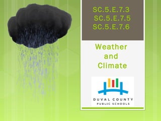
- 3. Grade 5 Big Idea 7: Earth Systems and Patterns Weather and Climate
- 4. Big Idea 7: Earth Systems and Patterns SC.5.E.7.3 - Recognize how air temperature, barometric pressure, humidity, wind speed and direction, and precipitation determine the weather in a particular place and time. AA SC.5.E.7.4 - Distinguish among the various forms of precipitation (rain, snow, sleet, and hail), making connections to the weather in a particular place and time. (Assesses as SC.5.E.7.3) SC.5.E.7.5 - Recognize that some of the weather-related differences, such as temperature and humidity, are found among different environments, such as swamps, deserts, and mountains. (Assesses as SC.5.E.7.3) SC.5.E.7.6 - Describe characteristics (temperature and precipitation) of different climate zones as they relate to latitude, elevation, and proximity to bodies of water. (Assesses as SC.5.E.7.3) Department of Mathematics and Science
- 5. Benchmark: SC.5.E.7.3 Recognize how air temperature, barometric pressure, humidity, wind speed and direction, and precipitation determine the weather in a particular place and time. SC.5.E.7.5 Recognize that some of the weather-related differences, such as temperature and humidity, are found among different environments, such as swamps, deserts, and mountains. SC.5.E.7.6 Describe characteristics (temperature and precipitation) of different climate zones as they relate to latitude, elevation, and proximity to bodies of water. Essential Question: How are weather tools used to describe weather conditions? How do clouds and precipitation form? How do the characteristics of different geographical areas affect climate? Vocabulary: Weather, (barometric) pressure, wind, speed, anemometer, barometer, wind vane, temperature, thermometer, cirrus, stratus, cumulonimbus condensation, precipitation, hail, sleet, rain, snow, clouds cumulus
- 6. Weather is the condition of the atmosphere at a particular place and time. Weather can change from day to day, hour to hour, or even minute to minute Weather
- 7. What is WEATHER? √ WEATHER is the mix of events that happen each day in our atmosphere including temperature, rainfall, wind, air pressure, and humidity. Department of Mathematics and Science
- 8. What are the Building Blocks of Weather ? Precipitation Clouds Wind Department of Mathematics and Science
- 9. What is Precipitation? Forms of Precipitation Rain Snow Sleet Hail Weather Condition Rain falls when the water making up clouds has become heavy enough to fall to Earth. Snow form in clouds where the temperature is below freezing as ice crystals or groups of many ice crystals called snowflakes. Sleet forms when a partially melted snowflake that has traveled through a warm layer of air or raindrop fall through a freezing layer of air. This last layer causes the raindrop to freeze or the melted snowflake to refreeze. Hail forms as a result of the strong updrafts common in thunderstorms usually in the summer.
- 10. Forms of Precipitation Group Project Prepare and deliver a 5 minute presentation on the four forms of precipitation: rain, snow, sleet, and hail. Research and develop an explanation for how each one forms and their related weather conditions. Be detailed, thorough, and use pictures. Department of Mathematics and Science
- 11. What determines the weather in a particular place and time? • air temperature • air pressure (barometric pressure) • wind speed and direction • humidity • precipitation Weather
- 12. How do we measure weather? Due to the unequal heating of the atmosphere by the Sun. Cloud cover affects the temperature of the air. Thermometers measure temperature in degrees Fahrenheit (°F) or Celsius (°C). This tells us how hot or cold it will be outside. Air Temperature
- 13. The measure of the weight of gases in the atmosphere. The pressure decreases as the altitude increases. There is more evaporation when the air pressure is low. Barometers measure air pressure. Air pressure may be measured in inches of mercury (in. Hg.) or in millibars (mb). Increasing air pressure can mean fair weather. Decreasing air pressure can mean rainy weather Air Pressure
- 14. Wind Speed and Direction Air moves from areas of high pressure to areas of low pressure as wind. high pressure low pressure
- 15. Wind vanes show the direction the wind is blowing: north, south, east, or west. A change in wind direction can mean a change in weather. Anemometers measure wind speed in kilometers or miles per hour. Knowing how fast the wind is blowing can help figure out how much damage a storm may cause. Wind Speed and Direction How do we measure weather?
- 16. On hot and sticky summer days the air feels humid. Humidity is the amount of water vapor that air can hold. Warm air holds more water vapor than cool air. Humid air is more likely to produce clouds and precipitation than drier air. Dry air is more likely to come with fair weather. Humidity
- 17. Hygrometers measure the amount of water vapor in the air, or humidity. Hygrometer readings can show how moist the air will feel or when precipitation may happen. Rain gauges measure rainfall in centimeters (cm) or inches (in.). Scientists can use rainfall measurements to help predict droughts or floods. Some people use rainfall measurements to help take care of gardens. Humidity
- 18. How do weather tools help us learn about weather patterns?
- 19. Land heats faster and to higher temperatures than water. Land cools faster and to lower temperatures than water. This means that air temperature variations are greater over land than over water. Earth’s weather is driven by the intense heat of the Sun. The Sun does not warm Earth evenly. Air Temperature
- 20. Air near the equator is heated, becomes lighter, and rises. At the poles, the air is cooled, becomes heavier, and settles downward. Air Pressure
- 21. The picture on the left is a 2-dimensional model of air pressure. The closer the lines are the more pressure there is. Air Pressure
- 22. warm air cool airTemperature affects air pressure. When air gets warmer, gas particles get farther apart. The air gets lighter and rises. Rising air presses down with less force, which creates a low. A low is an area of low air pressure. When a low forms, clouds tend to form, and you will often have rain. Temperature can affect air pressure Air Pressure
- 23. Temperature can affect air pressure When air gets cooler, the gas particles get closer together. The air gets heavier and sinks. It presses down with more force, creating a high. A high is an area of high air pressure. Clouds can’t form where air is sinking. So when air pressure gets higher, you will often see clear skies. warm air cool air
- 24. What is Wind ? Moving Air Measuring Wind Direction – Build a Wind Vane: Measuring Wind Speed - Build an anemometer Wind scale Department of Mathematics and Science
- 25. What is air pressure ? The weight of air pushing on everything around it. More on air pressure Measuring air pressure – Use a barometer Explore the Jumping Ping Pong Balls Inquiry Department of Mathematics and Science
- 26. Weather observations & Tools Observations temperature amount of precipitation air pressure humidity wind direction wind speed cloud conditions including type and altitude of clouds Recipe for Weather Video Quiz: Weather Smart Heat, Wind and Pressure The Whatdaya Know Quiz Show: Weather Tools thermometer rain gauge Barometer hygrometer wind vane anemometer & radar cloud classification charts
- 27. Weather - Tool Match Up Weather Observations 1. Temperature 2. Rain Fall 3. Wind Direction 4.Wind Speed 5.Air Pressure 6. Cloud Conditions Weather Tool to Use A. Wind Vane B. Thermometer C. Rain Gauge D. Barometer E. Anemometer F. Cloud Identification Chart
- 28. Weather - Tool Match Up Weather Observations 1. Temperature 2. Rain Fall 3. Wind Direction 4.Wind Speed 5.Air Pressure 6. Cloud Conditions Weather Tool to Use B. Thermometer C. Rain Gauge A. Wind Vane D. Anemometer E. Barometer F. Cloud Identification Chart
- 29. Weather Map Cold Front Warm Front Stationary Front - a front between warm and cold air masses that is moving very slowly or not at all Occluded Front - a composite of two fronts Look at the map for January 13, 2012. •Where do you see the symbol for each type of front? •What kinds of weather are predicted in some areas shown on this map? •Where do you see areas of high and low pressure?
- 30. Clouds Clouds are made of tiny water droplets, ice crystals, or both that condense on dust particles in the air. A cloud droplet is so small that the resistance of air prevents it from falling fast enough to reach the ground before it evaporates. Clouds
- 31. What are the basic Cloud Types ? 1. Cumulus 2. Cirrus 3. Stratus 4. Cumulonimbus fair weather” fluffy, white cotton ball clouds ice clouds thin, white clouds that can cover the whole sky producing little precipitation thunderstorm clouds
- 32. There are many different types of clouds. We will concentrate on four different types. Cirrus Cumulonimbus Cumulus Stratus
- 33. Cirrus Clouds High-level clouds form more than 6 km or 6,000 m above the ground. They are thin, wispy, and white or light grey You usually see these clouds before the arrival of precipitation. Clouds
- 34. Cirrus Clouds High Level Clouds Cirrus clouds are ice clouds. They can look like delicate white feathers or streamers. They are always more than three miles up where the temperature is below freezing, even in summer. Wind currents twist and spread the ice crystals into wispy strands. Department of Mathematics and Science
- 35. Cumulonimbus Clouds Cumulonimbus clouds grow vertically, having rising air inside them. The bases of these clouds can be as low as 1 km above the ground. Rising air can push the tops of these clouds up higher than 12 km or 12,000 m. These clouds are known to cause thunderstorms which produce heavy rain, strong winds, hail, and even tornadoes. Clouds
- 36. Cumulonimbus Mid Level Clouds Cumulonimbus clouds are a sure sign of bad weather to come. These clouds build up on hot days when warm, wet air rises very high into the sky. Up and down winds within the cloud may push water droplets up to very cold parts of the atmosphere, where they freeze. When the ice drops come back down, they get another coating of water and are pushed back up to freeze again. Finally, they get too heavy to stay in the cloud and fall to the Earth as hail.
- 37. Cumulus Clouds Cumulus clouds occur in fair weather. They can grow into cumulonimbus clouds. They are puffy or cotton-like. These clouds form when warm air rises and reaches a level of cool air, where the moisture in the air condenses. Cumulus clouds can be between 2 – 7 km or 2,000 – 7,000 m above ground. Clouds
- 38. Cumulus Clouds Mid Level Clouds Cumulus clouds are the fluffy, white cotton ball or cauliflower-looking clouds with sharp outlines. They are "fair weather clouds" and they are fun to watch as they grow and change in shape and size. Cumulus clouds make beautiful sunsets. Department of Mathematics and Science
- 39. Stratus Clouds Stratus clouds are low-level clouds and are often seen less than 2 km or 2,000 m above the ground. Stratus clouds can cover the whole sky. These clouds look dark because little sunlight gets through the layer of clouds. Clouds
- 40. Stratus Clouds Low Level Clouds Stratus clouds often look like thin, white sheets covering the whole sky. Since they are so thin, they seldom produce much rain or snow. Sometimes, in the mountains or hills, these clouds appear to be fog.
- 41. Clouds in Art Activity Using the S’COOL Cloud Chart 1. Cumulus 2. Cirrus 3. Stratus 4. Cumulonimbus A. thunderstorm clouds B. ice clouds C. a. fair weather” fluffy, white cotton ball clouds D. thin, white clouds that can cover the whole sky producing little precipitation Clouds Type Quiz: Match both Columns
- 42. Clouds Type Quiz Answers 1. Cumulus 2. Cirrus 3. Stratus 4. Cumulonimbus C. fair weather” fluffy, white cotton ball clouds B. ice clouds D. thin, white clouds that can cover the whole sky producing little precipitation A. Thunderstorm clouds
- 44. In your interactive journal complete weather writing prompt. http://www.weatherwizkids.com/weather-forecasting.htm
- 45. Have you ever wondered … Why one area of the world is a desert or another a rainforest? Why some areas have seasons and others don’t? The answer is climate. Climate is the average weather in an area over a long period of time (more than 30 years). It includes weather conditions, weather extremes, droughts, and rainy periods. The climate of an environment will determine what plants will grow and what animals will inhabit it.
- 46. What is the difference between weather and climate? Weather is what is happening each day in our atmosphere including temperature, rainfall, wind, air pressure, and humidity. Climate is the average weather in an area over a long period of time (more than 30 years). It includes weather conditions, weather extremes, droughts, and rainy periods. The climate of an environment will determine what plants will grow and what animals will inhabit it. What is our climate in North Florida?
- 47. What is climate? Climate is the general weather of an area over a long period of time. The climate of a region affects the environments found there. Let us take a look…
- 48. What is climate? Climate is the general weather of an area over a long period of time. The climate of a region affects the environments found there.
- 49. What are Factors that Affect Climate Zones? ScienceSaurus Handbook p. 217 Latitude or the distance of a place north or south of the equator Elevation(altitude) or the distance of a place above sea level Proximity to water (closeness)
- 50. Latitude is the distance north or south of the Equator. Latitude affects temperature. Generally it is warmest near the Equator and coolest near the poles. So the closer an area is to the Equator, the warmer the climate. Factors Affecting Climate: Latitude equator north south
- 51. Latitude √ Latitude or the distance of a place north or south of the equator, affects the temperatures that commonly occur in an area. As the Sun warms the equator more than the poles, climate varies with latitude. Temperatures are generally lower as your get farther from the equator (higher latitudes). This image shows how sea surface temperatures changes at different latitudes. Red colors indicate warmer ocean water, blues and purples indicate cooler ocean water.
- 52. The climate is tropical near the Equator. The climate is moderate in the temperate zones. The climate is extremely cold near the poles.
- 53. Comparing Climates at the Same Latitude√ Typical Winter San Diego 9º C 48ºF Phoenix 5º C 41ºF Typical Summer San Diego 24º C 75ºF Phoenix 41º C 106ºF 30° 30° 45° 45°
- 54. Elevation affects climate. Elevation is the height of an area above sea level. Factors Affecting Climate: Elevation What do you notice in the picture?
- 55. Elevation Why do you think the top of the nearby mountain is covered in snow while the plants in the meadow are green? The top of the mountain is at a higher elevation, therefore the temperature is colder than down in the meadow.
- 56. Elevation Elevation or the distance of a place above sea level, affects an area’s temperature. Temperatures generally decrease as elevation increases – about 6.5º Celsius cooler for every kilometer you climb. As a result, areas at high elevations, such as tall mountains, are generally cooler than places closer to sea level.
- 57. Mountains can also affect the amount of precipitation that an area on either side of a mountain receives called the rain shadow effect.
- 58. How can Proximity to water affect a climate? Water temperature rises and falls much more slowly than land or air temperatures. This is why air at the shore or beach is generally cooler than air over land. In winter, the water is generally warmer than the air over the land. The water helps to keep air temperatures from changing a lot over land near the ocean. This makes for mild climates in shore areas. Areas further inland generally have greater differences in temperature from summer to winter.
- 59. Temperatures are usually milder near large bodies of water such as oceans and large lakes. Water heats and cools at a slower rate than land. Factors Affecting Climate: Proximity to Large Bodies of Water Ocean water heats up during the summer. During the fall, the ocean water slowly releases this heat and warms the air. This means that temperature near the coast may not be as cold as temperatures inland away from the water. Also, the water does not get as hot or as cold as the land does. How does this affect climate?
- 60. Climate Data for Key West, FL (2010) Month Average High Temperature °C (°F) Average Precipitation cm (in) January 23.8 (74.8) 5.1 (2.0) February 24.1 (75.4) 4.6 (1.8) March 25.9 (78.6) 4.3 (1.7) April 27.6 (81.7) 4.6 (1.8) May 29.5 (85.1) 8.9 (3.5) June 30.9 (87.6) 13.0 (5.1) July 31.7 (89.1) 9.1 (3.6) August 31.8 (89.2) 12.7 (5.0) September 31.1 (88.0) 14.7 (5.8) October 29.1 (84.4) 11.2 (4.4) November 26.7 (80.0) 7.1 (2.8) December 24.5 (76.1) 5.1 (2.0) Key West, Florida is an island at the tip of Florida. It is known as the southernmost city in the United States. Key West is located at 24.55°N, which is very close to the tropical climate zone. There are no mountains, but it is surrounded by a large body of water. •When is the hottest month? (°C) •When is the coldest month? •What month gets the least precipitation? •What month gets the most precipitation? •What can you infer about Key West’s climate in the winter? •What can you infer about Key West’s climate in the summer?
- 61. Climate Data for Fargo, North Dakota (2010) Month Average High Temperature °C (°F) Average Precipitation cm (in) January -9.2 (15.4) 1.8 (0.7) February -6.1 (21.1) 1.3 (0.5) March 1.4 (34.6) 4.6 (1.8) April 12.1 (53.8) 6.4 (2.5) May 20.3 (68.5) 7.1 (2.8) June 25.2 (77.4) 7.1 (2.8) July 28.6 (83.4) 6.9 (2.7) August 27.4 (81.3) 6.1 (2.4) September 20.8 (69.4) 5.1 (2.0) October 13.7 (56.7) 4.3 (1.7) November 2.7 (36.8) 1.8 (0.7) December -6.6 (20.1) 1.8 (0.7) •When is the hottest month? (°C) •When is the coldest month? (°C) •What month gets the least precipitation? •What month gets the most precipitation? •What can you infer about Fargo’s climate in the winter? •What can you infer about Fargo’s climate in the summer? Fargo, North Dakota is a city found in the Great Plains of the United States. Fargo is located at 46.89° N, which is in the northern part of the temperate climate zone. There are no mountains or large bodies of water nearby.
- 62. • How do the winter temperatures in Fargo compare to the winter temperatures in Key West? • In which city would it most likely snow? How do you know? • How would you describe the climate where you live? Climate Data for Key West, FL (2010) Month Average High Temperature °C (°F) Average Precipitation cm (in) January 23.8 (74.8) 5.1 (2.0) February 24.1 (75.4) 4.6 (1.8) March 25.9 (78.6) 4.3 (1.7) April 27.6 (81.7) 4.6 (1.8) May 29.5 (85.1) 8.9 (3.5) June 30.9 (87.6) 13.0 (5.1) July 31.7 (89.1) 9.1 (3.6) August 31.8 (89.2) 12.7 (5.0) September 31.1 (88.0) 14.7 (5.8) October 29.1 (84.4) 11.2 (4.4) November 26.7 (80.0) 7.1 (2.8) December 24.5 (76.1) 5.1 (2.0) Climate Data for Fargo, North Dakota (2010) Month Average High Temperature °C (°F) Average Precipitation cm (in) January -9.2 (15.4) 1.8 (0.7) February -6.1 (21.1) 1.3 (0.5) March 1.4 (34.6) 4.6 (1.8) April 12.1 (53.8) 6.4 (2.5) May 20.3 (68.5) 7.1 (2.8) June 25.2 (77.4) 7.1 (2.8) July 28.6 (83.4) 6.9 (2.7) August 27.4 (81.3) 6.1 (2.4) September 20.8 (69.4) 5.1 (2.0) October 13.7 (56.7) 4.3 (1.7) November 2.7 (36.8) 1.8 (0.7) December -6.6 (20.1) 1.8 (0.7)
- 63. What is the biggest factor that influences weather and climate worldwide? Sun Its heat travels in all directions from the Sun and is the ultimate source of all energy on Earth and our seasons. Its energy is responsible for all sorts of weather events. Wind occurs when sunlight heats the ground, which heats the air above it, which rises, so that cool air whisks in to take its place. The Sun’s Angle on Different Parts of the Earth
- 64. What do you notice in the pictures of these three different environments? Weather Characteristics of Different Environments
- 65. Deserts are usually very dry, but they can be either cold or hot. Less than 25 cm of rain may fall each year in a desert. How does this affect the environment? Weather in the Desert
- 66. Weather in a Swamp Swamps are usually located in warm and wet environments. The swamps of the Florida Everglades contribute to the warm and humid weather conditions. How does this affect the environment?
- 67. Weather in the Mountains Mountains can have different climates. The mountain tops usually have cool temperatures and low humidity. The base of the mountains will have the climate of the surrounding area. How does this affect the environment?
- 68. How Do Different Environments’ Climate Differ? Environment High Temperature Low Temperature Precipitation Desert 113 °F (45 °C) 32 °F (0 °C) Very dry - receives less than 25 cm (16 in) of rain each year Tundra Summer 45 - 50°F Winter - 20 - 30 ° F (-° C) 30 to 85 cm Temperate Grassland Summer can be well over 38°C (100° F) Winter can be as low as -40° C (-40° F) 50.8 to 88.9 cm (20-35 inches) More rain than deserts, less rain than forests Tropical Rainforest 80–82ºF (27–28ºC) Very wet – receives 120 to 650 cm (-- in) of rain each year
- 69. Discovery Exploration: Types of Climates
- 70. Three Basic Climate Zones Factors that determine Climate Zones are temperature, humidity & precipitation
- 71. What are the Three Main Climate Zones? ScienceSaurus Handbook p. 216
- 72. Polar Temperature – cold Humidity - dry Precipitation - minimal
- 73. The climate is extremely cold near the poles.
- 74. Polar Climates Polar climates are cold and dry, with long, dark winters. Average monthly temperature is below freezing (0° C, 32° F) for 8 to 10 months. Maximum summer temperature is no more than 10 °C (42° F) . There are short burst of vegetation when snow melts that includes lichen, moss, some flowering plants. There are no trees.
- 75. Temperate Temperature –moderate; warm summers, cool winters Humidity – wet or dry Precipitation – year- round Temperate Temperate
- 76. The climate is moderate in the temperate zones.
- 77. Temperate Climates Temperate climates have warm summers and cool winters with year-round rain or snow. Temperate forests are characterized by deciduous trees, which lose their leaves during the winter.
- 78. Tropical Temperature – warm Humidity – wet or dry Precipitation – wet or dry Near the equator is the hottest point on Earth!!
- 79. The climate is tropical near the Equator.
- 80. Tropical Climates Tropical rainforests are found in regions near the equator. Here, the climate is hot and wet all year, with temperatures remaining at around 80–82ºF (27– 28ºC). Rainforests: As the name suggests, rainforests receive a lot of rain. The temperature stays warm in the rainforest all year long
- 82. Climate Zones Climate 1. Polar 2. Temperate 3. Tropical Climate Conditions A. hot and wet all year B. very cold and dry all year C. mild to cold winters and mild to dry hot summers
- 83. Concept Review: Climates Why are climates different in different regions of the world? Climate depends on three factors: The region’s nearness to bodies of water, the elevation of the land, and the way the sun hits the region of Earth. The way the sun hits the Earth’s region determines its weather and climate. Near the equator, the sun hits the Earth directly. This makes climates near the equator warm. The sun hits the Earth less directly north and south of the equator. Climates north and south of the equator tend to be cooler. If a region is near a large body of water, sometimes the climate is more moist and cooler. If a region is near a mountain range, sometimes the climate on one side of the mountain is different than the climate on the other side of the mountain.
- 84. Concept Review: Types of Climates 1. What characterizes a polar climate? Answer: Polar climates have cold temperatures. They can be either snowy or very dry. 2. What characterizes a tropical climate? Answer: A tropical climate is warm, and has wet air and a lot of precipitation. 3. What characterizes a temperate climate? Answer: A temperate climate has moderate precipitation and has a range of temperatures.
- 85. Sample FCAT 2.0 Question SC.E.5.7.3 Florida Achieves 1) Which answer correctly explains the difference between sleet and hail? A. Sleet is usually part of a thunderstorm, and hail comes from thin layers of rain clouds. B. Sleet is smaller than hail and usually falls in the winter, while hail usually falls in the summer. C. Sleet and hail are the same except that sleet usually falls in summer and hail usually falls in winter. D. Sleet is snow that forms as it falls through cold air, and hail is rain that freezes when it hits the ground.
- 86. Sample FCAT 2.0 Question SC.E.5.7.3 Florida Achieves 2) As the weather gets colder, the air pressure usually goes up. Why does this happen? A. As the temperature drops, the air takes up more space and presses down harder on the ground. B. Colder weather makes the air denser, and the increased weight of the air means that there is more air pressure. C. Cold weather causes Earth to cool, and the heat that leaves Earth pushes against the air and increases pressure. D.When the weather is colder, the clouds weigh more as ice begins to form. The heavier clouds increase the air pressure.
- 87. Sample FCAT 2.0 Question SC.E.5.7.3 Florida Achieves 3) Which answer choice correctly lists environments from most dry to least dry? A. desert, tundra, grassland, rainforest B. grassland, rainforest, desert, tundra C. tundra, rainforest, grassland, desert D. rainforest, grassland, tundra, desert
- 88. Sample FCAT 2.0 Question SC.E.5.7.3 Florida Achieves 4) Which answer choice lists the weather conditions that would most likely result in snow? A.warm temperature, light winds, low humidity B.low humidity, freezing temperature, light clouds C.freezing temperature, light clouds, heavy winds D.freezing temperature, heavy clouds, high humidity
- 89. Sample FCAT 2.0 Question SC.E.5.7.1 Florida Achieves 5) Water runs down creeks and rivers until it flows into the ocean. At what stage in the water cycle does the water return to the creeks and rivers? A. condensation B. evaporation C. precipitation D. vapor formation
- 90. Sample FCAT 2.0 Question SC.E.5.7.1 Florida Achieves 6) Which of the following best describes what clouds are made of? A.fog that has risen from the ground B.large amounts of water that has evaporated C.water vapor that has condensed into droplets D.rain or snow that has been pushed together by wind
- 91. Sample FCAT 2.0 Question SC.E.5.7.1 Florida Achieves 7) Which answer best explains why clouds usually form high in the sky? A. It is cold enough there for the water vapor to begin condensing. B. It is warm enough there for evaporated water to expand into clouds. C. It is dry enough there for precipitation to form from condensed water vapor. D. It is windy enough there for water droplets to get pushed together into clouds.
- 92. Sample FCAT 2.0 Question SC.E.5.7.1 Florida Achieves 8) Hurricanes generally produce a great deal of precipitation. Where do these storms collect the moisture needed to produce so much precipitation? A.from water evaporating quickly off the warm ocean surface B.from the energy of ocean currents moving water into the air C. from cold ocean water meeting warm land and producing clouds D.from rain condensing as the hurricane passes over high mountains
- 94. Interactive Sites to Explore http://interactivesites.weebly.com/seasons--weather.html http://science.dadeschools.net/byod/students/elStudents/ Quarter 3 http://scied.ucar.edu/weather http://scijinks.jpl.nasa.gov//
- 95. Weather & Climate ResourcesVideos: http://videoclips.mrdonn.org/weather.html http://www.teachersdomain.org/asset/idptv11_vid_d4kwea/ http://video.nationalgeographic.com/video/science/earth-sci/climate-weather-sci/ http://video.nationalgeographic.com/video/kids/forces-of-nature-kids/weather-101-kids/ http://www.sciencekids.co.nz/videos/weather/clouds.html http://weatherthings.com/TeacherVideos.html Air pressure act: http://www.srh.noaa.gov/jetstream/atmos/ll_engagement.htm http://www.sercc.com/education_files/aer_fall_01.pdf NASA Our World: http ://www.nasa.gov/audience/foreducators/nasaeclips/search.html?terms=What%20is%20weather%3F Weather Quizzes: Weather quiz: http://www.neok12.com/quiz/SEASON04 Instruments quiz: http://www.neok12.com/quiz/SEASON03
- 96. Making Weather Instruments Weather Stations: http://teacher.scholastic.com/activities/wwatch/index.htm Barometer: http://www.sercc.com/education_files/barometer.pdf http://homepage.eircom.net/~ kogrange/6th_ys_2009_pressure7_barometer.html Wind vane: http ://www.ciese.org/curriculum/weatherproj2/en/docs/windvane.shtml Wind scale: http://www.wrh.noaa.gov/sto/WindTable.php Finding Cloud Charts: http://scool.larc.nasa.gov/
- 97. Weather Sites for Kids http://www.edheads.org/activities/weather/index.shtml http://weather.weatherbug.com/weather- education/exploration_zone.asp?focus=2 http://weatherwizkids.com/ http://scijinks.jpl.nasa.gov/weather-menu http://www.eo.ucar.edu/webweather/ http://www.bbc.co.uk/schools/whatisweather/ http://www.scilinks.org/Harcourt_Hsp/HspStudentRetrieve.aspx? Code=HSP103 http://www.internet4classrooms.com/science_elem_weather.h tm http://www.fi.edu/weatherED/
- 98. Discovery Education Resources Exploration: Types of Climates Reading Passage: A Trip Through Two Climate Zones eBook: A Trip to the Tropics
Editor's Notes
- Animated balloon floats into distance (Advanced) To reproduce the balloon on this slide, do the following: On the Home tab, in the Slides group, click Layout, and then click Blank. On the Home tab, in the Drawing group, click Shapes, under Basic Shapes, click Teardrop (second row, fourth from the left). On the slide, drag to draw the teardrop. Under Drawing Tools, on the Format tab, in the Size group, click the Size and Position dialog box launcher, and then in the Format Shape dialog box, click Size in the left pane. In the Size pane, under Size and rotate, do the following: In the Height box, enter 1.66”. In the Width box, enter 1.7”. In the Rotation box, enter 133⁰. Also in In the Format Shape dialog box click Fill in the left pane, select Gradient fill in the Fill pane, and then do the following: In the Type list, select Linear. In the Angle box, enter 90. Under Gradient stops, click Add gradient stops or Remove gradient stops until three stops appear in the slider. Also under Gradient stops, customize the gradient stops as follows: Select the first stop in the slider, and then do the following: In the Position box, enter 13%. Click the button next to Color, and then under Theme Colors click Red, Accent 2, Darker 25% (fifth row, sixth option from the left). In the Transparency box, enter 0%. Select the next stop in the slider, and then do the following: In the Position box, enter 66%. Click the button next to Color, and then under Theme Colors click Red, Accent 2, Lighter 40% (fourth row, sixth option from the left). In the Transparency box, enter 0%. Select the last stop in the slider, and then do the following: In the Position box, enter 100%. Click the button next to Color, and then under Theme Colors click White, Background 1 (first row, first option from the left). In the Transparency box, enter 0%. Also in the Format Shape dialog box in the left pane, click Line Color, and in the Line Color pane, select No line. On the Home tab, in the Drawing group, click Shapes, and then under Basic Shapes, click Isosceles Triangle (third option from the left). On the slide, drag to draw the isosceles triangle. Select the isosceles triangle. Under Drawing Tools, on the Format tab, in the Size group, click the Size and Position dialog box launcher. In the Format Shape dialog box, click Size in the left pane. in the Size pane, under Size and rotate, do the following: In the Height box, enter 0.16”. In the Width box, enter 0.11”. In the Rotation box, enter 8⁰. Also in the Format Shape dialog box, in the left pane, click Fill. In the Fill pane, click Solid Fill. Click the button next to Color, and then under Theme Colors click Red, Accent 2, Darker 25% (fifth row, sixth option from the left). Also in the Format Shape dialog box in the left pane, click Line Color, and then in the Line Color pane select No line. Position the isosceles triangle on the slide so that the sharp angle touches the point of the teardrop. On the Home tab, in the Drawing group, click Shapes, and under Lines click Curve (tenth option from the right). On the slide, draw a curve (for, example, one that has four points). Press ESC to end the curve. Select the curvy line. On the Home tab, in the Drawing group, click the arrow next to Shape Outline, and then under Theme Colors, click White, Background 1, Darker 15% (third row, first option from the left). On the Home, in the Drawing group, click Shape Outline, point to Weight, and then click 1 pt. Position the curve on your slide so that one end is touching the bottom edge of the isosceles triangle. On the Home tab, in the Drawing group, click Shapes, and under Basic Shapes, select Oval (second option from the left). On the slide, drag to draw an oval. Select the oval. Under Drawing Tools, on the Format tab, in the Size group do the following: In the Shape Height box, enter 1.2”. In the Shape Width box, enter 1.2”. Under Drawing Tools, on the Format tab, in the Shape Styles group, click the arrow next to Shape Fill, point to Gradient, and then click More Gradients. In the Format Shape dialog box, in the left pane click Fill. In the Fill pane, select Gradient fill. In the Type list, select Radial. Click the button next to Direction, and then click From Center (third option from the left). Under Gradient stops, click Add gradient stops or Remove gradient stops until three stops appear in the slider. Also under Gradient stops, customize the gradient stops as follows: Select the first stop in the slider, and then do the following: In the Position box, enter 0%. Click the button next to Color, and then under Theme Colors click White, Background 1 (first row, first option from the left). In the Transparency box, enter 0%. Select the first stop in the slider, and then do the following: In the Position box, enter 50%. Click the button next to Color, and then under Theme Colors click White, Background 1 (first row, first option from the left). In the Transparency box, enter 81%. Select the first stop in the slider, and then do the following: In the Position box, enter 71%. Click the button next to Color, and then under Theme Colors click White, Background 1 (first row, first option from the left). In the Transparency box, enter 100%. Also in the Format Shape dialog box in the left pane, click Line Color, and then in the Line Color pane click No line. Position the oval at the top, left edge of the teardrop to create a lighting effect. Press and hold CTRL, and then select all four objects. On the Home tab, in the Drawing group, click Arrange, and then under Group Objects click Group. To reproduce the animation effects on this slide, do the following: On the slide, select the balloon and drag it off the bottom left corner of the slide. On the Animations tab, in the Advanced Animation group, click Add Animation, and then click More Motion Paths. In the Motion Path dialog box, under Lines & Curves, click Diagonal Up Right, and then click OK. On the slide, select the motion path and then drag the end point (red triangle) across the slide and off the top right corner. On the Animations tab, in the Timing group, in the Start list, select With Previous. On the Animations tab, in the Timing group, in the Duration box, enter 32. On the Animations tab, in the Advanced Animation group, click Add Animation, and then under Emphasis click Grow/Shrink. On the Animations tab, in the Timing group, in the Start list, select With Previous. On the Animations tab, in the Timing group, in the Duration box, enter 32. On the Animations tab, in the Animation group, click Effect Options, and then click the Show Additional Effect Options dialog box launcher. In the Grow/Shrink dialog box, under Settings, click the arrow next to the Size box and in the Custom box, enter 2%. To reproduce the background on this slide, do one of the following: Note: You can save the background of this slide template as a picture and use it in your own slides. To use the same background as this slide, do the following: Right-click the sky background on the original template, and then click Save Background. Save the file as a JPEG (.jpg) file format. On the Design tab, in the Background group, click Background Styles, and then click Format Background. In the Format Background dialog box, click Fill in the left pane, select Picture fill in the Fill pane, and then under Insert from click File. In the Insert Picture dialog box, select a picture, and then click Insert.
- SC.5.E.7.3 Recognize how air temperature, barometric pressure, humidity, wind speed and direction, and precipitation determine the weather in a particular place and time. SC.5.E.7.5 Recognize that some of the weather-related differences, such as temperature and humidity, are found among different environments, such as swamps, deserts, and mountains. SC.5.E.7.6 Describe characteristics (temperature and precipitation) of different climate zones as they relate to latitude, elevation, and proximity to bodies of water.
- BBC site http://www.bbc.co.uk/schools/whatisweather/aboutweather/flash_menu.shtml is a better fit to primary classes.
- Activities: Make Fog in a Jar; Create a Portable Cloud √ Activity: Winds: Soaking Up the Rays ( Power of Science Weather Book p. 20 1 Video: Clouds Make Our World a Better Place √ Video: Water Vapor, Clouds, Dew and Frost
- Elaborate: This can be an extension of the CER – How do snowflakes form?
- SC.5.E.7.3 Recognize how air temperature, barometric pressure, humidity, wind speed and direction, and precipitation determine the weather in a particular place and time. SC.5.E.7.5 Recognize that some of the weather-related differences, such as temperature and humidity, are found among different environments, such as swamps, deserts, and mountains. SC.5.E.7.6 Describe characteristics (temperature and precipitation) of different climate zones as they relate to latitude, elevation, and proximity to bodies of water. What does a weather balloon do and measure? http://www.ehow.com/video_4872167_weather-balloon-do-measure_.html
- Adapted from Weather by Seymour Simon
- Air Pressure (barometric pressure) is the measure of the weight of gases in the atmosphere. The pressure of the atmosphere is measured with an instrument called a barometer. The pressure decreases as the altitude increases. There is more evaporation when the air pressure is low.
- SC.5.E.7.3 Recognize how air temperature, barometric pressure, humidity, wind speed and direction, and precipitation determine the weather in a particular place and time. SC.5.E.7.5 Recognize that some of the weather-related differences, such as temperature and humidity, are found among different environments, such as swamps, deserts, and mountains. Bill Nye The Science Guy on Wind (Full Clip): http://www.youtube.com/watch?v=uBqohRu2RRk&safety_mode=true&persist_safety_mode=1&safe=active For TEACHER BACKGROUND What Causes Wind- Driven Currents? http://www.ehow.com/video_5238517_causes-wind_driven-currents_.html ESOL Strategy: Ask students to hold a sheet of paper before their faces. Direct them to blow on the paper so that it moves. Tell students they have just created wind. Wind is moving air.
- Adapted from Weather by Seymour Simon
- SC.5.E.7.3 Recognize how air temperature, barometric pressure, humidity, wind speed and direction, and precipitation determine the weather in a particular place and time. SC.5.E.7.5 Recognize that some of the weather-related differences, such as temperature and humidity, are found among different environments, such as swamps, deserts, and mountains. SC.5.E.7.6 Describe characteristics (temperature and precipitation) of different climate zones as they relate to latitude, elevation, and proximity to bodies of water. For TEACHER BACKGROUND - http://www.ehow.com/video_4872171_humidity_.html
- Adapted from Weather by Seymour Simon
- Adapted from Weather by Seymour Simon How do weather tools help us learn about weather patterns? Analyzing the reading from these tools will help identify weather patterns. Some instruments help scientists predict the weather.
- SC.5.E.7.3 Recognize how air temperature, barometric pressure, humidity, wind speed and direction, and precipitation determine the weather in a particular place and time. SC.5.E.7.5 Recognize that some of the weather-related differences, such as temperature and humidity, are found among different environments, such as swamps, deserts, and mountains. SC.5.E.7.6 Describe characteristics (temperature and precipitation) of different climate zones as they relate to latitude, elevation, and proximity to bodies of water. Our World: What is Weather? http://www.youtube.com/watch?v=UtgFHHhm1xU&safety_mode=true&persist_safety_mode=1&safe=active
- SC.5.E.7.3 Recognize how air temperature, barometric pressure, humidity, wind speed and direction, and precipitation determine the weather in a particular place and time.
- Explore the Jumping Ping Pong Balls Inquiry. See the Designing Effective Inquiry from Brevard’s Lesson Plan from the FAST Conference.
- (Activity: How do you Measure Wind Speed?) (Activity: Air Pressure: The Pressure is On)
- Explore: See handouts or Scholastic Weather Watch: http://teacher.scholastic.com/activities/wwatch/index.htm Barometer: http://www.sercc.com/education_files/barometer.pdf Wind vane: http://www.ciese.org/curriculum/weatherproj2/en/docs/windvane.shtml
- Explore: See handouts or Scholastic Weather Watch: http://teacher.scholastic.com/activities/wwatch/index.htm Barometer: http://www.sercc.com/education_files/barometer.pdf Wind vane: http://www.ciese.org/curriculum/weatherproj2/en/docs/windvane.shtml
- SC.5.E.7.3 Recognize how air temperature, barometric pressure, humidity, wind speed and direction, and precipitation determine the weather in a particular place and time. Weather maps available at National Weather Service: http://www.nws.noaa.gov/outlook_tab.php
- SC.5.E.7.4 Distinguish among the various forms of precipitation (rain, snow, sleet, and hail), making connections to the weather in a particular place and time. SC.5.E.7.3 Recognize how air temperature, barometric pressure, humidity, wind speed and direction, and precipitation determine the weather in a particular place and time. How Does Hail Form? http://www.ehow.com/video_5238519_hailform_.html?cp=1&wa%5Fvrid=ba1ee34a%2D42b0%2D496f%2D9742%2Dba994ab78bae&pid=1&wa%5Fvlsrc=continuous
- Explore Activities: do SF Gr. 5 p. 216 What is a Cloud? Additional Activities: See handouts for Make Fog in a Jar; Create a Portable Cloud
- SC.5.E.7.4 Distinguish among the various forms of precipitation (rain, snow, sleet, and hail), making connections to the weather in a particular place and time. SC.5.E.7.3 Recognize how air temperature, barometric pressure, humidity, wind speed and direction, and precipitation determine the weather in a particular place and time.
- SC.5.E.7.4 Distinguish among the various forms of precipitation (rain, snow, sleet, and hail), making connections to the weather in a particular place and time. SC.5.E.7.3 Recognize how air temperature, barometric pressure, humidity, wind speed and direction, and precipitation determine the weather in a particular place and time.
- SC.5.E.7.4 Distinguish among the various forms of precipitation (rain, snow, sleet, and hail), making connections to the weather in a particular place and time. SC.5.E.7.3 Recognize how air temperature, barometric pressure, humidity, wind speed and direction, and precipitation determine the weather in a particular place and time. How Thunderstorms Form: http://www.ehow.com/video_5238518_thunderstorms-form.html How Does Hail Form? http://www.ehow.com/video_5238519_hailform_.html?cp=1&wa%5Fvrid=ba1ee34a%2D42b0%2D496f%2D9742%2Dba994ab78bae&pid=1&wa%5Fvlsrc=continuous
- SC.5.E.7.4 Distinguish among the various forms of precipitation (rain, snow, sleet, and hail), making connections to the weather in a particular place and time. SC.5.E.7.3 Recognize how air temperature, barometric pressure, humidity, wind speed and direction, and precipitation determine the weather in a particular place and time. http://www.youtube.com/watch?v=uBqohRu2RRk&feature=related&safety_mode=true&persist_safety_mode=1&safe=active http://www.ehow.com/video_5238518_thunderstorms-form.html http://www.ehow.com/video_5238519_hailform_.html?cp=1&wa%5Fvrid=ba1ee34a%2D42b0%2D496f%2D9742%2Dba994ab78bae&pid=1&wa%5Fvlsrc=continuous
- SC.5.E.7.4 Distinguish among the various forms of precipitation (rain, snow, sleet, and hail), making connections to the weather in a particular place and time. SC.5.E.7.3 Recognize how air temperature, barometric pressure, humidity, wind speed and direction, and precipitation determine the weather in a particular place and time. http://www.youtube.com/watch?v=uBqohRu2RRk&feature=related&safety_mode=true&persist_safety_mode=1&safe=active http://www.ehow.com/video_5238518_thunderstorms-form.html http://www.ehow.com/video_5238519_hailform_.html?cp=1&wa%5Fvrid=ba1ee34a%2D42b0%2D496f%2D9742%2Dba994ab78bae&pid=1&wa%5Fvlsrc=continuous
- (Activity: Make a Cloud Finder and Cloud Poem)
- Tool Kit for teachers: http://www.epa.gov/climatechange/wycd/CCWKit.html AIMS Gr. 5 Earth Science Resource: pp. 79-80 Weather and Climate
- Tool Kit for teachers: http://www.epa.gov/climatechange/wycd/CCWKit.html AIMS Gr. 5 Earth Science Resource: pp. 79-80 Weather and Climate
- SC.5.E.7.5 Recognize that some of the weather-related differences, such as temperature and humidity, are found among different environments, such as swamps, deserts, and mountains. SC.5.E.7.6 Describe characteristics (temperature and precipitation) of different climate zones as they relate to latitude, elevation, and proximity to bodies of water. Basics of Geography: Climate: http://www.youtube.com/watch?NR=1&v=95TtXYjOEv4&safety_mode=true&persist_safety_mode=1&safe=active Climate and Weather http://video.nationalgeographic.com/video/player/science/earth-sci/climate-weather-sci.html
- SC.5.E.7.5 Recognize that some of the weather-related differences, such as temperature and humidity, are found among different environments, such as swamps, deserts, and mountains. SC.5.E.7.6 Describe characteristics (temperature and precipitation) of different climate zones as they relate to latitude, elevation, and proximity to bodies of water. Basics of Geography: Climate: http://www.youtube.com/watch?NR=1&v=95TtXYjOEv4&safety_mode=true&persist_safety_mode=1&safe=active Climate and Weather http://video.nationalgeographic.com/video/player/science/earth-sci/climate-weather-sci.html
- SC.5.E.7.5 Recognize that some of the weather-related differences, such as temperature and humidity, are found among different environments, such as swamps, deserts, and mountains. SC.5.E.7.6 Describe characteristics (temperature and precipitation) of different climate zones as they relate to latitude, elevation, and proximity to bodies of water. For TEACHER BACKGROUND How Does Latitude Affect Climate? http://www.ehow.com/video_5238515_latitude-affect-climate_.html
- San Diego = 32.71 Phoenix = 33.42
- SC.5.E.7.5 Recognize that some of the weather-related differences, such as temperature and humidity, are found among different environments, such as swamps, deserts, and mountains. SC.5.E.7.6 Describe characteristics (temperature and precipitation) of different climate zones as they relate to latitude, elevation, and proximity to bodies of water.
- SC.5.E.7.5 Recognize that some of the weather-related differences, such as temperature and humidity, are found among different environments, such as swamps, deserts, and mountains. SC.5.E.7.6 Describe characteristics (temperature and precipitation) of different climate zones as they relate to latitude, elevation, and proximity to bodies of water.
- SC.5.E.7.5 Recognize that some of the weather-related differences, such as temperature and humidity, are found among different environments, such as swamps, deserts, and mountains. SC.5.E.7.6 Describe characteristics (temperature and precipitation) of different climate zones as they relate to latitude, elevation, and proximity to bodies of water.
- SC.5.E.7.3 Recognize how air temperature, barometric pressure, humidity, wind speed and direction, and precipitation determine the weather in a particular place and time. SC.5.E.7.5 Recognize that some of the weather-related differences, such as temperature and humidity, are found among different environments, such as swamps, deserts, and mountains. SC.5.E.7.6 Describe characteristics (temperature and precipitation) of different climate zones as they relate to latitude, elevation, and proximity to bodies of water. For more data on a cities climate visit - http://www.climate-zone.com/climate/united-states/north-dakota/fargo/index_centigrade.htm
- SC.5.E.7.3 Recognize how air temperature, barometric pressure, humidity, wind speed and direction, and precipitation determine the weather in a particular place and time. SC.5.E.7.5 Recognize that some of the weather-related differences, such as temperature and humidity, are found among different environments, such as swamps, deserts, and mountains. SC.5.E.7.6 Describe characteristics (temperature and precipitation) of different climate zones as they relate to latitude, elevation, and proximity to bodies of water. For more data on a cities climate visit - http://www.climate-zone.com/climate/united-states/north-dakota/fargo/index_centigrade.htm
- SC.5.E.7.3 Recognize how air temperature, barometric pressure, humidity, wind speed and direction, and precipitation determine the weather in a particular place and time. SC.5.E.7.5 Recognize that some of the weather-related differences, such as temperature and humidity, are found among different environments, such as swamps, deserts, and mountains. SC.5.E.7.6 Describe characteristics (temperature and precipitation) of different climate zones as they relate to latitude, elevation, and proximity to bodies of water. For more data on a cities climate visit - http://www.climate-zone.com/climate/united-states/north-dakota/fargo/index_centigrade.htm
- SC.5.E.7.5 Recognize that some of the weather-related differences, such as temperature and humidity, are found among different environments, such as swamps, deserts, and mountains. SC.5.E.7.6 Describe characteristics (temperature and precipitation) of different climate zones as they relate to latitude, elevation, and proximity to bodies of water. Basics of Geography: Climate: http://www.youtube.com/watch?v=uBqohRu2RRk&feature=related&safety_mode=true&persist_safety_mode=1&safe=active
- SC.5.E.7.5 Recognize that some of the weather-related differences, such as temperature and humidity, are found among different environments, such as swamps, deserts, and mountains. SC.5.E.7.6 Describe characteristics (temperature and precipitation) of different climate zones as they relate to latitude, elevation, and proximity to bodies of water. Basics of Geography: Climate: http://www.youtube.com/watch?v=uBqohRu2RRk&feature=related&safety_mode=true&persist_safety_mode=1&safe=active Tundra http://en.wikipedia.org/wiki/Tundra
- SC.5.E.7.5 Recognize that some of the weather-related differences, such as temperature and humidity, are found among different environments, such as swamps, deserts, and mountains. SC.5.E.7.6 Describe characteristics (temperature and precipitation) of different climate zones as they relate to latitude, elevation, and proximity to bodies of water.
- SC.5.E.7.5 Recognize that some of the weather-related differences, such as temperature and humidity, are found among different environments, such as swamps, deserts, and mountains. SC.5.E.7.6 Describe characteristics (temperature and precipitation) of different climate zones as they relate to latitude, elevation, and proximity to bodies of water.
- SC.5.E.7.5 Recognize that some of the weather-related differences, such as temperature and humidity, are found among different environments, such as swamps, deserts, and mountains. SC.5.E.7.6 Describe characteristics (temperature and precipitation) of different climate zones as they relate to latitude, elevation, and proximity to bodies of water.
- SC.5.E.7.5 Recognize that some of the weather-related differences, such as temperature and humidity, are found among different environments, such as swamps, deserts, and mountains. SC.5.E.7.6 Describe characteristics (temperature and precipitation) of different climate zones as they relate to latitude, elevation, and proximity to bodies of water.
- SC.5.E.7.5 Recognize that some of the weather-related differences, such as temperature and humidity, are found among different environments, such as swamps, deserts, and mountains. SC.5.E.7.6 Describe characteristics (temperature and precipitation) of different climate zones as they relate to latitude, elevation, and proximity to bodies of water.
- SC.5.E.7.5 Recognize that some of the weather-related differences, such as temperature and humidity, are found among different environments, such as swamps, deserts, and mountains. SC.5.E.7.6 Describe characteristics (temperature and precipitation) of different climate zones as they relate to latitude, elevation, and proximity to bodies of water.