런던의 '걸을 수 있는 도시 만들기 계획'
•
1 like•694 views

2004년 런던의 좌파 시장 켄 리빙스턴이 주도한 "걸을 수 있는 도시" 계획서이다. 이 계획서 <making> 는 2004년 2월에 작성되었다.

Recommended
Recommended
More Related Content
What's hot
What's hot (17)
Viewers also liked
Viewers also liked (11)
Similar to 런던의 '걸을 수 있는 도시 만들기 계획'
Similar to 런던의 '걸을 수 있는 도시 만들기 계획' (20)
More from Seongwon Kim
More from Seongwon Kim (20)
Recently uploaded
Recently uploaded (20)
런던의 '걸을 수 있는 도시 만들기 계획'
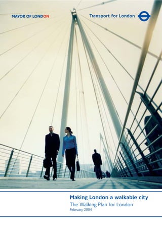
- 1. Making London a walkable city The Walking Plan for London February 2004 MAYOR OF LONDON
- 3. Forward by the Mayor 2 About the Plan 3 Part 1: 2015 - Stating the vision 4 Part 2: Walking – the facts 4 Part 3: The Action Plan 4 Part 1: 2015 - Stating the vision 5 1.1 The vision 5 1.2 Defining walkability 5 1.3 London – a walkable city 6 1.4 Learning from others 7 1.5 Links to other Mayoral strategies 10 1.6 Links to Local Authority walking strategies 11 Part 2: Walking – The facts, benefits and barriers 12 2.1 The growth of London 13 2.2 Journeys on foot 13 2.2.1 Journeys to work 13 2.2.2 Journeys to school 14 2.2.3 Leisure journeys 15 2.3 The benefits of walking 15 2.3.1 Encouraging more use of public transport 15 2.3.2 A better environment 16 2.3.3 Social inclusion 17 2.3.4 Healthier lifestyles 17 2.3.5 Boosting the economy 19 2.4 Barriers to walking 20 2.4.1 Institutional issues 20 2.4.2 Traffic volume 20 2.4.3 Air quality 21 2.4.4 The walking environment 21 2.4.5 Safety 21 2.4.6 Security 23 2.4.7 Information 23 2.4.8 Access and mobility 24 Part 3: The action plan 26 3.1 Policy into practice 26 3.2 Headline targets 26 3.2.1 Linking to local level targets 27 3.3 Objectives and actions 27 3.4 Review and monitoring 27 3.5 The local level 28 3.6 The Action Plan 28 Objective 1: Improving co-ordination & inclusiveness in the Walking Plan development 29 Objective 2: Promoting walking 30 Objective 3: Improving street conditions 31 Objective 4: Improving development proposals & interchanges 33 Objective 5: Improving safety and security 34 Objective 6: Plan delivery and monitoring 35 Appendix 1: Supporting organisations & glossary 37 Appendix 2: Bibliography 39 Contents
- 4. ‘London is a great city for walking. My vision is to make it one of the world’s most walking friendly cities by 2015. Walking is an enjoyable, free and accessible activity and for most people, a necessary part of their everyday journeys. Every journey begins and ends with an element of walking and every traveller is a pedestrian at various points during their trip. Wheelchair users are also pedestrians, although they may have additional design needs that determine their experience of the pedestrian environment. Walking contributes to the health and wellbeing of individuals and to many aspects of community life and the vibrancy of London. It is also a very popular leisure pursuit. The range of opportunities for leisure walking in London is vast, with an array of promoted, self guided routes and trails within the City and along rivers, canal paths, parks, woodlands, with attractive squares, landmarks and world class buildings to enjoy along the way. Walking is a fundamental part of human day-to-day activity, but walking environments can sometimes be challenging. It is important that we create a safe, attractive and accessible environment that enriches Londoners experience and appreciation of walking. This plan identifies all the key issues relevant to walking in London and proposes how they can be addressed in a practical and cost effective way. I challenge all those organisations involved in making London a walkable city to work together to deliver the actions contained within this plan.’ Ken Livingstone Mayor of London 2 Foreword by Mayor Ken Livingstone
- 5. The Walking Plan for London has been developed to assist all organisations involved in achieving the Mayor’s walking vision for London. These include professionals in a variety of fields including transport planning, transport engineering, health, tourism, social inclusion, crime prevention, community enhancement, urban design and a wide variety of other activities. During the comprehensive public consultation that preceded publication of the Mayor’s Transport Strategy, many Londoners voiced concerns about the difficulties of walking in London. In particular, they supported measures to reduce traffic congestion and local transport initiatives that would encourage more walking. This Plan identifies many difficulties faced by all members of the community and proposes solutions that will overcome them. Delivering these improvements will involve many organisations, either individually or in partnership. In particular, London boroughs have an important role to play. In line with its remit in funding and encouraging walking, TfL has responsibility for initiating and leading on many aspects of the Plan. About the Plan 3 Who is the plan for?
- 6. Part 1: 2015 - Stating the vision Part 1 sets the 2015 vision for London and explains what TfL aims to achieve through its delivery. In this section, we address the issue of what is actually meant by ‘a walking friendly city’. Part 2: Walking - the facts Part 2 highlights why we should be encouraging more walking and the potential benefits for health, the environment, the community and the economy. It also looks at the factors that have led to a decline in walking over the past decade. Survey data shows the issues that people rate as significant deterrents to making journeys on foot, illustrating the broad range of organisations and policies that have an impact on the walking environment. Part 3: The Action Plan Part 3 sets out London-wide targets, suggests an approach to developing targets at a local level and identifies actions needed to improve conditions for pedestrians and encourage people to walk more. Actions are listed under six key objectives: G Objective 1: Improving co-ordination and inclusiveness in the Walking Plan development co-ordinate delivery and further develop the plan to ensure pedestrians needs are being met G Objective 2: Promoting walking educate and inform the public, via published material and campaigns G Objective 3: Improving street conditions draw up guidelines, develop integrated pedestrian networks and deliver improvements G Objective 4: Improving developments and interchanges develop guidelines and measures to improve pedestrian conditions at new developments and interchanges G Objective 5: Improving safety and security implement safety and security measures to help pedestrians G Objective 6: Plan delivery and monitoring Timely delivery of the Mayor’s vision will require significant funding and resource input at the regional and local level. Many of the actions contained in this plan do not require financial support from TfL to enable their delivery. However, a number of activities depend on the provision of funding for improvements, for example, through the Borough Spending Plan process. As part of the submission to the Government’s Comprehensive Spending Review 2004, TfL has set out the case for additional resources to enable delivery of this plan (as part of the wider case for delivering the Mayor’s agenda for transport). In order for the 2015 vision to be fully realised, it is necessary that these funds are secured, together with the support of the London boroughs and other partners for delivering key actions. The plan will be reviewed to ensure that any available funds and resources are targeted at areas where the maximum benefit can be achieved. 4
- 7. 1.1 The vision 1.2 Defining ‘walkability’ A walking friendly city is a city where people select walking as their preferred choice of travel for health and to relax and one which exhibits a high degree of ‘walkability’. Walkability may in turn be defined as the extent to which walking is readily available to the consumer as a safe, connected, accessible and pleasant activity. Aspects which make a city walkable are described as the 5 ‘Cs’ in the London Planning Advisory Committee’s Walking Strategy for London and are adopted as key indicators of walkability for inclusion within the Walking Plan for London. They are as follows: Connected The extent to which the walking network is connected to key ‘attractors’ like public transport interchanges, homes, places of work and leisure destinations in addition to the degree that the routes themselves connect. To Londoners this will mean a marked improvement to the logic and coherence of the walking network e.g. walking routes which get them from A to B safely, easily and via the most direct route. TfL supports the vision that London will become one of the world’s most walking friendly cities by 2015 set out in the Mayor’s Transport Strategy. The aim of the Walking Plan for London is to see more people making walking their first choice for short journeys and making more trips over longer distances by a combination of walking and public transport. In addition, the Plan supports the revitalisation of public spaces and the creation of a high quality urban environment that enriches Londoners’ experience and appreciation of walking as a valued and enjoyable activity. Part 1: 2015 Stating the vision 5
- 8. 1.3 London – a walkable city The Mayor’s Draft London Plan states that making London an easier city to move around will help to achieve both a better city to live in and a more prosperous economy. Improving the environment for walking is fundamental to creating a city where access to opportunities are available to everyone. In general terms, London’s walkability has deteriorated over the last few decades. As a result of this, walking in London is often considered a chore rather than a pleasure or a comfortable way to move around. In many streets, footpaths are too narrow for the number of pedestrians that use them. Concentration and effort are required to steer through the obstacle course of inappropriately designed and placed street furniture, poles supporting traffic signage, bursting rubbish bags, uneven and dirty paving, dug-up roads and footpaths while at the same time avoiding collision with vehicles and other pedestrians. Conversely, there are many examples of high quality walking environments already in London. These include flagship schemes in central London such as the partial pedestrianisation of Trafalgar Square, completed in July 2003, and the radical re-shaping of Hungerford Bridge, which clearly demonstrate what can be done. There are now only two road crossings which pedestrians have to pass between Waterloo and Leicester Square as a result. Where once pedestrians were forced onto a narrow, dark and run down passage on the railway bridge, there are now broad, well-lit walkways affording brilliant views across the Thames. Walking schemes throughout London should follow these precedents with designs that encourage people to explore London on foot. 6 Convivial The extent to which walking is a pleasant activity in terms of interaction with people and the built and natural environment, including other road users. To Londoners this will mean a significant reduction in litter, graffiti and other problems which reduce the quality of the walking environment and prevent the creation of high quality public spaces that make being ‘out and about’ a pleasurable activity. Conspicuous The extent to which walking routes and public spaces are safe and inviting, with attention paid to lighting, visibility and surveillance. This also includes the availability of mapping and signage. To Londoners this will mean safer streets where people feel secure at all times of the day through increased natural surveillance and other measures such as street lighting to increase security. Comfortable The extent to which walking is made more enjoyable through high quality pavement surfaces, attractive landscaping and architecture, the efficient allocation of road space and control of traffic. To Londoners this will mean well-maintained footpaths and the provision of seating, landscaping and public toilets, which make the public realm a more comfortable place to be. Convenient The extent to which walking is able to compete with other modes in terms of efficiency through the implementation of the above factors. To Londoners this will mean the creation of walking routes and environments, which compete with other less sustainable options for short trips through increased journey ambience and greater pedestrian priority. These will help to make walking a more convenient and attractive mode of travel.
- 9. For the past two decades, Barcelona has been one of the most important sources of inspiration for architects, landscape architects, urban and transport planners as well as politicians who work with public spaces. The city has been both radical and imaginative in implementing its public space policy. In only a decade, several hundred new parks, squares and promenades were created by tearing down dilapidated apartment buildings, warehouses and factories, as well as by renovating existing squares and regulating traffic to benefit pedestrians. London’s parks and open spaces are among the greatest assets we have. At their best, they mark out London as one of the world’s most civilised cities. But shoddy design and maintenance are letting too many of our spaces fall into neglect, even as London’s economy (and the quality of much private development) has boomed. Improving the quality of public space makes: G a beautiful city, where the spaces between buildings can inspire, excite and delight all its citizens G a sustainable city, where walking and cycling are pleasant, safe and as easy as driving G a prosperous city, with business centres that can compete locally, nationally and internationally G a connected city, where diverse individual spaces and places are linked together G a safer city, where citizens are freed from crime and the fear of crime. As part of the agenda to create or upgrade public spaces in London, the Mayor has launched the 100 Public Spaces Programme. The aim of the initiative is to create or upgrade 100 public spaces in London based on the Mayor’s conviction that ‘creating and managing high quality public spaces is essential to delivering an urban renaissance in London’. This and other projects will act as examples of the difference improved public space can make and of the ways in which the highest quality designs can be secured without excessive expenditure. The programme also aims to increase Londoners’ awareness of and identification with the whole city, by giving a public profile to spending on projects across the whole of Greater London. 1.4 Learning from others 7 Case study - Barcelona TfL also recognise the clear benefits of looking to other major cities for examples of innovative and exemplary walking initiatives to emulate and adapt for London. Cities of different sizes, where public life and walking have been strongly reinforced or reintroduced during the past two to three decades, can be found in many other locations around the world. Examples include Barcelona, Birmingham, Bristol, Lyon, Strasbourg, Freiburg, Copenhagen, Portland (Oregon) and Melbourne. In these cities an impressive increase has occurred in the volume of walking and other people- orientated activities in public spaces. As stated by Jan Gehl, a renowned landscape architect and advocate of high quality walking environments, ‘there is much more to walking than walking’.
- 10. 8 Key successes: G shorter trips and more walking and motorcycle/ scooter use brought about by high urban densities and mixed land uses G average trip distance is a third lower than London G car use discouraged and managed with strictly enforced on-street parking controls and technical transport solutions G low fares on public transport and integrated ticketing forecast to increase ridership by 15% G low pedestrian accident rates, despite high pedestrian mode share. Recent planning policies have favoured the regeneration of inner city neighbourhoods within the established urban areas, for example, at the Vila Olimpica in Barcelona and the Eix Macia in Sabadell. While these projects are often at slightly lower density than the older urban plans they replaced, they are mixed and well located adjacent to public transport, compared with much recent development in London. All have good provision for pedestrians and cyclists, traffic-calmed public areas and easy access to public transport. The table below shows annual investment in various transport activities based on data for the Metropolitan Area between 1996 and 2000. The bulk of investment continues to be made in the highway network, with substantial sums also being spent on the existing Metro and rail networks and a surprisingly high amount on facilities for pedestrians. Key comparisons Investment in Barcelona transport system (000 Euros) Indicator Population (000’s) 1 Area (Sq.km) Average Density (Persons/Sq.km) Central Area Density GDP / Capita (US$) Jobs in CBD (%) Car Ownership (Cars/000 Pop) 4,228 3,240 1,307 8,520 18,124 20 410 7,187 1,579 4,553 5,900 22,363 36 332 1 Figures cover recognised metropolitan area of Barcelona and Greater London Area. Barcelona London Components Existing road network Road network extensions Road transport telematics Existing Metro/Rail infrastructure New Metro/Rail infrastucture Existing and new bus infrastructure Existing and new pedestrian Existing and new cycle Total 15,000 36,000 1,600 16,000 8,000 180 5,920 30 82,730 % 18.1 43.5 1.9 19.3 9.7 0.2 7.2 0.1 100 Source: ATM. Citizens Network Benchmarking Data (2001). Metro and Tram expenditure is expected to increase substantially through PDI. Euros (000’s)
- 11. Mode share The mode share for walking is also significant because of: G high densities G mix of land uses within the urban area G provision for pedestrians within the streetscape G constraints on car parking. Mode share for journeys to school Compared to London, a far higher proportion of children walk or use public transport, rather than the car to get to school in Barcelona. This appears to be due to differences in land use densities and mix (with influences on school catchment areas), relatively low public transport fares and the fact that many schools provide dedicated student buses for those living beyond a certain distance. 9 Mode share for selected trip types in Barcelona 100% 90% 80% 70% 60% 50% 40% 30% 20% 10% 0% Home to work Non home to work Total On Foot Public Transport Private Transport Mode share for walking to school in Barcelona Car Public Transport Cycle Walk 17% 58% 24% 1%
- 12. Commitments from a range of other Mayoral Strategies support the promotion and development of walking as a more widely accepted means of transport for shorter journeys. Some of these are outlined below. The Mayor’s Transport Strategy, July 2001 The Mayor has made it clear that his top priority is tackling the transport crisis facing our city. Policy 4I.3 states that ‘TfL will work with the London boroughs, other public bodies, the private sector, and voluntary groups with expertise in walking issues to produce a Walking Plan for London which will provide a framework for implementing and monitoring the Transport Strategy’s proposals for walking.’ The Draft London Plan - The Mayor’s Spatial Development Strategy (SDS), June 2002 The draft London Plan forms the basis of the future spatial development strategy for the capital. Increased walking has a vital role to play in the development of more compact and sustainable settlement described within the plan. London: Cultural Capital - The Mayor’s Draft Culture Strategy, June 2003 London: Cultural Capital is the Mayor's ten-year plan to develop London as a centre of cultural excellence and creativity. Strategies such as the World Squares for All initiative actively promote the cultural heart of London as a convivial, vibrant and walkable environment. The Mayor’s Draft London Ambient Noise Strategy, March 2003 Increased levels of walking will contribute to the reduction of ambient noise and increased levels of walking may be partially dependent on strategies to reduce noise to create a more pleasant environment. The Mayor’s Draft Energy Strategy, January 2003 Energy is central to life in London and the way we use energy has huge implications for our environment, economic regeneration and social equity. Walking is the most energy efficient mode of transport for travelling short distances and increased levels of walking will actively contribute to greater energy efficiency within London. The Mayor’s Draft Air Quality Strategy, September 2002 This strategy is focused on improving London’s air quality towards the challenging objectives in the government's National Air Quality Strategy. Walking is a pollution free mode of transport and increased levels of walking will actively contribute to cleaner air within London. The Mayor’s Draft Biodiversity Strategy, July 2002 The Mayor’s Draft Biodiversity Strategy is the first regional biodiversity strategy with a statutory basis. The document details the Mayor’s vision for protecting and conserving London's natural open spaces. The strategy states that all Londoners should be within walking distance of a quality natural space. The Mayor’s Draft Children and Young People’s Strategy, April 2003 This strategy aims to put children and young people’s best interests at the heart of policy-making in the capital. Walking is often the mode of transport most readily available to children and young people and it is important that they have access to high quality, connected walking environments to enhance their health and promote greater levels of social interaction. 10 1.5. Links to other Mayoral strategies
- 13. 11 Local authorities are central to the successful delivery of the Walking Plan for London. Working in partnership with a broad range of public, business and voluntary sector partners, they can provide the necessary strategic leadership to turn policy into action in a way that reflects the needs and aspirations of their local communities. In order for the plan to be successful, each local authority should develop its own walking strategy, setting local targets, where appropriate, to encourage more people to walk. Integration is the key to the development of a successful walking strategy and walking strategies must: G be part of an integrated local transport strategy, which successfully uses various modes G ensure support and participation of all local organisations with an interest in walking G have cross-departmental support within the local authority administration G bring together the achievement of targets across the spectrum of local authority responsibility G consider walking for both functional and leisure purposes G plan on-road and off-road routes to link, where possible, into one network linking open spaces with key ‘attractors’ such as stations and town centres. 1.6 Links to local authority walking strategies
- 14. Although London’s population is increasing, walking trips in and outside the central area have declined and so contributed to the increase in traffic congestion. Part 2 of the Walking Plan for London looks at the facts and figures relevant to walking both as a mode of transport and as a popular leisure activity. The section highlights some of the many benefits of walking, both for the individual and the community as a whole. It demonstrates why greater levels of walking should be encouraged. This section also sets out some of the factors that discourage people from making journeys on foot. Case studies are included to demonstrate model improvements to the walking environment already underway. 12 Part 2: Walking The facts, benefits and barriers
- 15. Walking is a key element in the way we travel around London, forming at least a small part of every journey. London Area Travel Survey (LATS) 2001 shows that ‘walk all the way’ trips account for 31% of single mode trips in London. However, this underestimates the importance of walking, as it is also an element of many trips by bus, train, cycle and car. Walking accounts for the second highest proportion of all trips made in London, after driving at 49%. This compares with national figures for walking of 26% and driving 62%. More trips are made on foot in London than on all types of public transport combined. ‘Walk all the way’ trips account for 62% of all trips under one mile (LATS 2001) and is the main way in which public transport in accessed. However, the past decade has seen a marked decline in the number of walking trips. In Greater London, the number of walking trips have reduced by 13%, but in inner London the reduction is nearer 20%. In central London, the picture is somewhat different with an 18% increase in walking occurring over the same period. London Area Travel Survey (LATS - 2001 Household Survey) shows that 94% of ‘walk all the way’ journeys are less than two kilometres. 2.2.1. Journeys to work Between 1990-2000, the number of people employed in Greater London rose by 3% to 4.5 million. Of these, an estimated 1.1 million enter central London on a typical weekday between 7am-10am (TfL Statistics 2001). Data in table 2.1 shows that in autumn 2001, 81% of people entering central London used public transport. Comparable figures for inner London (excluding the central area) and outer London were 46% and 19% respectively. Walking is an essential part of these trips as many people need to walk to the start of their public transport journey, walk at interchanges between services and then walk to their final destination. Only 4% ‘arrived on foot’ as a single mode trip. Improving the walking experience will encourage people to switch from cars to public transport, helping the whole community to benefit from the environmental advantages of more sustainable transport. London is a growing city. Rising numbers of residents, workers and visitors all contribute to an increasing demand for travel. Between 1990-2001 the population of Greater London increased by 7% to 7.2 million (TfL Transport Statistics for London 2001). The Mayor’s Draft London Plan estimates a further 10% increase by 2016, bringing the population of Greater London close to 8 million. Work-related travel will continue to be a key area of growth, with the Draft London Plan forecasting a net increase of 636,000 jobs by 2016. Currently on a typical weekday, 1.1 million people enter central London between 7am-10am (TfL Statistics 2001). Tourism also has an impact on transport needs, with 28.6 million visitors travelling to London in 2001. This figure is expected to rise, with the Draft London Plan predicting an increase of 36,000 hotel rooms by 2016. In accommodating the growing population of London, attention will be given to the need to promote the proximity of residential developments to places of employment and retail, to increase the prospect that walking will be a feasible travel option. 13 2.1 The growth of London 2.2 Journeys on foot
- 16. 2.2.2 Journeys to school There have been significant changes in school journeys in London since the mid 1980s as reported in the publication ‘School Run - Blessing or Blight?’ commissioned by the Pedestrian’s Association in 1998. The report was compiled by researchers at the Institute of Child Health, who analysed published data on changing patterns of school travel over the past 20 years. According to the report in 1985-86, 59% of 5-16 year-olds in London walked to school. By 1999, this figure had fallen to 48%. Over the same time period the proportion travelling by car increased from 16% to 30% and, currently 16% of cars on the road during the morning peak hour are taking children to school. Promoting alternatives to car use for these trips could have significant benefits in reducing congestion during the morning peak. Travel patterns are different for primary and secondary school pupils. At primary level, where pupils are more likely to live close to their school, 60% of pupils regularly make the trip on foot (see table 2.2). At secondary school level where distances are generally further and single mode trips by foot are reduced, pedestrian routes to and from bus stops are particularly important. 14 Walk Car Bus1 Rail Other 5-10 years old 60% 33% - - 7%1 11-16 years old 32% 17% 36% 9% 6% Table 2.1 Journeys to work by mode London Travel Report 2002 (source Labour Force Survey, ONS) Table 2.2 Journeys to school by mode Source: NTS 2001 1 Includes school buses Walk Car Other Bus Rail Across all London boroughs: 8% 41% 4% 11% 36% By London region: - Central: 4% 12% 4% 9% 72% Rest of Inner: 11% 38% 5% 13% 33% Outer: 10% 66% 3% 11% 8% 2.2.3 Leisure journeys Walking is popular as a mode of travel for leisure purposes in London, with 49% of adults regularly making leisure orientated trips on foot. Almost 33% of leisure journeys over 200m are on foot (London Area Transport Survey – LATS 1991). Leisure journeys include: G visiting friends at home G visiting friends elsewhere G entertainment/sport G holidays/day trips. In London the annual number of leisure trips per person (all modes) remained almost constant between 1990-2000 at 296 trips per person per year (29% of all journeys). This compares to a national decrease of almost 8% over the same period. High demand for walking makes the quality of pedestrian links to leisure attractions and for leisure walks important. Particularly important are links between attractions, routes from underground/bus stops, information and signing.
- 17. Walking as an activity is accessible to all social groups, ages, religions and cultures. Encouraging people to walk is the central element of this Plan. It aims to provide benefits including: G greater use of public transport G a better environment G social inclusion G healthier lifestyles G an improved economy. Everyone should be able to choose to walk as part of a journey, or in preference to any other form of transport. 2.3.1 Encouraging more use of public transport Walking is the main way in which public transport is accessed. However, until recently, most travel surveys only counted walking as a mode of transport if the whole journey was made on foot. Some people are discouraged from using public transport by the walking element of the journey. A 2001 survey by the Office of National Statistics on public transport and security concerns showed: G 8% of people would use buses more if personal security measures were improved G 44% of women and 19% of men feel unsafe waiting at a bus stop after dark G people in the most deprived areas are around five times more likely to say that they are concerned about safety at bus stops compared with people in more affluent areas. Significant improvements have been made to London’s public transport network in recent years but improvements in the access and interchange parts of the journey are required to encourage more people to switch to public transport. Better lighting, safety-conscious street design and greater numbers of pedestrians on the streets will all help encourage people to regard walking and public transport as a viable alternative to the private car. A test of the Walking Plan’s success will be whether those who depend on London’s public transport system – residents, workers, visitors, businesses and other organisations – experience real improvements in their day-to-day travel where they need them most, especially in the walking links that make up their overall journey. 15 2.3 The benefits of walking Walking, however, does not only have a utility purpose and is a valued recreational activity for many people. There are many pleasurable walks throughout Greater London and there are over 300 promoted routes incorporating hundreds of miles of public rights of way. 2.2.4 Shopping journeys Shopping accounts for 20% of trips by London residents. On average 25% of these journeys over 200 metres are made on foot (LATS 1991). Pedestrian links to local shopping facilities are therefore important routes. Although the number of shopping trips in London is in decline, the proportion made on foot remains high. Between 1990-1999 the number of shopping trips per person per year in London fell by 6% to 205.
- 18. Case study – Hammersmith Broadway In 1994 as part of the redevelopment of the Hammersmith Broadway Island site, the London Borough of Hammersmith & Fulham installed surface level pedestrian crossings at a number of locations around the road scheme. These facilities, which replaced the existing subways, better reflected pedestrian desire lines, were accessible and created a safer environment for users (particularly at night). The crossings improved the interchange opportunities between the Hammersmith & City Underground station, the Piccadilly and District Line station, bus services (within the bus station and in the surrounding area), together with connections to the town centre and the wider area. Following installation the level of pedestrian activity increased by up to 300% at certain crossing points (between the Broadway Centre towards King Street and towards Hammersmith Road) with significant increases in flows on all other surface crossings compared with the previous subway usage. In 2000/01 the London Borough of Hammersmith & Fulham widened the surface-level crossing facilities to cater for the increased levels of pedestrian usage. In addition, an enhanced and extended pedestrian area at the front of the Broadway Centre was provided together with wider footways on King Street, linking through to the main shopping area. The works also included the closure of certain subways, tree planting and cycle parking provision. Public perception surveys were carried out after the improvements, with 87% of respondents considering that the measures: G encouraged increased use of sustainable modes (walking, cycling and public transport use) G improved access between public transport services (between the tube station and bus services) G provided safer, more convenient pedestrian facilities G enhanced the economic viability of the area. 16 2.3.2 A better environment Walking has the least external environmental impacts of all forms of travel. Motorised travel has significant impacts on the environment and air quality, despite improvements such as catalytic converters. The most effective way of reducing the impact of travel on the environment is to reduce the number of motorised vehicle trips. Short car journeys, of two kilometres or less, contribute disproportionately to air pollution, since engines and catalytic converters do not work efficiently until properly warmed up. In a dense and mixed urban environment such as London there is great scope to create walkable environments with local facilities and good links to public transport where a car is not necessary. Walking cannot replace all car trips, however, many short trips can be made on foot, and longer trips can be made by more sustainable modes where walking is just one element of the journey.
- 19. 2.3.3 Social inclusion Walking is unique in being able to promote equality and reduce social exclusion. Walking is a free means of travel that can provide access to most facilities and financial status does not limit opportunity. Activities that involve local people in the development of projects can help to strengthen the local community and reduce people’s worries about personal security. Creating a walkable environment has the ability to promote accessibility, particularly for those in deprived communities by: G improving access to passenger transport links G supporting the local economy G strengthening the local community G providing a no-cost alternative to public transport G improving travel for those unable to drive because of age, mobility or lack of access to a car. If residents are to overcome the anonymity of many neighbourhoods and know the people living close by, it is necessary for them to share time and space with each other. This is what happens when people walk their local streets rather than drive from one front door to another. This helps to engender trust and underpins civic organisations such as residents and tenants associa- tions and is particularly crucial to the lives of people in disad- vantaged communities. In addition, more and more people can enjoy town centres in the evening with improvements like better lighting and pedestrian crossings. The RNIB have found that many older people would visit their town centres in the evening if there were attractions for them and the pedestrian environment was improved. 2.3.4 Healthier lifestyles According to a health survey of England and Wales, 60% of men and 70% of women are not reaching recommended levels of physical activity. (DoH 1999) The 2002 Health Survey for England showed that a sixth (16%) of boys and girls aged 2 – 15 are obese and almost a third (30%) are overweight. (DoH 2002) Health professionals recommend that adults participate in moderate physical 17 April 2003 saw the successful completion of TfL’s multi- million pound street improvement scheme at Shoreditch. The new scheme will improve traffic flow in the area and aims to reduce the number of casualties on Hackney’s roads, the third highest in the Capital for children up to 15 years old. The old system at Shoreditch, built during the 1960s, provided limited facilities for pedestrians and vulnerable road users. The scheme enhances the street environment and provides a number of new facilities for pedestrians including: G new crossings at the Great Eastern Street / Holywell Lane, Shoreditch High Street/New Inn Yard, western side of the Curtain Road/ Great Eastern Street and Old Street/Great Eastern Street junctions G pedestrianisation of New Inn Yard between Anning Street and Shoreditch High Street G a dedicated ‘all-red’ pedestrian traffic light phase at the Kingsland Road/Shoreditch High Street, Curtain Road/ Old Street and Rufus Street/Old Street junctions. An ‘all-red’ phase means that all traffic lights show a red light, allowing pedestrians to cross any arm of the junction in one go G complete renovation of the area including new pavements, lamp posts and seating areas using high quality materials. Traffic demand on Curtain Road has greatly reduced, making the area within the Triangle more pleasant for pedestrians. Case study - Shoreditch Triangle
- 20. Lewisham Walking Forum is a new group within the London Borough of Lewisham. It draws together people, organisations and public bodies involved and concerned with diverse aspects of walking including voluntary groups. Health, regeneration, education, leisure, transport, environment, parks user groups, walking groups and local residents. The principal partners are the London Borough of Lewisham and the local Primary Care Trust. The objectives of the group are: G to raise awareness and increase the profile of walking G to promote the social, environmental and health benefits of walking G to increase levels of walking G to campaign to make walking in the London Borough of Lewisham safe, easy and enjoyable G to produce and share publicity and information about walking issues, options for walking, walk routes groups, and places both in the London Borough of Lewisham and the wider London area G to involve many people, organisations and public bodies. They have a number of activities in place to achieve these objectives including regular led health walks in local parks and green spaces and in May 2003 held a highly successful walking festival to raise the profile of walking in the borough. Case study – Lewisham healthy walks 18 activity for 30 minutes a day, at least three days a week. The regime is equally as effective when distributed over three separate 10 minute sessions. It is a target which most people could attain through walking for short trips and combining walking with public transport for longer trips. Brisk walking for 20 minutes uses the same energy as swimming for 10 minutes or playing football for 12 minutes and is shown to help reduce the risk of cardio-vascular disease, help control weight and strengthen bones. In children and young people, walking can be promoted as part of the daily journey to and from education establishments and leisure activities with the following benefits: G reduces the risk of obesity and associated health risks G provides opportunities for socialising G develops personal independence and self-esteem G maximises bone density G forms a positive life-long habit. From young adulthood to middle age, walking can become part of the travel routine to and from work and leisure activities with the following benefits: G becoming more active in middle age is associated with lower mortality G develops a healthy physical activity habit G reduces cholesterol levels in men who walk more than 2.5 hours per week G lowers blood pressure in those with hypertension G can help protect against osteoporosis after the menopause. In older-age walking is the most important physical activity. The benefits of physical activity can still be gained if walking is taken up in later life: G reduces all-cause mortality and hospital admissions for elderly people who start being vigorously active (brisk/fast walking) G adds healthy years of life G improves muscle bulk, and strength G preserves daily living activities and helps avoid isolation or institutionalisation. Fundamentally the promotion of physical activity in the population costs less than the healthcare required by its absence.
- 21. In 2002, Colin Buchanan and Partners were commissioned by the Royal Borough of Kensington and Chelsea to undertake a series of ‘before’ surveys prior to pedestrian improvements to Kensington High Street. This involved a survey of shoppers to find out the contribution of public transport and walkers to spending in the High Street compared with car drivers. The key findings were: G The majority of respondents walked to Kensington High Street (49% on a weekday). G The analysis of frequency of visits to Kensington High Street reinforces conventional opinion that car users shop much less frequently than those who walk to the shops. G Walkers made a substantial contribution to total spend (35%) whereas car drivers accounted for only 10%. Kensington High Street is one of London’s premier shopping streets with many flagship stores. Faced with direct commercial competition from other centres, the Royal Borough of Kensington and Chelsea carried out an ambitious programme of high quality streetscape improvements to ensure its retail economy remained buoyant. After studies are currently taking place. 2.3.5 Boosting the economy Central London Partnership’s recent publication ‘Quality Streets’, states ‘London, being the UK’s capital, is the UK’s ‘shop window’, as well as being a major contributor to national GDP. Ensuring London’s success is fundamental to the continued competitiveness of the UK as a whole. Central to that success is maintaining London as a place where people want to live and work, invest in and visit. A vibrant, attractive street scene and well managed, safe streets are key components of this – environments that encourage people to walk, either as a leisure activity or means of transport.’ The importance of a good walking environment as a fundamental component of town centre vitality was underlined in a recent study of 12 London town centres (Harris Research, Town Centre Survey, Oct 1999). The study revealed that 44% of all visitors arrived by foot. Shopping centre locations surveyed included Richmond, Sutton, Tooting, Acton, Angel, Barking, Bethnal Green, Eltham High Street, Harrow, Kings Road West, Muswell Hill and Thornton Heath. TfL recently carried out a literature review on the economic impacts of pedestrian environments. The review included a number of case studies of other UK cities including Oxford, Leeds and Edinburgh and developed a series of indicators of economic vitality following the introduction of public realm or pedestrian improvements. In all of the case studies the city centre’s position in the UK’s retail rankings remained high or improved, prime retail rents remained steady or improved and office rents and air quality also improved. This research also suggests a strong link between streets with fast moving traffic and poor quality shopping. Many shoppers want to visit places like Covent Garden or other well paved areas safe from traffic, where they can sit, eat and drink outdoors and be entertained. Tourism remains vital to the economy in London and is directly linked to the pedestrian environment. In 2001 there were over 28 million visitors travelling to London and 90% of these visitors use public transport and walk. These tourists spend around £6 billion annually during their visits. 19 Case study – Kensington High Street
- 22. The London Borough of Merton has been working with developers and stakeholders to implement a range of pedestrian enhancements in Wimbledon Town Centre. The enhancements provide a safer and more convenient environment for pedestrians, particularly the mobility impaired. They are also designed to raise driver awareness of pedestrian activity in the area. The scheme reduces the difficulty experienced by pedestrians crossing the Broadway and helps to make walking more pleasant. Enhancements include: G increasing the number and width of pedestrian crossings G increasing footway widths G installing ramped tables at pedestrian crossing points G implementation of a 20mph zone. Pedestrian benefits include: G easier access to the station G shorter and easier side road crossings G safer and more pleasant environment G direct access to the town centre. 20 During the Walking Plan’s development the following barriers to walking in London were identified: G institutional issues G traffic volume G air quality G the walking environment G safety G security G information G mobility and access. These are set out in more detail below. 2.4.1. Institutional issues It has been difficult to achieve a consistent approach to increasing the level of walking in London, as there are many individuals and organisations with a role in managing different aspects of London’s streets. An effective and consistent definition of success is needed, as well as a means of monitoring and reporting progress to stakeholders. There is currently no clear and quantifiable definition to help organisations define and understand ‘walkability’. The definition of ‘walkability’ is included within Part 1 of the Plan. Often the benefits made possible by investment are not co-ordinated between different areas of local government and different stakeholders. This results in an uncoordinated streetscape and poor attention to minimising the disruption caused by maintenance and other works. The large number of people and organisations involved in making streetscape alterations that affect pedestrians, means that information on best practice is often unavailable. This can lead to inconsistent approaches across London. Travel statistics have, in the past, neglected the role of walking in car and public transport trips, with the result that plans and legislation often ignore the needs of pedestrians. Funding and investment for walking schemes may also be affected as traditional cost benefit analysis focuses on direct travel costs and ignores environmental costs (high for road schemes, low for walking). However, more recent appraisal methodologies have begun to redress this balance. 2.4.2 Traffic volume The amount of traffic on the road is a major factor that discourages people from walking in London. The fear of accidents and crossing roads are directly related to traffic volume. A GLA transport survey revealed that 44% of Londoners were not satisfied with the ease of crossing roads. To address the problems caused by high traffic volumes, some 66% of people supported increased priority for pedestri- ans in towns and cities – even if this made things difficult for other road users. Only 14% disagreed with increased priority for pedestrians (GLA 2001). 2.4 Barriers to walking Case study - Wimbledon Town Centre
- 23. 2.4.3 Air quality Consultation preceding the publication of the Mayor’s Draft Air Quality Srategy in 2002 revealed that 71% of Londoners consider traffic exhaust fumes a serious problem, making walking unappealing. As well as the immediate and unpleasant effect exhaust fumes have on the environment, they have also been shown to affect health, leading to respiratory and cardiovascular problems. In London, nitrogen dioxide and fine particles are currently of greatest concern for human health. In Greater London in 1999, 58 per cent of nitrogen oxide and 68 per cent of fine particle emissions came from road transport (GLA/TfL London Atmospheric Emissions Inventory, version February 2002). Other harmful exhaust chemicals include sulphur, ozone, benzene, butadiene, and carbon monoxide. Carbon dioxide produced by exhausts is harmless to humans at atmospheric concentrations but it is the most common greenhouse gas and contributes towards global warming and climate change. Over 25 years, the percentage of traffic-related pollution has risen as the number of vehicles has increased and other sources of pollution (such as power stations and industry) have reduced their emissions. 2.4.4 The walking environment ‘Walking through the streets of London has become difficult, stressful and to many it feels dangerous. Londoners and people who come to the City everyday for work are frustrated by it, and tourists are beginning to stay away because of it.’ (CLP 2003). Only 33% of Londoners believe walking conditions on London’s pavements are good according to a GLA survey from 2001. Poorly maintained footways can contribute to a significant number of pedestrian injuries through trips and falls. Street maintenance has a major role to play in the walking experience. Blocked drains and uneven surfaces lead to puddles that cause problems for pedestrians in wet weather. Other factors that discourage walking by creating a threatening or confusing environment for pedestrians include poorly maintained street lighting, overgrown foliage, street clutter, pavement hawkers, fly-posting, unauthorised signs and graffiti. It has also been shown that uncleared litter can lead to a steady decline in street conditions, encouraging dumping, tipping and graffiti – all of which discourage walking by increasing pedestrians’ concerns about personal security. (Living Streets 2001) In contrast, a clean, quality streetscape helps to encourage responsible behaviour by street users and engenders a sense of stewardship. However, this can be difficult to achieve without clear design, maintenance and enforcement strategies which co-ordinate the responsibilities of different organisations and departments. 2.4.5 Safety In the first half of 2003, pedestrians accounted for 43% of those killed and 29% of those seriously injured on London’s roads. (TfL 2003) In London, certain groups of pedestrians are more likely to be involved in a collision that causes an injury, particularly young people: G 57% of pedestrians injured are male G 13% of pedestrians injured are aged 60+ G 42% of pedestrians injured are under 16 years old G children in deprived areas are three times more likely to be injured in a collision than their better-off contemporaries (IPPR 2002) 21
- 24. The West Ealing (Five Roads) Home Zone covers five residential roads in an inner urban area near West Ealing station including Hastings Road, Hartington Road, Broughton Road, Denmark Road and Arden Road. It covers 370 households, covering around 580 adult residents. The area was typical of many parts of London, with straight roads and without parking spaces, encouraging high speeds. Residents were concerned about the poor environment which was noisy, polluted, unattractive and poorly lit. ‘Rat-running,’ parking by non-residents, HGV traffic, and dangerous/inconsiderate parking caused obstructions (including for emergency and service vehicles). The project was undertaken as a partnership between London Borough of Ealing, Five Roads Forum (residents association), Parkman engineering consultants and Groundwork West London. Construction work was completed in November 2001, including gateway features with raised tables, and lighting improvements. A 20mph zone has also been introduced. Physical features include: G changed road layout to incorporate 30-degree parking bays, marked on alternating sides to create chicanes which will help slow traffic down G six gateway features consisting of a raised table and width restriction to mark the entry to the home zone G shared surface G new street lighting to double the number of street lights in the area G 20mph zone G controlled parking zone G planting areas G installation of community mosaics G a play area developed from a disused area of a carpark, (which was already used informally by children) which residents have applied for grants to provide equipment for the area. 22 G child pedestrians aged 5-15 have high rates of road related injuries. This peaks at ages 11-12 when children change to secondary school and travel independently before they have skills to recognise the risks of road collisions and how to reduce them. Reassessing road space and priority given to cars can reduce vehicle speeds and improve road safety. TfL recently commissioned research into 20mph zones in London and published the results in LRSU Safety Research Report No.2, 2003 (from TRL research in unpublished project report PR/T/077/03). The conclusions were: G road user casualties within the zones reduced by about 45% and fatal and serious (KSI) casualties reduced by about 57% G flows in the treated streets fell by around 15% G accident migration onto surrounding roads was not found to be a problem. Conflicts can occur with pedal cyclists, although in 2002 only six incidents were recorded, of which two were classified as serious. Compared to the 7,457 pedestrian casualties in 2002, this doesn’t appear to be a significant casualty issue, but it is likely that many other incidents go unreported. The perceived safety issue of pedestrian and cycle conflicts is far more significant. Illegal and inconsiderate pavement cycling can be a major deterrent to walking, particularly for older and more vulnerable pedestrians. Case study – West Ealing (five roads) – Home zone
- 25. Light at the End of the Tunnel is an on-going project led by Cross River Partnership to reduce the impact of railway viaducts that slice through riverside central London. The Cross River area, south of the river, is divided by three Victorian viaducts carrying railway lines into Charing Cross, Blackfriars and Waterloo stations. Supporting them is a wave of approximately 2000 railway arches. Some are in the public realm, used by cars and pedestrians, whilst others are commercial units. The project will assess how the impact can be reduced by improving arches used for transport and exploring how those standing empty can be converted into imaginative new business units. This year the project has created six new or improved business units from railway arches near Waterloo as part of regeneration plans for the South Bank. The units, between Waterloo East rail station and Southwark tube station, cost £1.85 million and took seven months to redevelop. They will provide 20,000 sq. ft of leisure space, which will house a new restaurant and lively bar. 23 2.4.6 Security People are discouraged from walking because of the fear of crime and threatened personal security. Different sections of the community have different concerns about personal security, which can lead to various forms of social exclusion. Age and sex are strongly related to concerns about crime and feelings of safety. In 2001, 13% of British Crime Survey (BCS) respondents said that they felt ‘very unsafe’ walking alone in their area after dark and a further 20% felt ‘a bit unsafe’. Women were more likely to feel unsafe when walking alone at night and older people were more anxious than younger people. Women aged 60 and over were by far the most likely to say they felt or would feel ‘very unsafe’ (33%). Overall, 30% said that they never walked alone in their local area after dark and a further 13% said they went out less than once a month. Women were more likely to say they never walked in their local area alone after dark (43%), particularly those aged 60 or over (66%). Although reported crime is declining, there are substantial variations in the risks to different ethnic groups. The risk of being mugged is around three times higher for minority ethnic groups than for white groups. A better re-design of perceived danger spots and optimising street lighting can reduce the opportunities for crime and fear of crime, encouraging more people onto the streets. The presence of other road users, particularly other walkers, can help pedestrians to feel safe and lead to a virtuous circle where walking increases walking. Case study – Light at the end of the tunnel 2.4.7 Information TfL research has shown that pedestrians often say that a lack of information puts them off when considering walking. The public’s knowledge of London’s relatively complex network of streets is often limited. There are few, if any, walking maps that provide much needed information on good walking routes that link the daily destinations within London. There is also a lack of consistent and comprehensive signage to assist pedestrians. The current level of information is inadequate to support the encouragement and promotion of walking as an attractive and convenient mode of travel. There are a number of potential ways of improving information for walkers:
- 26. G On street signing - a clear, consistent and well- maintained system of street signing designed specifically for pedestrians. For example, York, where a network of well signed priority pedestrian routes have been developed which are safe, direct and convenient and the Bristol Legible City project. This included a new, integrated pedestrian signage system and maps, linking main points of arrival with key attractions, visitor destinations and landmarks. G Access to journey planning information – this may be a web based product that allows people to assess the full range of available modes (including walking) prior to making their trip, for example, TfL’s Journey Planner (www.tfl.gov.uk/ journeyplanner) or a similar tool available in Barcelona (www.tmb.net). G Walking Maps – a product which users can carry around with them which provides additional information, over and above the A-Z and other similar products. A product which allows them the flexibility of making changes to their planned route as they travel, for example, Edinburgh’s Pedestrian Navigation System, which integrates portable mapping and information, boards using an innovative new graphic language. 2.4.8 Access and mobility The term ‘disability’ is a broad one. It includes people with physical, sensory or mental impairment. The Disability Discrimination Act (DDA) 1995 defines a person as having, ‘a disability…if they have a physical or mental impairment which has a substantial and long term adverse effect on their ability to carry out normal day-to-day activities’. (DfT 2002) Approximately one in 20 (5%) of Londoners aged 16-50 experience mobility problems. This figure increases to 34% for those aged 50+ and to almost 66% for those aged 80+. There are over 750,000 people with a disability registered in London, 55% of whom do not have access to a car (All Change, GLAD 2000). Many but not all people with a disability face barriers to movement in the environment. There are others who are not normally considered to have a disability who also encounter barriers to movement. People with small children, carrying heavy shopping or luggage, with temporary injuries and older people can all benefit from a better design of the pedestrian environment. Without a barrier free environment, many of these people can be considered to be mobility impaired. While it is true that there are many aspects of design in the pedestrian environment that are helpful to all or most disabled people (and many others as well) there are also some specific facilities needed by people with a particular kind of impairment. Some examples are outlined below. Manual wheelchair users need sufficient space to be able to propel the chair without banging their elbows or knuckles on doorframes or other obstacles. Someone who walks with sticks or crutches also needs more space than a walker without disabilities; so too does a long cane user, a person carrying luggage, a lot of shopping bags or with small children. Many people would benefit from the adequate clear space on pavements, along passages and through entrances. Similarly, the rotating cone below the push button box on a controlled pedestrian crossing is essential for a deaf-blind person to know when the green man signal is lit. The provision of access for all is fundamental to the development of the Walking Plan. TfL will use the requirements of the DDA to benchmark the Plan’s initiatives and many of its action points. 24
- 27. 25 In recent years, TfL, the London Borough of Lewisham and others have made significant improvements to Lewisham High Street. Old and substandard footways have been replaced with new higher quality paving to create ‘Lewisham Promenade’. New, co-ordinated and sympathetically sited street furniture has been introduced. Better lighting (including bulbs in trees) and pedestrian signing has been provided. The renovation of green squares and other open spaces has been completed with a consistent design for walls, railings and seating introduced. Additional trees have been planted. Traditional phone boxes are provided at appropriate locations. New and improved road crossing facilities have been provided – inclusive of facilities for people with a disability. Bus lanes and bus stops able to accommodate low floor buses were also provided. Case study – Lewisham High Street
- 28. The Mayor’s vision to make London one of the world’s most walking friendly cities by 2015 presents a challenge for a wide range of stakeholders. However, the value of walking to individuals and to London as a whole provides an important stimulus for action. London needs an action plan that will reverse the decline in the number of people walking and overcome the problems experienced by pedestrians. Walking must become an attractive and safe travel option, available to everyone in London. Targets have an important role to play in measuring and monitoring progress. TfL acknowledges the benefit in setting London wide aspirational targets. These will provide guidance and direction to local authorities as they implement their own walking strategies. Walking activity targets should generally be defined in terms of the number or proportion of trips made, since the average length of walking trips is unlikely to increase significantly. Most walking trips are short in length and local in nature. At a London-wide level the following targets are proposed: G The short-term target is to stop the decline in the number of journeys per person made on foot. G The long term 2015 targets are: a) to increase the modal share of walking for trips under two miles by 10% b) to increase the average number of trips made on foot per person / per year by 10% c) to increase the level of London’s ‘walkability’ both in terms of people’s perceptions and in actual measured terms against other world cities. The main focus of these targets is functional walking, that is walking trips which are made for a purpose such as to work, school, shopping or visiting friends. 26 Part 3: The action plan 3.1 Policy into practice 3.2 Headline targets
- 29. At the London wide level, TfL will undertake a number of activities to monitor the successful delivery of the Walking Plan for London. Principal monitoring tools: G quarterly rolling LATS G LATS 2001 analysis G London Travel Demand Survey G National Travel Survey (NTS) G Red Route/TLRN Retail Monitoring Surveys. A walkability index is being developed in order to assess London’s walkability against other cities. The International Walkability Benchmark will be one of the measures of TfL’s implementation of this strategy. It will be an objective comparison of how walkable each World City is, using a set of quantitative measures of transport system outputs that have been found to contribute to the amount of walking and the quality of the walking environment. Measurement criteria will be established under the five Cs outlined in section 1.2. Other tools and monitoring: Satisfaction surveys TfL will undertake regular customer satisfaction surveys to assess people’s perception Beneath these broad headline targets are a set of objectives relating to more detailed activity areas that are supported by a set of corresponding actions. Objectives and actions in the context of the Walking Plan relate to facilities or resources under the control of TfL and the London boroughs. They are generally linked to service standards, improvement programmes or other changes in the management or maintenance of the physical environment. In order to increase the number of journeys made on foot there has to be systematic improvement and maintenance of the physical environment in which people walk. Objectives and actions need to be ‘SMART’ i.e.: G Specific G Measurable G Attainable G Realistic G Targeted. They should relate to specific aspects of the physical environment and can be used by local authorities to consider resource priorities within the overall context of their local transport strategy. In order for the plan to be successful, local authorities will need to set their own objectives and actions. In many cases two or three well-defined objectives are likely to be more effective and achievable than a large number of objectives which will fragment resources. 27 3.3 Objectives and actions 3.2.1 Linking to local level targets In order for the Plan to be successful local authorities must translate the broad London wide targets outlined above into meaningful local targets. It is recognised that local circumstances vary greatly across London. Some local authorities have already begun to translate their local walking strategies into action, while others are still in the early stages. The range of local factors at work across London points to the need for local targets to meet local circumstances. Local authorities may wish to consider setting specific targets by journey type for example: G work G school G leisure G shopping. It is essential however, that local targets are reliable and take full account of the relationship of walking to other modes within the local area. 3.4 Review and monitoring
- 30. 28 More extensive monitoring may be required at the local level to determine the extent to which targets have been achieved. A number of London boroughs have already incorporated walking targets into their transport plans and other policy documents. However, the Plan’s success will require all local authorities to follow this lead. To set meaningful input targets, local authorities should first conduct a review of walking routes and facilities within their area. The review should consider the current network and identify where there are missing links or where linkages or standards could be improved. This would involve a review of all existing routes and catchment areas, with priority given to those areas with high levels of pedestrian activity (e.g. town centres). The physical condition of all routes such as surfacing, signing, street furniture, lighting and cleanliness should be considered. Local authorities may also wish to consider benchmarking prior to setting targets for their area. Local authorities should also commit to a programme of routine monitoring of progress against the targets. of the walking environment in London as a whole. Often it is the perception of a city’s walkability that is the most poignant indicator of success. People are often able to tell that an area has improved without actually being able to specify exactly what has changed. Flow monitoring In addition to the above, work is being undertaken to monitor and forecast pedestrian flows across London, to assess existing demand, future demand and inform the targeting of necessary improvements. There are practical difficulties in measuring walking, including defining what comprises a ‘walk trip’ (e.g. somebody leaving the office to buy a sandwich at lunchtime), counting within a largely unconstrained environment and accounting for the weather. For all of these reasons, measurements of changed pedestrian activity in relation to the Walking Plan can only be indicative. 3.5 The local level 3.6 The Action Plan The Action Plan is split into six objectives. Each objective comprises a number of action points outlined below. A lead agency has been allocated responsibility for co-ordinating work, to support the successful implementation of each action. Additional agencies have been identified as key partners to lend support and help ensure objectives are fulfilled. Abbreviations used for lead agencies and key partners are included in the glossary in Appendix 1.
- 31. The many individuals and organisations that have a role in encouraging walking can make it difficult to adopt a consistent approach across London. A number of groups already exist at local and sub-regional level to improve co-ordination between stakeholders involved in the promotion of walking in London. These stakeholders incorporate a wide range of disciplines including engineering, planning, health, crime, social exclusion, tourism and the environment. TfL will support and assist such groups where possible and explore opportunities for innovative partnerships tailored to the needs of individual areas. The aim of these partnerships will be to achieve a coherent set of strategies in terms of what can be delivered on the ground. To make the best use of investment and reduce disruption, opportunities will be identified in maintenance and management plans (3.5) to integrate maintenance and improvement work. Where appropriate work should be incorporated into area treatments or other programmes to deliver co-ordinated improvements to the streetscape. As work progresses it will be important to circulate information and share best practice. This will be achieved through a variety of media including the London Walking website (2.2) and Walking Matters newsletter (2.3). Knowledge of the particular requirements of walkers is a new field for many, so there is a need to develop and deliver professional training for planners and engineers on issues relevant to walking (1.4). Community and stakeholder involvement is essential in making the Walking Plan a success. Transport users’ priorities must be the prime focus for transport service providers, so the need to involve pedestrians and understand their needs is critical. The boroughs are key agents in implementing the Plan – as individual authorities, members of sub-regional partnerships and through emerging local strategic partnerships. They have responsibility for: G ensuring accessibility of public space to all sections of the community G managing quality services to the satisfaction of local people G responding to local needs G effective partnership working G integrating council services with those of other agencies G achieving efficiency and effectiveness via performance management. The full list of Objective 1 actions appear in the following table. All actions are funded unless indicated below. 29 Objective 1: Improving co-ordination & inclusiveness in the Walking Plan development Objective 1 actions General 1.1 Develop and facilitate partnership working and community involvement at all levels of the Plan’s delivery. TfL will lead this at the London-wide level and facilitate a group to oversee the development of the Plan. (See action 6.2) 1.2 Develop and establish an annual London Walking Conference and establish an annual prize for the most beneficial walking initiative/project. Legal 1.3 Encourage the Government to take into account the needs of walkers when developing relevant legislation Training 1.4 Ensure that professional training courses properly reflect the needs of the pedestrian. Lead agency & key partners TfL TfL Robert Gordon University TfL ALG T2000 LS IHT TfL LoTAG Delivery Spring 2004 Starts Spring 2004 Ongoing Starts 2004
- 32. 30 The benefits of walking are clear and well documented. Walking is healthy, fun and virtually cost free. It also results in proven benefits for economic activity and social interaction within the community and is one of the easiest and most efficient ways of making short trips around London. On paper therefore, walking appears to be an activity that is relatively easy to promote and encourage. However, these advantages are set against some significant barriers to walking, outlined earlier in the Plan. Creating a walking culture will help overcome psychological barriers to walking and promote a more sustainable future. To achieve this, awareness of walking needs to be raised amongst both transport professionals and the public. A key issue will be educating people to reconsider their travel options. It is therefore important to review material on walking available to London education establishments (primary, secondary, tertiary and community) and provide updated information that can be incorporated into the curriculum (2.1). This needs to be combined with improved information to help make London a more legible city for pedestrians and to raise awareness of how easy it is to walk between key origins and destinations within the capital (2.4 and 2.5). Very often walking can be quicker, more reliable and undoubtedly cheaper than, for example, a short trip on the tube. TfL will develop a London Walking website dedicated to providing walking information (2.2) including an annual calendar of London-wide walking events and activities. TfL will work with partners to develop both location-specific and route information (2.4). TfL will also develop and support enforcement campaigns to protect pedestrians from illegal practices such as speeding, running red lights, pavement parking and footway cycling. These issues are a common cause of safety concerns raised by Londoners. Further campaigns and initiatives will promote the benefits of walking by focusing on walking to school and work and encouraging walking rather than driving for short journeys (2.6). The full list of Objective 2 actions appear in the following table. All actions are funded unless indicated. Objective 2: Promoting walking Objective 2 actions Education 2.1 Review existing material on walking available to London education establishments (primary, secondary, tertiary and community) and where appropriate provide updated material that can be incorporated into the curriculum. This will be linked to campaigns and initiatives supported by a London-wide Travelwise Initiative. Media 2.2 Develop a TfL London Walking web site dedicated to walking information. This will include a comprehensive database of London walking routes and an annual calendar of London wide walking events and activities. 2.3 Develop and establish a quarterly walking newsletter to promote and showcase walking initiatives and activities. 2.4 Work with partners to develop location specific and route information including paper based products, on street information and web based resources. Lead agency & key partners TfL TfL TfL TfL LB Delivery Review during 2004/5 with material provided by end of 2005/6 subject to funding Complete Spring 2004 Already established Consult in 2004/5 with projects implemeted by 2007 subject to funding
- 33. Work to improve street conditions is very wide-ranging, encompassing large-scale projects, area treatments, local improvements and maintenance requirements. People will walk further and more frequently where conditions are favourable and take account of the principles of good design. These have already been discussed as the five Cs – connected, convenient, comfortable, convivial and conspicuous. These principles continue to hold true and should be applied in respect of the following programmes of work. Completion of London’s six strategic walking routes (totaling 500km) will be an important step towards achieving the Mayor’s vision (3.1). Discussions are also underway with the Boroughs and other partners on the most effective way to develop east/west and north/south walking routes. Streetscape A large number of streetscape measures are also proposed at the more local level. Central to many planned improvements will be a unified pedestrian review and auditing tool being developed by TfL and partners (3.2). The tool is intended to set a framework for developing schemes and promoting social inclusion by indicating an appropriate level of priority and service for different road users. The audit will consider existing street conditions, accessibility, safety and the needs of elderly and people with disability to assess existing and proposed levels of demand. It will then be used to assess public spaces for the provision of walking facilities, giving priority to areas with high demand and high potential risks for pedestrians. The review measures should be incorporated into area treatments or other programmes to help deliver co-ordinated improvements to the streetscape. TfL is also developing Streetscape and Urban Design guidelines for the TLRN (3.3) and recommends that each London borough develops complementary local guidance on style and material variations needed to reflect an area’s character. Maintenance A good quality, even footway with no unnecessary changes in level is a key requirement for every pedestrian or wheelchair user. It is therefore essential that maintenance programmes place sufficient emphasis on footways (3.6). Footway maintenance will be prioritised according to the level of pedestrian use and the severity of surface irregularity. Asset Inventory Management System (AIMS) surveys will be used to identify the order of priority. Appropriate maintenance work should be incorporated into area treatments or other programmes and identified in management and maintenance plans. Street maintenance and management plans should also include local standards for the removal of litter, rubbish and graffiti to help make London’s streets cleaner, more attractive and less threatening (3.4). 31 Objective 2 actions Campaigns 2.5 Develop enforcement and awareness campaigns to support the rights of pedestrians and to promote the benefits of walking to the individual and the wider community in order to encourage walking for short trips and as part of longer public transport trips. Lead agency & key partners TfL ALBRSO SusT T2000 LS PCT CALB Delivery Implement within core marketing strategy in 2004/5 Objective 3: Improving street conditions
- 34. 32 These plans should also identify opportunities to integrate local maintenance and improvement measures, e.g. lighting maintenance (5.5). For the TLRN, this will be a joint plan between the London boroughs and TfL. TfL will work in partnership with the boroughs to achieve improved co-ordination and control of streetworks and ensure that appropriate measures are employed to minimise disruption to pedestrian movement (3.5). Area treatments Area treatments combine streetscape access improvements and reallocation of road space in a holistic, creative process involving the community and other partners. Forward programmes will be identified by TfL in partnership with the boroughs and sub-regional partnerships and will be developed with local stakeholders including residents, amenity groups and the business community. A key part of an area treatment should be the provision of connected, safe, convenient and attractive pedestrian routes, which are integrated with other measures to link the major destinations within communities e.g. shops, recreation, work, schools and transport interchanges etc. Area treatments will include (3.7): G The Streets-for-People programme aims to redress traffic dominance in residential areas. Where appropriate this will complement Safer Routes to School. This will reduce the disproportionate impact of traffic on deprived communities. G Town centre programmes to improve routes into and access within local town centres to create walkable communities. Schemes currently under development/construction include Lewisham Town Centre. G The Interchange programme to improve walking access to transport and main destinations in larger town centres. Accessibility treatments In addition to area treatments, more localised work is needed to remove physical barriers or obstructions on the street. Local improvements will be implemented to make public spaces more accessible, safer and less difficult for walkers (3.8) and (3.10). This may include large projects such as removing subways or footbridges and replacing them with street level crossings. Improving access for people with mobility difficulties will include measures such as dropped kerbs and tactile paving to give better access to popular destinations and public transport. Wherever possible these improvements should be incorporated into footway maintenance works. The full list of Objective 3 actions appear in the following table. All actions are funded unless indicated. Objective 3 actions General 3.1 Complete London’s six strategic walking routes: Capital Ring, Jubilee Walkway, Lee Valley Walk, London Outer Orbital Path, Southeast Green Chain and Thames Path. Streetscape 3.2 Develop a review and auditing tool to assess public spaces for the provision of walking facilities. This will enable objective assessment of walking scheme proposals and the benchmarking of an area’s walkability. 3.3 Develop TfL Streetscape and Urban Design guidelines for the TLRN. Complementary local guidance should also be developed by each borough covering any departures in styles and materials needed to reflect local character and distinctiveness. Lead agency & key partners LB TfL LWF TfL LB TfL LB Delivery 2012 subject to funding By the end of 2004 TLRN guidance by end of 2004 and boroughs 2005/6
- 35. 33 Objective 3 actions Maintenance 3.4 Develop maintenance and management plans to incorporate local standards for the removal of litter, rubbish and graffiti from London’s streets and identify opportunities to integrate maintenance and improvement measures locally. 3.5 Develop improved co-ordination and control of streetworks and ensure that appropriate mitigation measures are employed to minimise disruption to pedestrians. 3.6 Ensure sufficient maintenance emphasis is placed on footways. Sites should be prioritised by intensity of pedestrian use and severity of surface irregularity, for principal roads identification will be through the AIMS surveys. Area Treatments 3.7 Implement improvements to whole areas including Streets-for-People, local town centre & interchange improvements, consistent with best practice guidelines. Accessibility Treatments 3.8 Remove unnecessary barriers and obstructions in the street to make public spaces more accessible and safer for all walkers. Outside area treatments will include measures such as dropped kerbs and tactile paving to give better access to popular destinations, in particular the public transport network. 3.9 Work with highway authorities to enforce regulations relating to footway parking and actively discourage development proposals that exacerbate the problem. 3.10 Carry out regular inspections of the highway to remove temporary obstructions to the footway e.g. advertising boards and display goods. Lead agency & key partners LB TfL Lo TAG TfL LB TfL LB TfL LB TfL LB LB TfL TfL LB Delivery By end of 2006 Initiated in 2004 fully operational in 2006 Prioritisation by end of 2005 2004 onwards subject to funding 2004 onwards subject to funding 2004 onwards 2005 onwards Objective 4: Improving development proposals and interchanges To ensure the needs of pedestrians are fully considered in new developments, all public and private proposals need to be assessed to make sure that designs maximise pedestrian access and convenience and minimise crime risks (4.1). For other private development proposals, TfL will monitor the effectiveness of Section 106 planning conditions and agreements in delivering improvements to the walking environment and provide recommendations on how they could be used more effectively. TfL will also provide guidance to local authorities relating to the securing of good provision for pedestrians through the planning system and opportunities for attracting third-party funding (4.2). The TfL interchange programme will aim to improve accessibility for pedestrians within public transport interchanges, consistent with the requirements of best practice guidelines. For example through increased security, better signing and improved information (4.3). The full list of Objective 4 actions appear in the following table. All actions are funded unless indicated.
- 36. Safety There is support for the introduction of Home Zones and 20mph areas where these are the most appropriate way to increase pedestrian safety and priority (5.1). Vehicle speed is a key factor affecting the number of pedestrian casualties and the severity of injuries. Where appropriate, these measures should be incorporated into area treatments (3.8) and identified in management and maintenance plans (3.6). Where facilities at signalled crossings are detrimental to accessibility or safety, the introduction of pedestrian phases and/or complementary facilities will be programmed wherever possible. Work will be prioritised by intensity of use and pedestrian casualty rates. TfL will also investigate opportunities to modify its traffic signal maintenance and renewal programme to improve facilities for pedestrians (5.2). However, increased funding would be needed for this, reflecting the need to improve many locations. The Safe Routes to School programme will continue to be implemented with the aim of increasing walking trips to school. This will encourage physical activity from an early age and help teach ‘roadcraft’ (5.3). Security The proposed audit of public spaces will help provide guidance on how to increase personal security through good street design (3.4). Personal security will also be improved through the development of a programme to remove footbridges and subways (3.8). Street design and maintenance programmes both have a part to play in ensuring the provision of suitable footway lighting and making pedestrians feel more secure (5.4). These measures should be identified in the management and maintenance plans. Security measures also include work to assess new developments for pedestrian security (4.1) and to improve personal safety at transport interchanges (4.3). The full list of Objective 5 actions appear in the following table. All actions are funded unless indicated. 34 Objective 4 actions 4.1 Assess public and private development proposals to ensure designs minimise crime/security risks and provide sufficient pedestrian access. 4.2 Provide guidance to local authorities relating to good provision for pedestrians through the planning system. Monitor the effectiveness of Section 106 conditions and agreements in delivering improvements to the walking environment, and provide recommendations on how they could be used more effectively. 4.3 Develop an improvement programme for pedestrian accessibility within public transport interchanges consistent with best practice guidelines. This may include measures to increase security and improve information and signage. Lead agency & key partners LB TfL ALBPO ATCM MPS TfL GLA ATCM LCCI LoTAG TfL Delivery 2004 onwards Guidance by Spring 2005, monitoring to begin 2004 2004 onwards subject to funding Objective 5: Improving safety and security
- 37. 35 Timely delivery of the Mayor’s vision will require significant funding and resource input at the regional and local level. Many of the actions contained within this plan do not require financial support from TfL to enable their delivery. However, a number of activities are dependent upon the provision of funding for improvements, such as, through the Borough Spending Plan process. As part of the submission to the Government’s Comprehensive Spending Review 2004 (SR2004), TfL has set out the case for additional resources to enable delivery of this plan (as part of the wider case for delivering the Mayor’s agenda for transport). In order for the 2015 vision to be fully realised it is necessary that these funds are secured, together with the support of the London boroughs and other partners for delivering the key actions. The plan will be subject to review to ensure that any available funds and resources are targeted at areas where maximum benefit can be achieved. Funding For 2004/5, there are firm funding commitments through the TfL Business Plan to implement the measures identified in Section 3 of the Walking Plan. Funding in future years will be dependant upon TfL’s business planning process and the outcome of SR2004. Funding is available under a number of headings for Borough Spending Plans (BSPs) and for work on the TLRN. These headings include: G Travel Awareness - to raise awareness and encourage informed decision-making about travel choices G Safe Routes to School - to assist a modal change towards walking for school trips G Town Centre, Residential, and Interchange Area Treatments - to encourage a holistic approach to pedestrian accessibility that is integrated with other streetscape changes G Interchange programmes G Road safety G Accessibility - to reduce barriers on the road network and increase provision of dropped kerbs, tactile paving and bus stop accessibility G Walking - to emphasise elements of pedestrian accessibility outside area treatments G Highway maintenance Objective 5 actions Safety 5.1 Introduce Home Zones and 20mph zones where these are the most appropriate way to increase pedestrian safety and priority 5.2 Review all traffic signal junctions and implement pedestrian phases and facilities wherever practicable, taking account of the impact on priority traffic such as buses. Investigate potential for modifying TfL’s signal maintenance and renewal programme to incorporate improvements for pedestrians. 5.3 Continue support for a Safer Routes to School programme consistent with the requirements of best practice guidelines. Security 5.4 Ensure suitable footway illumination is included in scheme designs and in street lighting maintenance programmes. Lead agency & key partners LB TfL LB TfL LB ALBRSO TfL LB TfL Delivery Ongoing subject to funding Ongoing subject to funding By end of 2004 Ongoing subject to funding From 2005/6 Objective 6: Plan delivery and monitoring
- 38. The objectives and actions cover a broad range of topic areas, which reflect the diversity of walking and its impacts as a mode of travel and a popular leisure activity. The realisation of the 2015 vision of ‘London as one of the world’s most walking friendly cities’ is dependent on the effective delivery and continuous monitoring of each one of the actions listed. As such, no one action or objective takes precedence over another and each should be developed and progressed in a consistent and coherent manner. The Walking Plan for London is not intended to be a static document and will be regularly updated and reviewed to ensure the optimal delivery of a Plan that will ensure London’s place as a truly world class walking city by 2015. 36 Guidance TfL has issued specific guidance on the items covered by each heading, how proposals should be categorised and how they will be assessed. Success in attracting third-party funding is particularly important to secure additional investment in walking and demonstrate successful partnership working. Key sources of additional funding include: G Section 106 and 278 planning obligations and conditions G Local Health Authority G Metropolitan Police G Local Education Authority G European Social Fund G Train Operating Companies G Strategic Rail Authority G Local bus operators G Local traders. The full list of Objectives 6 actions appear in the following table. All actions are funded unless indicated. Objective 6 actions Guidance 6.1 Issue specific guidance on the items covered by each BSP topic area. This will include information on how walking schemes will be categorised and assessed. 6.2 TfL will convene a group to monitor progress of the plan and provide expert advice on specific areas of work. 6.3 Develop a qualitative and quantitative business case and monitoring framework to ensure the efficient and timely delivery of the Walking Plan, its objectives and targets. Lead agency & key partners TfL TfL TfL Delivery Review annually Starts 2004 2004/5
- 39. 37 Development of the Walking Plan has been a collaborative process, led by TfL with valuable input from many key London stakeholders. Stakeholders responded positively to the challenge of translating the high-order walking objectives of the Mayor’s Transport Strategy into the finished plan. The importance of TfL, London boroughs and other relevant organisations working together cannot be emphasised enough. The sharing and distribution of best practice examples will contribute significantly to the realisation of the aims and objectives of this plan. In agreeing to contribute to the development of the Plan, stakeholders agreed, within their area of expertise, to: G communicate the group’s progress to their own organisation and its associated bodies G share information within their own organisation and its associated bodies G raise awareness of the group’s vision and role among their own profession’s stakeholders G discuss the concepts of the group with their stakeholders and associated bodies G contribute expert professional advice and information to the group G increase the group’s knowledge and awareness of the walking needs of their stakeholders G assist in identifying the planning implications associated with the group’s vision G assist in identifying the financial implications associated with the group’s vision G at all times serve the best interests of the group G work on policy/strategy level issues rather than individual cases G contribute to future working or standing committees established to address specific issues. Development Group Members G Age Concern London G Association of London Borough Road Safety Officers G Association of London Chief Education Officers G Association of London Government G Association of London Town Centre Management G Automobile Association (Corresponding) G British Heart Foundation G Countryside Agency G Department for Transport G English Heritage G Environmental Transport Association G Greater London Authority G Greater London Forum for the Elderly G Kings Fund G Living Streets G London Accessible Transport Alliance G London Chamber of Commerce & Industry G London Health Link G London Play G London Technical Advisors Group G London Tourist Board G London Walking Partnership G Metropolitan Police Service G Ramblers Association G Regional Public Health Group of the Department of Health G Royal Automobile Club Foundation (Corresponding) G SusTrans G Transport 2000 Appendix 1: Supporting organisations & glossary
- 40. 38 AA – Automobile Association AIMS – Asset Inventory Management System ALBPO – Association of London Borough Planning Officers ALBRSO – Association of London Borough Road Safety Officers ALG – Association of London Government ATCM – Association of Town Centre Managers BSP – Borough Spending Plan CA – Countryside Agency Central London – The area bounded by London’s mainline railway stations DfT – Department for Transport DTLR – Department for Transport, Local Government and the Regions (now DFT) EH – English Heritage GLA – Greater London Authority GLAD – Greater London Action on Disability GLFE – Greater London Forum for the Elderly Greater London – London’s 32 Boroughs and the Corporation of London IHT – Institution of Highways and Transportation Inner London – Corporation of London & 13 Boroughs of Camden, Greenwich, Hammersmith & Fulham, Hackney, Islington, Kensington & Chelsea, Lambeth, Lewisham, Newham, Southwark, Tower Hamlets, Wandsworth & Westminster KF – Kings Fund LATS – London Area Transport Survey LB – London Boroughs LCCI – London Chamber of Commerce & Industry LoTAG – London Technical Advisers Group LS – Living Streets LWF – London Walking Forum MPS – Metropolitan Police Service NTS – National Travel Survey ONS – Office of National Statistics Outer London – 19 Boroughs of Barking & Dagenham, Barnet, Bexley, Brent, Bromley, Croydon, Ealing, Enfield, Haringey, Harrow, Havering, Hillingdon, Hounslow, Kingston upon Thames, Merton, Redbridge, Richmond upon Thames, Sutton & Waltham Forest PCT – Primary Care Trust PI – Performance Indicator TfL – Transport for London TLRN – Transport for London Road Network TRL – Transport Research Laboratory UDP – Unitary Development Plan UKPMS – United Kingdom Pavement Management System UUS – Underground Users Survey Glossary
- 41. Central London Partnership, Transport for London and Llewellyn-Davies (2003) Quality Streets – Why Good Walking Environments Matter for London’s Economy Central London Partnership (2003) London Walking City – Draft 2015 Vision and Framework Plan Commission for Integrated Transport (2001) Study of European Best Practice in the Delivery of Integrated Transport, Report on Stage 2: Case Studies Colin Buchanan and Partners (2002) Kensington High Street Study DfT (2002) Inclusive Mobility - A Guide to Best Practice on Access to Pedestrian and Transport Infrastructure DfT (2001) National Travel Survey DETR (2000) Encouraging Walking – Advice to Local Authorities DoH (1999) Health Survey for England: Cardiovascular Disease ’98 oH (2002) Health Survey for England Gehl J and Gemzoe L (2000) New City Spaces Danish Architectural Press GLA (2001) - The Mayor’s Transport Strategy GLA (2002) The Draft London Plan - The Mayor’s Spatial Development Strategy (SDS) GLA (2002) The Mayor’s Draft Air Quality Strategy GLA (2002) The Mayor’s Draft Biodiversity Strategy GLA (2003) London: Cultural Capital - The Mayor’s Draft Culture Strategy GLA (2003) The Mayor’s Draft London Ambient Noise Strategy GLA (2003) The Mayor’s Draft Energy Strategy GLA (2003) The Mayor’s Draft Children and Young People’s Strategy GLAD – Greater London Action on Disability – All Change 2000 Home Office (2001) The 2001 British Crime Survey IPPR (2002) Streets ahead: safe and liveable streets for children Living Streets (2001) Streets are for living report LPAC (1997) Advice for a Strategy on Walking in London 39 Appendix 2: Bibliography
- 42. 40 London Walking Forum (1999) Walking - Making it Happen Transport for London (2003) Accidents and casualties in Greater London during the first six months of 2003 Transport for London London Travel Report 2002 Transport for London LRSU Safety Research Report No.2, 2003 Transport for London Statistics 2001 Transport for London Towards the year 2010 – Monitoring Casualties in Greater London Transport for London Congestion Charging Impacts Monitoring First Annual Report Transport for London Street Management (2002) The benefits of town centre pedestrian and public realm schemes Woodroffe, Roberts and DiGuiseppi (1998) The School Run: Blessing or Blight? Child Health Monitoring Unit, Institute of Child Health, for the Pedestrians Association.
- 44. Address: Transport for London Windsor House, 42-50 Victoria Street London, SW1H 0TL Phone: 020 7941 7536 Email: enquire@tfl.gov.uk Website: www.tfl.gov.uk