4. Preface Introduction
Congratulations on choosing one of the most advanced marine navigation systems available! The Customer Service &
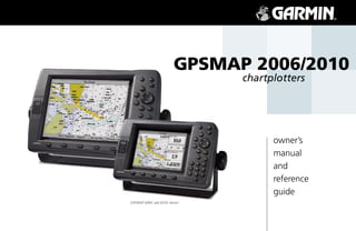
Garmin GPSMAP 2006/2006C/2010/2010C utilizes the proven performance of Garmin GPS and full fea- Product Registration
tured mapping to create an unsurpassed marine navigation chartplotter.
To get the most out of your new navigation system, take the time to go through this owner’s manual
and learn the operating procedures for your unit. This manual covers both the monochrome and color
models of the GPSMAP 2006 and 2010, software version 5.2 and higher. This manual is broken down into
Garmin’s Technical Support Department can be reached
two sections for your convenience. Monday-Friday 8am to 5pm Central Standard Time.
Section One introduces you to the GPSMAP 2006/2010 and provides a Getting Started tour so that you By phone at—
may become more familiar with the unit. This section will provide you with a basic working knowledge 1-800-800-1020 or 913-397-8200
necessary to use the unit to its fullest potential.
By internet at—
Section Two is divided into sections that provide detailed references to the advanced features of the http://www.garmin.com/support/index.html
GPSMAP 2006/2010. This allows you to concentrate on a specific topic quickly and can be used to look
up detailed information about the GPSMAP 2006/2010.
Software License Agreement
BY USING THE GPSMAP 2006/2010, YOU AGREE TO BE BOUND BY THE TERMS AND CONDI- Technical Support Product Registration
TIONS OF THE FOLLOWING SOFTWARE LICENSE AGREEMENT. PLEASE READ THIS AGREEMENT
CAREFULLY. Have the external serial number of your GPSMAP 2006/2010
handy and connect to our web site (www.garmin.com). Look for
Garmin grants you a limited license to use the software embedded in this device (the “Software”) in the Product Registration link on the Home page. Also, be sure
binary executable form in the normal operation of the product. Title, ownership rights, and intellectual to record your serial number in the area provided on page iii of
property rights in and to the Software remain in Garmin. this manual.
You acknowledge that the Software is the property of Garmin and is protected under the United States
of America copyright laws and international copyright treaties. You further acknowledge that the structure,
organization and code of the Software are valuable trade secrets of Garmin and that the Software in source
code form remains a valuable trade secret of Garmin. You agree not to decompile, disassemble, modify,
reverse assemble, reverse engineer, or reduce to human readable form the Software of any part thereof or
create any derivative works based on the Software. You agree not to export or re-export the Software to any
country in violation of the export control laws of the United States of America. i
5. Introduction The GPS system is operated by the United States government, which is solely responsible for its accuracy and
maintenance. The system is subject to changes which could affect the accuracy and performance of all GPS equip-
Warnings and Cautions ment. Although the Garmin GPSMAP 2006/2010 is a precision electronic NAVigation AID (NAVAID), any NAVAID
can be misused or misinterpreted and, therefore, become unsafe.
The electronic chart is an aid to navigation and is designed to facilitate the use of authorized government charts,
not replace them. Only official government charts and notices to mariners contain all information needed for safe
navigation – and, as always, the user is responsible for their prudent use.
Use the GPSMAP 2006/2010 at your own risk. To reduce the risk of unsafe operation, carefully review and
MAP DATA INFORMATION: One of the goals of Garmin
understand all aspects of this Owner’s Manual—and thoroughly practice operation using the simulator mode prior
is to provide customers with the most complete and accurate
cartography that is available to us at a reasonable cost. We to actual use. When in actual use, carefully compare indications from the GPSMAP 2006/2010 to all available
use a combination of governmental and private data sources, navigation sources, including the information from other NAVAIDs, visual sightings, charts, etc. For safety, always
which we identify as required in product literature and copyright resolve any discrepancies before continuing navigation.
messages displayed to the consumer. Virtually all data sources
contain inaccurate or incomplete data to some degree. This is FCC Compliance
particularly true outside the United States, where complete The GPSMAP 2006/2010 complies with Part 15 of the FCC interference limits for Class B digital devices FOR
and accurate digital data is either not available or prohibitively HOME OR OFFICE USE. These limits are designed to provide more reasonable protection against harmful interfer-
expensive. ence in a residential installation, and are more stringent than “outdoor” requirements.
CAUTION: IT IS THE USER’S RESPONSIBILITY TO Operation of this device is subject to the following conditions: (1) This device may not cause harmful interfer-
USE THIS PRODUCT PRUDENTLY. THIS PRODUCT IS
ence, and (2) this device must accept any interference received, including interference that may cause undesired
INTENDED TO BE USED ONLY AS A NAVIGATIONAL AID
AND MUST NOT BE USED FOR ANY PURPOSE REQUIR-
operation. This equipment generates, uses, and can radiate radio frequency energy and, if not installed and used in
ING PRECISE MEASUREMENT OF DIRECTION, DIS- accordance with the instructions, may cause harmful interference to radio communications. However, there is no
TANCE, LOCATION, OR TOPOGRAPHY. guarantee that interference will not occur in a particular installation. If this equipment does cause harmful interfer-
ence to radio or television reception, which can be determined by turning the equipment off and on, the user is
WARNING: This product, its packaging, and its components encouraged to try to correct the interference by one of the following measures: Reorient or relocate the receiving
contain chemicals known to the State of California to cause antenna. Increase the separation between the equipment and the receiver. Connect the equipment into an outlet
cancer, birth defects, or reproductive harm. This Notice is being on a circuit different from that to which the receiver is connected. Consult the dealer or and experienced radio/TV
provided in accordance with California’s Proposition 65. If you technician for help.
have any questions or would like additional information, please
refer to our web site at http://www.garmin.com/prop65. The GPS GPSMAP 2006/2010 does not contain any user-serviceable parts. Repairs should only be made by an
authorized Garmin service center. Unauthorized repairs or modifications could result in permanent damage to the
equipment, and void your warranty and your authority to operate this device under Part 15 regulations.
ii
6. LIMITED WARRANTY Introduction
This Garmin product is warranted to be free from defects in materials or workmanship for one year Warranty &
from the date of purchase. Within this period, Garmin will at its sole option, repair or replace any compo- Serial Number
nents that fail in normal use. Such repairs or replacement will be made at no charge to the customer for
parts or labor, provided that the customer shall be responsible for any transportation cost. This warranty
does not cover failures due to abuse, misuse, accident or unauthorized alteration or repairs.
THE WARRANTIES AND REMEDIES CONTAINED HEREIN ARE EXCLUSIVE AND IN LIEU OF ALL Serial Number
OTHER WARRANTIES EXPRESS OR IMPLIED OR STATUTORY, INCLUDING ANY LIABILITY ARIS-
ING UNDER ANY WARRANTY OF MERCHANTABILITY OR FITNESS FOR A PARTICULAR PURPOSE,
STATUTORY OR OTHERWISE. THIS WARRANTY GIVES YOU SPECIFIC LEGAL RIGHTS, WHICH MAY Use this area to record the serial number (8-digit number
VARY FROM STATE TO STATE. located in the back of the unit) in case it is lost, stolen, needs
service, or if you need to contact Technical Support. Be sure
IN NO EVENT SHALL GARMIN BE LIABLE FOR ANY INCIDENTAL, SPECIAL, INDIRECT OR to keep your original sales receipt in a safe place or attach a
CONSEQUENTIAL DAMAGES, WHETHER RESULTING FROM THE USE, MISUSE, OR INABILITY TO
USE THIS PRODUCT OR FROM DEFECTS IN THE PRODUCT. Some states do not allow the exclusion of photocopy inside the manual.
incidental or consequential damages, so the above limitations may not apply to you. Serial Number:
Garmin retains the exclusive right to repair or replace the unit or software or offer a full refund of the
purchase price at its sole discretion. SUCH REMEDY SHALL BE YOUR SOLE AND EXCLUSIVE REMEDY
FOR ANY BREACH OF WARRANTY.
To obtain warranty service, contact your local Garmin authorized dealer. Or call Garmin Customer
Service at one of the numbers shown below, for shipping instructions and an RMA tracking number. The
unit should be securely packed with the tracking number clearly written on the outside of the package.
The unit should then be sent, freight charges prepaid, to any Garmin warranty service station. A copy of
the original sales receipt is required as the proof of purchase for warranty repairs. The Garmin GPSMAP 2006/2010 has no user-serviceable
parts. Should you ever encounter a problem with your unit,
Products sold through online auctions are not eligible for rebates or other special offers from Garmin. please take it to an authorized Garmin dealer for repairs.
Online auction confirmations are not accepted for warranty verification. To obtain warranty service, an
original or copy of the sales receipt from the original retailer is required. Garmin will not replace missing The GPSMAP 2006/2010 is fastened shut with screws. Any
components from any package purchased through an online auction. attempt to open the case to change or modify the unit in any
way will void your warranty and may result in permanent
Garmin International, Inc. Garmin (Europe) Ltd. damage to the equipment.
1200 East 151st Street Unit 5, The Quadrangle, Abbey Park Industrial Estate
Olathe, Kansas 66062, U.S.A. Romsey, SO51 9DL, U.K.
Phone: 913/397.8200 Phone: 44/1794.519944
USA Only: 800/800.1020 FAX: 44/1794.519222
FAX: 913/397.0836
iii
7. Introduction Designed for detailed electronic charting capability, the Garmin GPSMAP 2006/2010 are powerful navi-
gation devices that can give you the navigation information you need:
Capabilities
Precision Performance
• The GPSMAP 2006/2010 features a high-contrast, ten-level gray, 640 x 480 LCD display with
adjustable contrast and backlighting.
• The GPSMAP 2006C/2010C features a high resolution, 256-color, 640 x 480 color LCD display
with adjustable brightness.
• GPS 17: 12-channel parallel receiver tracks and uses up to 12 satellites for fast, accurate positioning.
• DGPS; USCG and WAAS capable.
• Fully gasketed, high-impact plastic alloy case, waterproof to IEC 529-IPX7
Advanced Navigating and Plotting
• 3000 alphanumeric waypoints with selectable icons and comments.
• Built-in worldwide basemap includes detailed ocean, river and lake coastlines, cities, U.S. interstates,
state highways, and built-in tide information from over 3,000 tide stations around the USA coastline,
Alaska, Hawaii, western Canada, and several Caribbean Islands.
• 50 reversible routes with up to 254 waypoints each.
• Enhanced mapping with an additional data card and Garmin’s BlueChart or MapSource PC products.
• Coordinates: Lat/Lon, UTM/UPS, Loran TD, plus sixteen grids, including Maidenhead.
• TracBack route feature, which allows you to quickly retrace your track log to a starting position.
Superior Fishfinding Ability (when combined with the GSD 20 Sounder Module)
• Whiteline feature provides a clear image of bottom hardness and structure.
• See-Thru technology, which helps separate fish returns from thermoclines and structure.
• Depth Control Gain (DCG) feature automatically adjusts fishfinder sensitivity according to depth.
• Four Zoom levels with a moving view window, plus bottom lock.
• Underwater waypoint marking.
• Map/Sonar split screen combines navigation and fishfinding ability.
• Fish and Depth alarms.
iv
8. Introduction............................................................i-vi
Route List Page .............................................47 Introduction
Customer Service & Product Registration .............i Reviewing and Editing ..................................48
Warnings and Cautions .......................................ii Active Route Page ..............................................52 Table of Contents
Warranty and Serial Number ..............................iii Find Feature ......................................................53
Capabilities ........................................................ iv Main Menu Page................................................55
Table of Contents ................................................ v GPS Info Tab ................................................56
“How To” Index .................................................. vi Tide Tab .......................................................60
Trip Tab ........................................................61
Section One: Getting Started .............................. 1-13
Celestial Tab .................................................62
Looking at the GPSMAP 2006/2010 ....................1 Tracks Tab ....................................................63
Learning the Keypad ...........................................2 DSC Tab .......................................................64
Quick Start Tour - Learning the Basics.................3 User Card Tab...............................................69
Main Pages ..........................................................4 Time Tab ......................................................69
Activating the Simulator ......................................5 Pages Tab ......................................................69
Creating Waypoints.............................................6 Temp Tab......................................................70
Entering Data ......................................................7 System Tab ...................................................71
Basic Navigation ..................................................9 Units Tab ......................................................72
Initializing the GPSMAP 2006/2010 ..................12 Communication Tab .....................................75
Alarms Tab ...................................................77
Section Two: Reference ..................................... 14-70
Map Page and Options.......................................14 Appendices ........................................................ 72-74
Map Page Configuration ...............................20 Appendix A: Time Offsets..................................78
Sonar Page and Options ....................................24
Sonar Page Configuration .............................26 Appendix B: Messages .......................................79
Compass Page and Options ...............................32 Appendix C: Map Datums .................................81
Numbers Page and Options ...............................33 Appendix D: Navigation Terms..........................83
Highway Page and Options ...............................33 Appendix E: Installing Data Cards .....................85
Waypoints .........................................................35 Appendix F: Specifications/Interfacing ..............86
Creating........................................................35 Appendix G: Packing List/Accessories ...............87
Reviewing and Editing ..................................36
Proximity ......................................................39 Appendix H: Understanding Sonar ....................88
Going to a Destination.......................................41 Appendix I: Index .............................................92
TracBack .......................................................42
MOB .............................................................44
Routes ...............................................................45
Creating........................................................45 v
10. Getting Started
Data Card Slots
Looking Page Sequence
Main at the 2006/2010
Function Keys
Mounting Knobs
Power/Data Cable Port Data Port
for future use
Soft Keys Data Entry Keys
1
11. Getting Started Function Keys
Main Page Sequence
2006/2010 Keys The IN Key — adjusts the map scale to show a smaller area with more detail. (Zooms in)
The OUT Key — adjusts the map scale to show a larger area with less detail. (Zooms out)
The PAGE Key — cycles the unit through the main display pages in sequence and returns the display
from a submenu page.
The QUIT Key — cycles the unit through the main display pages in a reverse sequence, restores the
previous value in a data entry field, or cancels an unintended function such as a GOTO.
The ENTER/MARK Key — selects a highlighted menu option. When entering data, it allows you to initiate
entry and then accept the selected value(s). It also marks the current location as a waypoint when pressed
and held for more than one second.
The MENU Key — displays the Main Menu.
The NAV Key — displays a selection list allowing the user to select a navigation option.
The FIND Key — allows you to quickly access User Waypoints and other items used for navigation.
The MOB Key — immediately stores the location and gives the option of setting direct navigation.
The POWER Key — is used to turn the unit on and off and to activate the backlight.
The ARROW KEYPAD — is used to select (highlight) menu options and enter data. It controls the
Left/Right and Up/Down movement of the cursor.
Data Entry Keys
The Data Entry Keys are used when entering alpha-numeric data in the unit, such as a waypoint name.
The Data Entry Keys can be used in conjunction with the ARROW KEYPAD. To select the first letter
press the key once, to select the second letter press the key twice, to select the third letter press the key
three times, or to select the number press the key four times. When you have correct letter or number
selected, pause and the unit advances the cursor to the next character automatically.
Soft Keys
The Soft Keys are located along the bottom of the display and are used to select options for the page
2 that is displayed. To select an option, press the Soft Key below it.
12. 2006/2010 Basic Operation Getting Started
Before moving ahead to the features of the GPSMAP 2006/2010, you will need to learn basic opera- Main Page Sequence
tions. Many times throughout this manual you will be prompted to press a key. When instructed, press,
then release the key. If the key needs to be held down, the instructions will prompt you.
Turning the GPSMAP 2006/2010 ON:
1. Press the POWER key.
As the unit powers on, a Warning Page is displayed. After reading the Warning Page, press the
ENTER/MARK key to display the GPS Info on power-up window. (This window will be covered at the
end of the Getting Started section.) Press the ENTER/MARK key to continue to the Map Page.
Adjusting the Contrast and Backlight
The 2006/2010 monochrome versions have adjustments for the Contrast and Backlighting, the color
versions do not have a Contrast adjustment.
Adjusting the Contrast on Monochrome Units:
1. Press the POWER key to display the Contrast/Backlight Adjustment Window.
2. Press the ARROW KEYPAD left to decrease (lighten) the Contrast
3. Press the ARROW KEYPAD right to increase (darken) the Contrast.
The Backlight can be turned off for operation in sunlight or increased in steps to produce the right
lighting for the situation.
Activating the Backlight:
1. Press the POWER key to activate the Backlight Adjustment Window.
2. To increase the backlighting, press the ARROW KEYPAD up.
Contrast Adjustment on Monochrome Units Only
3. To decrease the backlighting, press the ARROW KEYPAD down.
TIP: After the Backlight Adjustment Window is activated, pressing the POWER key repeatedly will cycle
through the backlight’s three settings.
3
13. Getting Started First let’s take a look at the Main Display Pages as they come from the factory. There are five pages: the
Main Page Sequence Map Page, Sonar Page, Compass Page, Numbers Page, Highway Page and the Active Route Page. When the
unit is turned on the first Main Page displayed is the Map Page.
To scroll through the Main Display Pages:
1. Press the PAGE key. Each time the PAGE key is pressed the GPSMAP 2006/2010 will display the next Main
Page.
2. The QUIT key acts like the PAGE key in reverse. Each time the QUIT key is pressed, the next Main Page
PAGE
will be displayed in a reverse sequence. PAGE
Map Page Sonar Page Compass Page Numbers Page Highway Page Active Route Page
QUIT (If equipped with QUIT
GSD 20)
While learning the basic operation of the GPSMAP 2006/2010, let’s put the unit into its Simulator
Mode. The Simulator Mode is great for practicing with the unit. When the unit is in Simulator Mode,
it will not accept GPS input, but will simulate satellite navigation. When in the Simulator Mode, the
GPSMAP 2006/2010 CAN NOT be used for actual navigation.
NOTE: Do not try to navigate while using the Simulator Mode. When the GPSMAP
2006/2010 is using the built-in simulator, the unit is not accepting GPS input. The unit will,
however, simulate actual satellite navigation.
4
14. Activating the Simulator Mode: Getting Started
1. Press the MENU key.
Using thePage Sequence
Main Built-in Simulator
2. With the ‘GPS Info’ tab displayed, at the lower left of the display will be a SOFT KEY label ‘Start Simula-
tor’, press the SOFT KEY that corresponds with this option. Choose ‘No’ to the retail demonstration and
press ENTER/MARK. Press ENTER/MARK again to acknowledge the Running Simulator/Sonar Message.
3. The “Simulator Setup” window will be displayed.
There are seven parameters that can be set for the simulator: “Current Time”, “Current Date”, “Track
Control”, “Track”, “Speed”, “Transducer” and “Set Position” (SOFT KEY). We need to change the “Current
Time” and “Current Date” settings.
There are two methods that you can use when entering alpha-numeric data, one is the
ARROW KEYPAD and the other is the DATA ENTRY keys. We will use the ARROW KEYPAD for set-
ting the Current Time and Current Date. See page 7 for instructions using the DATA ENTRY keys.
Current Time:
1. Using the ARROW KEYPAD, highlight the “Current Time” field and press the ENTER/MARK key.
2. Using the Right/Left function of the ARROW KEYPAD, place the highlight on the correct digit to begin
entering the current time.
3. Using the Up/Down function of the ARROW KEYPAD, scroll through the list until the correct number is
displayed. Press the ARROW KEYPAD to the right to highlight the next digit. Select this SOFT KEY to start the Simulator
4. Continue this process until the correct “Current Time” is displayed then press the ENTER/MARK key to
accept the new time.
Current Date:
1. Using the ARROW KEYPAD, highlight the “Current Date” field and press the ENTER/MARK key.
2. Using the Right/Left function of the ARROW KEYPAD, place the highlight on the correct digit to begin
entering the Current Date.
3. Using the Up/Down function of the ARROW KEYPAD, scroll through the list until the correct number is After the ‘Start Simulator’ SOFT KEY has been pressed, the
displayed. Press the ARROW KEYPAD to the right to highlight the next digit. “Simulator Setup” window will be displayed. Set the current
4. When the month is highlighted the Up/Down function of the ARROW KEYPAD will scroll through a list of time and date, and change the “Track Control” to ‘User Track’.
the months. Select the current month then move to the next digit. When finished press the QUIT key to begin simulation.
5. Continue entering the date. When finished, press the ENTER/MARK key to accept the new date. 5
15. Getting Started The Simulator is now set up and ready to use!
Main Page Sequence
Creating Waypoints Let’s review what we have covered so far:
1. The PAGE and QUIT key will cycle through the Main Pages, the PAGE key in a forward direction and the
QUIT key in reverse.
2. To select a field or option use the Right/Left and Up/Down functions of the ARROW KEYPAD to control
the cursor or highlight.
Name Field 3. To activate a field or option, place the highlight over the item and press ENTER/MARK.
Symbol Field Comment Field 4. Use the ARROW KEYPAD to scroll through alpha-numeric character lists when entering data.
(up to 20 characters) Creating Waypoints
There will be many times that you will need to enter data in the GPSMAP 2006/2010, an example is
naming a waypoint. We have already taken a brief look at entering data, but let’s practice some more.
Through this exercise we will create a new waypoint, name the waypoint, and assign a symbol to the
waypoint. The term “Waypoint” may be new to you. You will find the term “Waypoint” is used frequently
when talking about navigation. A “Waypoint” is a position stored in the unit’s memory, that can be used for
navigation. Waypoints are used for direct navigation or you can use several waypoints to build a route.
Creating, or “Marking” a waypoint in the 2006/2010 is really very easy. The unit has to be turned on
and receiving at least three satellite signals or in Simulator Mode to mark a waypoint.
Marking your present position as a Waypoint:
1. Press and hold the ENTER/MARK key (more than 1 second) until the ‘New Waypoint’ window is dis-
played.
Distance and Direction Depth Field When you hold the ENTER/MARK key, the GPSMAP 2006/2010 captures its current location and
from Captured Location displays the ‘New Waypoint’ window. You can see that the unit assigned a square as the default symbol
Captured Location and a number as the default name. The ‘OK’ button is now highlighted. Pressing the ENTER/MARK key
will store the new waypoint using the default settings for the symbol and name, but let’s change them for
practice.
Changing the symbol:
1. Using the ARROW KEYPAD, highlight the symbol field, then press the ENTER/MARK key. This will
6 display a list showing all of the available symbols.
16. 2. Using the ARROW KEYPAD, highlight the ‘Information’ symbol and then press the ENTER/MARK key. Getting Started
We will enter a new waypoint name using the DATA ENTRY keys. Each DATA ENTRY key has mul- Main Page Sequence
Entering Data
tiple characters assigned to it. Pressing the key one time will select the first character, twice will select the
second character, three times the third character, and four times will select the number assigned to the key.
The only DATA ENTRY key that does not have four characters is the “+, -, 0” key.
When entering data using the DATA ENTRY keys, press the key repeatedly until the correct character
is selected, then pause briefly or press the next letter/number from a different key. The unit will automati-
cally move the cursor to the next placeholder.
Changing the name:
1. Using the ARROW KEYPAD, highlight the Name field and then press the ENTER/MARK key. This will
activate the field with the highlight on the first placeholder.
2. Press the ARROW KEYPAD to the left to clear the field.
3. We will name this waypoint “PRACTICE 1”, press the DATA ENTRY key labeled “P, Q, R, 6” one time to DATA ENTRY keys
set the letter “P”. (If you are entering a letter/number from the same key, pause briefly and the unit will
move to the next placeholder automatically. Otherwise, press the next letter/number from a different key.)
4. Press the same key three times to set the letter “R”. Continue entering the name until “PRACTICE” is
spelled.
5. To move the cursor to the right one space, press the ARROW KEYPAD to the right one time.
6. Finish the waypoint name by selecting the number “1”.
7. Press the ENTER/MARK key to accept the new name.
Directly below the Name field is a Comment Field. You can enter a comment of up to twenty digits
about the waypoint in this field. For some more practice, enter “First Waypoint” in the comment field.
Entering a Comment:
1. Highlight the ‘Comment’ field and press the ENTER/MARK key. Select the ‘Information’ symbol, enter the name “Practice 1”,
2. Using the ARROW KEYPAD and DATA ENTRY keys, enter “FIRST WAYPOINT”. and enter the comment “First Waypoint”.
3. Press the ENTER/MARK key to accept the comment.
7
17. Getting Started Now that you have finished modifying the waypoint you will need to save it to the Waypoint List.
Main PageKeys
Soft Sequence To Save the Waypoint:
1. Using the ARROW KEYPAD, highlight the ‘OK’ button at the bottom of the “New Waypoint” window.
2. Press the ENTER/MARK key to save the waypoint.
Data Entry Tips:
1. Remember that you can use both the ARROW KEYPAD and DATA ENTRY keys to enter data.
2. When using the ARROW KEYPAD, if you press and hold the key, the unit will scroll through the alpha-
numeric list quickly.
3. When using the DATA ENTRY keys, press the key the appropriate number of times for the character that
you want to display. The number is always last.
Soft Keys
The SOFT KEYS are located along the bottom of the unit under the display. The SOFT KEYS are used
to perform functions or display menus specific to the page that is displayed. The labels showing the func-
tion of each key are along the bottom of the display just above the corresponding SOFT KEY. To perform
the listed function press the SOFT KEY. If the function in the label is “Grayed Out”, that function is not
currently available.
The SOFT KEYS are located under the display on the front of
the unit. The SOFT KEYS are used to change display options Press the PAGE or QUIT key until the Map Page is displayed. To see how the SOFT KEYS work we
and show menus for the Main Page that is currently displayed. will hide and show the ‘Numbers’ Fields located along the right side of the screen and display the Map
Labels showing the function of the SOFT KEYS are located Setup Menu.
along the bottom of the display. To select the function, press the
SOFT KEY located directly below it. To Hide the Numbers:
1. Press the SOFT KEY located below ‘Full Map’ at the bottom of the display.
You should now have a map that covers the entire display from left to right. Now let’s redisplay the
‘Numbers’.
To Display the Numbers:
1. Press the SOFT KEY located below ‘Set Up Page’, then press the ‘Show Data’ SOFT KEY.
To Display the Map Setup Menu:
8
18. 1. Press the SOFT KEY located below the ‘Set Up Map’ tag located at the bottom of the display. Getting Started
The Map Setup Page Menu will be displayed. The Map Setup Page will be discussed in detail in the Main Page Sequence
Basic Navigation
Reference Section of this manual. Now let’s return to the Map Page.
To Return to the Map Page:
1. Press the QUIT key.
Remember that SOFT KEYS are used to quickly access options or functions for the Main Page that
is displayed. The options or functions assigned to a SOFT KEY may be different for every page that is
displayed.
Basic Navigation
The main use of a GPS is to be able to navigate to a known position. We have already created a
waypoint using the ENTER/MARK key. Let’s create another waypoint using the Map Pointer and then
begin navigation to that point.
Press the PAGE key until the Map Page is displayed. Press the IN key several times until the Map Scale
located at the bottom right of the display reads “2 nm”. This will “Zoom In” on the map showing a smaller
area in more detail.
The ARROW KEYPAD controls the Map Pointer. The Map Pointer originates from the current GPS
location, represented by the triangle in the middle of the display.
To Display the Map Pointer: Map Pointer
1. Press the ARROW KEYPAD in any direction.
Using the ARROW KEYPAD you can move the Map Pointer around the map. As you move the Map
Pointer around the map, the direction and distance of the Map Pointer from the current GPS location is
displayed in the information bar along the top of the display. Move the Map Pointer until it is approxi-
mately two miles from the current GPS location.
To Create a Waypoint Using the Map Pointer:
1. With the Map Pointer at the desired location (not on a road or map feature), quickly press and release the
ENTER/MARK key. (Holding the ENTER/MARK key for more than one second will mark your present loca- 9
19. Getting Started tion. See pg. 6) The “New Map Waypoint” Page is displayed.
Main Page Sequence
Basic Navigation Change the waypoint name to “MAP 1”, and assign the ‘Information’ symbol. Save the waypoint by
highlighting the ‘OK’ button and pressing the ENTER/MARK key. Press the QUIT key to hide the Map
Pointer and center the display on the current GPS location.
Navigating to a waypoint
When you begin navigation to a waypoint, the GPS sets a straight line course to that point. The unit
will draw a Course Line on the display between the current GPS location and the destination waypoint.
You may use any of the main pages for navigation. All of these pages are discussed in detail in the Refer-
ence section of this manual. For this exercise, let’s use the Highway Page.
Going to a waypoint:
1. Press the NAV key.
2. Highlight ‘Go To Point’ and press the ENTER/MARK key.
3. Highlight ‘Waypoints’ and press the ENTER/MARK key. This will display the ‘Select Waypoint’ window.
From this window you can select waypoints “By Name”, or by “Nearest From Current Position”. Select the
tab ‘By Name’ using the ARROW KEYPAD.
4. Using the ARROW KEYPAD, scroll through the list until the waypoint “Map 1” is highlighted. Press the
ENTER/MARK key to display the “Waypoint Review” Page.
5. With the ‘Go To’ button highlighted, press the ENTER/MARK key to begin navigation.
For a GPS to navigate it has to be moving. When the Compass Page or Highway Page is displayed and
the unit is in the Simulator Mode, you can set a simulated speed by pressing the ARROW KEYPAD ‘Up’.
Each time the ARROW KEYPAD is pressed ‘Up’ the simulated speed will increase by ten knots. Pressing
the ARROW KEYPAD ‘Down’, will decrease the simulated speed by the same amount.
Press the PAGE key until the Compass Page is displayed. Along the right side of the display there are
four data fields, the top field is the Speed. Press the ARROW KEYPAD ‘Up’ one time to set a speed of 10
knots.
Using the Compass Page
10
Located on the Compass Page are the Bearing Pointer, and a Compass Ring. When you are moving, the
20. Bearing Pointer points toward your destination, while the Compass Ring reflects the direction that you are Getting Started
traveling. In short, when you are headed directly toward your destination, the Bearing Pointer will point
Compass Page
Main Page Sequence
toward the top of the display, aligned with the vertical line displayed in the Compass Ring. If you are not
heading toward your destination, the Bearing Pointer will turn, continuing to point toward your destina-
tion. To head toward your destination, turn until the Bearing Pointer is realigned with the vertical line in
the Compass Ring.
The GPSMAP 2006/2010 will allow you to simulate a turn so you can see what will happen.
To simulate a turn:
1. Press the ARROW KEYPAD to the right until the Compass Ring has changed about 40°.
The Bearing Pointer should now be pointing to the left. This is exactly what will happen during actual
navigation. To get back on course, press the ARROW KEYPAD to the left, simulating a left turn. When
the Bearing Pointer is aligned with the vertical line in the Compass Ring, you are headed directly toward
the destination waypoint. Compass Page — Heading directly toward the destination
Congratulations you should now have enough experience to use the basic functions of your GPSMAP waypoint. When the Bearing Pointer is aligned with the vertical
2006/2010. Enjoy your new GPSMAP 2006/2010 and thank you for choosing Garmin. line in the Compass Ring then you are on a direct course to
your destination.
Compass Page — showing off course about 40°. Turn left until
the Bearing Pointer is aligned with the vertical line to get back
on course.
11
21. Getting Started Initializing the Receiver
Initializing the Receiver
Main Page Sequence The first time you power up your new GPSMAP 2006/2010 and GPS 17 receiver, the receiver must be
given an opportunity to collect satellite data and establish its present position. To ensure proper initializa-
tion, the GPS 17 is shipped from the factory in AutoLocate mode, which allows the receiver to “find itself”
anywhere in the world. To speed up the initialization process, we recommend using the graphic initializa-
tion process, which usually provides a position fix within a few minutes. If you know your approximate
coordinates, you may also enter the position as text.
Before you initialize, make sure the GPSMAP 2006/2010 unit and GPS 17 antenna have been correctly
installed on your vessel according to the instructions in the 2006/2010 Installation Guide. The antenna
needs a clear and unobstructed view of the sky to receive satellite signals.
To turn the GPSMAP 2006/2010 on:
1. Press and hold the POWER key until the display comes on, then release the POWER key.
Warning page A warning page appears, asking you to read and acknowledge important information regarding the
proper use of the unit.
To acknowledge the warning:
1. After reading the warning, press the ENTER/MARK key if you agree.
Next you will see the GPS Info window which provides a visual reference of satellite acquisition, GPS
receiver status, and accuracy. The status information will give you an idea of what the GPS receiver is
doing at any given moment.
To graphically initialize the GPSMAP 2006/2010:
1. From the GPS Info window, press the ‘Set Position’ SOFT KEY.
2. The Initialize Position Page will appear, prompting you to select your approximate location with the map
cursor. Use the ARROW KEYPAD to move the map cursor and point to your approximate location within
200 miles. If you have difficulty identifying your position, press and release the IN key to zoom in to view
Point to your approximate location and press ENTER/MARK. the map at the next lower scale.
3. Once you have determined your approximate location on the map, press the ENTER/MARK key.
12
22. 4. If you wish to enter your approximate location as text, from the Initialize Position Page, press the ‘Enter Getting Started
As Text’ SOFT KEY then use the DATA ENTRY keys to enter the coordinates and press ENTER/MARK
Initializing the Receiver
Main Page Sequence
when done.
satellite acquisition. If thethe unit in any“Readybut rather(3D )” during thisupprocess, it is not
This does not “calibrate”
unit displays
way,
(2D) or
helps to speed the initial
necessary to initialize the unit.
The GPSMAP 2006/2010 will now begin searching for the appropriate satellites for your region and
should acquire a fix within a few minutes. When viewing the GPS Info, a signal strength bar for each
satellite in view will appear on the bottom of the page, with the appropriate satellite number under each
bar. The progress of satellite acquisition is shown in three stages:
• No signal strength bars— the receiver is looking for the satellites indicated.
• Hollow signal strength bars— the receiver has found the indicated satellite(s) and is collecting data.
• Solid signal strength bars (green on color models)— the receiver has collected the necessary data A satellite’s strength bars will turn black (or green) when it’s ready
and the satellite(s) are ready for use. for use.
Once the receiver has collected information from at least three satellites, the top of the screen displays
either “Ready (2D or 3D)”, the GPS Info window automatically disappears and the display switches to the
Map Page showing your current position. The GPSMAP 2006/2010 is now ready for use!
The GPS Info may also be accessed from the Main Menu once the unit is ready to navigate. For more
detailed information on the GPS Info tab and its related options, see pages 56-59. The GPS Info on power-
up window may also be turned off in order to go directly to the first Main Page using the Pages tab options
(see pg. 55).
is possible2006/2010 ‘“Ready (2D)position information fromsatellite data. NMEA source, it
Since the
to have a
can receive
or (3D)” status with no
a non-Garmin
The GPS Info screen and additional options may also be accessed
from the Main Menu after the unit has acquired satellites.
13
23. Reference Map Page
Map Page The GPSMAP 2006/2010’s Map Page provides a comprehensive display of electronic cartography, plot-
ting and navigational data. When using the unit with the optional BlueChart data or MapSource soft-
ware, the map display shows your boat on a digital chart, complete with geographic names, map items,
navaids, and a host of other chart features. Additional information on BlueChart data may be found in the
“BlueChart User’s Guide”. You may also display sonar information (if equipped). It also plots your track and
displays any routes and waypoints you create. An on-screen cursor lets you pan and scroll to other map
areas, determine the distance and bearing to a position, and perform various route and waypoint functions.
Geographic Map When the cursor is active, an additional data window appears above the map to indicate the position,
Land Name Item Data Fields
any identifying text, rang, and bearing to the cursor or a selected waypoint or map item. The map scale
displays at the bottom right of the map.
The IN and OUT keys, combined with the ARROW KEYPAD, let you select zoom ranges and move the
cursor. Two basic map operating modes, position mode and cursor mode, determine what cartography is
shown on the map display. Position mode pans the cartography to keep the present position marker within
the display area, while cursor mode pans the cartography to keep the cursor within the display area.
The GPSMAP 2006/2010 system (by default) powers up in the position mode, with your vessel centered
on the map display. When sufficient map coverage is not available to keep the boat centered, the boat icon
will move toward the edge of the display.
When the ARROW KEYPAD is pressed, the GPSMAP 2006/2010 enters cursor mode. In cursor mode:
Water Boat Icon Navaids Map Scale
• The cursor can be moved over the map display using the ARROW KEYPAD.
Map Page shown using
• Whenever the cursor reaches the edge of the display, the map scrolls forward under the cursor. Keep
optional BlueChart data.
in mind that the boat icon moves with the map scrolling and may go off the display screen (you may
not be able to see your present position).
• When the cursor is stationary, a fixed coordinate position will appear in the position field. Note that
the distance and bearing changes as the boat’s position changes.
• Whenever you zoom in cursor mode, the cursor is centered on screen.
• To return to position mode, press the QUIT key.
14
24. When the cursor reaches the edge of the map, the unit may pause as it loads new map Reference
data. Map Page Cursor
Using the Cursor
The cursor allows you to pan away from your present position and scroll to other map areas around
the world (even outside of your current detail coverage). As you pan past the edge of the current map
display, the screen actively scrolls forward to provide continuous map coverage. You will see an hourglass
symbol by the pointer while the unit is busy drawing new map detail.
To move the cursor:
1. Press the ARROW KEYPAD to move the cursor in an up, down, left, or right direction.
As you move the cursor, the distance and bearing from your present position to the cursor is displayed
in the data window, with the cursor’s position coordinates. Keep in mind that when the cursor is station-
ary, the distance and bearing from your present position changes as your boat moves. The cursor may
Move the cursor over an item on the map to highlight it.
also be used to ‘snap’ to on-screen waypoints and map items, allowing you to review a selected position
directly from the map display.
Additional information tabs.
To select an on-screen waypoint or map item with the cursor:
1. Use the ARROW KEYPAD to move the cursor to the desired waypoint or map item (if there are several
waypoints grouped closely together, zoom in closer for a better view).
2. When a waypoint or map item is selected, it will become highlighted on screen, with the name and position
displayed. Press ENTER/MARK to show details of the map item. When using BlueChart or MapSource
data, additional information tabs will appear. Use the ARROW KEYPAD to highlight the individual tabs
to display the information and additional options. Use the SOFT KEY options to Scroll Up, Down, Left
Option
or Right when necessary.
buttons
To eliminate the cursor and re-center your position on-screen:
1. Press the QUIT key.
The cursor may also be used to create new waypoints directly from the map. Pressing ENTER/MARK while highlighting a map item will
To create a waypoint with the cursor: bring up additional details and options.
1. Use the ARROW KEYPAD to move the cursor to the desired map position. (continued) 15
25. Reference 2. Press the ENTER/MARK key and the ‘New Map Waypoint’ window will appear. If the cursor is on a
map item, you will get a new window with details about the item when ENTER/MARK is pressed. Press
Map Page Zooming
and Options ENTER/MARK again on the highlighted ‘Create Waypoint’ option.
3. Highlight ‘OK’ and press ENTER/MARK to confirm the new waypoint using the default three-digit name
and symbol. To change any of the available data fields, see page 27.
Selecting Map Scales
The map display has 28 available range scales from 20 ft. to 800 mi. (5 m to 1200 km). The map scale
is controlled by the IN and OUT keys, with the current scale displayed at the bottom right of the data
window. The scale value represents the distance from one end of the scale bar to the other.
To select a map scale:
1. Press the OUT key to zoom out and the IN key to zoom in.
The GPSMAP 2006/2010’s system has a built-in worldwide database to 20 mi, with more detailed
coverage available through the use of the optional BlueChart or MapSource data. The GPSMAP 2006/2010
Creating New Map Waypoint
will display cartography as long as there is chart information available for the range you’ve selected. Map
coverage will conform to the following conditions:
• When the selected zoom range is covered by either the internal database, BlueChart, or MapSource
data, cartography will be displayed.
• When the selected zoom range is covered by both the internal database and BlueChart/MapSource
data, cartography will be displayed using the data with the best resolution.
• When the selected zoom range exceeds the resolution of the data in use, overzoom cartography will
Using Built-In Basemap be displayed and an ‘overzoom’ warning will appear below the scale field.
Map Page Options
Many features of the GPSMAP 2006/2010 are SOFT KEY driven. Each of the main pages have SOFT
Using BlueChart/MapSource Data
KEY options, allowing you to custom tailor the corresponding page to your preferences and/or select
special features that specifically relate to that page. The data window, located at the right of the main pages
(except Active Route Page) provides a user-selectable layout of various types of useful data. Each data
field may be configured to display any one of several data options. The data window layout may also be
Overzoom, no additional data changed to display additional data fields and change the actual size of the data displayed.
16
26. The GPSMAP 2006/2010’s Map Page provides access to functions and features relating to the Map Page Reference
and the layout options. Map Page Options
The available SOFT KEY options are Measure, Full Map/Show Data, Set Up Page, Set Up Map, and
Declutter On/Off. Following are details on using each of these options.
• Measure — allows you to measure the bearing and distance between any two points on the map display. Distance and
To measure the BRG/DIS between two points: Bearing
1. Press the ‘Measure Distance’ SOFT KEY. An on-screen pointer appears on the map display at your present
position with ‘ENT REF’ below it. Cursor
2. Move the cursor to the desired reference point (the point that you want to measure from) and press Coordinates
ENTER/MARK.
3. Move the cursor to the point that you want to measure to. The bearing and distance from the reference Map
point and cursor coordinates will be displayed in the data window at the top of the display. Press the QUIT Cursor
key to finish.
Full screen map shown
• Full Map/Show Data — toggles between a Map Page without or with data fields on the map display.
To maximize the map/show data fields:
1. Press the ‘Full Map’ SOFT KEY. The Map Page will now be maximized with no data fields.
2. To show the data fields again, press the ‘Show Data’ SOFT KEY.
• Set Up Page — allows you to configure the map layout to your preferences, including changing the
type of data displayed in the data fields, showing sonar information and sizing a split display.
• Change Nmbrs (Numbers) — allows you to specify the type of data displayed in each number field
used on the map display. This option is available from any of the main pages.
To change a number field:
1. Press the ‘Change Nmbrs’ SOFT KEY.
2. Move the field highlight to the data field you want to change and press ENTER/MARK.
3. Move up or down on the list using the ARROW KEYPAD to highlight the data you want to display, and Highlight the field you wish to change.
press ENTER/MARK. To exit, press QUIT or the ‘Quit’ SOFT KEY.
17
27. Reference The following data options are available for data fields on the main pages:
• BEARING – Compass direction from your position to destination
Map Page Options • COMPASS – Compass ribbon
• COURSE – Desired Track
• DEPTH – Depth below transducer (if receiving proper sonar data from other device)
• DISTANCE TO DEST – Distance to final waypoint
• DISTANCE TO NEXT – Distance to next waypoint
• ELEVATION – Elevation above/below MSL (Mean Sea Level)
• ETA AT DEST – Estimated Time of Arrival to final waypoint
• ETA AT NEXT – Estimated Time of Arrival to next waypoint
• GPS ACCURACY – Current accuracy of GPS receiver
• HIGHWAY – Smaller version of the Highway Page
• MAX SPEED – Fastest speed the unit has traveled
• MOVING AVG SPEED – Average moving speed
• MOVING TIME – Time unit has been moving for a trip
• OFF COURSE – Distance from desired track
Choose the type of data you wish to display. • POINTER – Arrow points to your destination
• POSITION – Current position coordinates
• SONAR* – Compressed view of sonar data
• SPEED – Speed over ground
• TIME OF DAY – Current time
• TIME TO DEST – Time to final waypoint
• TIME TO NEXT – Time to next waypoint
• TO COURSE – Distance to desired track
• TOTAL AVG SPEED – Total average speed
• TOTAL TRIP TIME – Total travel time of trip, stopped and moving
• TRACK – Current compass direction of travel
• TRIP ODOMETER – Trip Odometer
• TURN – Directional amount of turn needed to match bearing
• VELOCITY MADE GOOD – Velocity Made Good to destination
• VOLTAGE – Current voltage reading being received by unit
• WATER SPEED* – Speed through the water
• WATER TEMPERATURE* – Water temperature
• WATER TEMP. LOG* – Timeline graph of the transducer’s temperature reading.
18 * If receiving proper sonar data from other device, such as a GSD 20 Sounder Module)
28. Reference
NOTE: COMPASS, HIGHWAY and POSITION will only be available on medium and large sized data fields.
Map Page Options
You may also choose to ‘split’ the default numbers to 4 smaller fields for more data or you may
‘merge’ the smaller fields back to their original size. All the Main Pages (except the Numbers and
Active Route Pages) will have 4 medium sized fields, which may be split to a total of 16 small fields.
The Numbers Page will display 4 large fields, which may be split to a total of 16 medium fields. This
option is available from any of the Main Pages, except the Active Route Page. Split, small fields
To Split or Merge the Numbers fields:
1. While in ‘Change Nmbrs’ mode, highlight the data field you want to change and press the ‘Split Number’ Default, medium fields
or ‘Merge Numbers’ SOFT KEY. You will now see four new data fields or one large field. You may also use
the IN or OUT keys to split and merge the fields. Press QUIT when done or press the ‘Quit’ SOFT KEY.
2. To return to the factory configuration, press the ‘Defaults’ SOFT KEY while in ‘Change Nmbrs mode. Press
QUIT when done or press the ‘Quit’ SOFT KEY. Single, large data field
• Hide/Show Nmbrs (Numbers) — toggles between a Map Page without or with data fields on the
map display.
• Hide/Show Sonar — toggles between a Map Page without or with sonar information on the map
display.
• Size Split— enables width adjustment of the Map Page sonar split screen. You may adjust the size
of the map/sonar split window anywhere from 1/4 to 3/4 width from the right half of the Map Page.
You must be showing sonar information to use this option.
To resize the Map Page sonar split screen:
1. From the Map Page split screen, press the ‘Set Up Page’ then ‘Size Split’ SOFT KEYS.
2. Move the horizontal double-arrow LEFT or RIGHT using the ARROW KEYPAD until the desired vertical
width line shows, then press ENTER/MARK or the ‘Accept Resize’ SOFT KEY. You may also press the
‘50/50’ SOFT KEY to equally proportion the map and sonar windows.
3. If you wish to cancel this operation, press QUIT or press the ‘Cancel Resize’ SOFT KEY.
Move double arrow left or right to size the split screen.
19
29. Reference • Set Up Map— allows you to configure the map display to your preferences, including map detail, map
Map Page Options orientation, automatic zoom, and various map items and points. The map set up option uses a ‘file tab’
feature, making it easier to organize the various settings for ease of use. The following table lists the file
tabs and the settings available under each tab:
General Detail, Orientation, AutoZoom, Map Colors
Source Basemap, Data Card Maps
Waypoints Waypoints, Active Route
Points Spot Soundings, Tide Stations, Services
Navaids Symbol Set, Symbol Size, Text Size, Light Sectors
Nav Line Heading Line, Bearing Line, Course Line
Track Saved Tracks, Track Log
Other Accuracy Circle, Lat/Lon Grid, Map Outlines
To change a map setup feature:
Main Menu—Map Configuration Tab 1. Press the ‘Set Up Map’ SOFT KEY.
2. Move LEFT or RIGHT on the ARROW KEYPAD to highlight the desired tab, then UP or DOWN on the
ARROW KEYPAD to highlight the setting you want to change and press ENTER/MARK.
3. Move UP or DOWN on the ARROW KEYPAD to highlight to the desired setting and press
ENTER/MARK. To exit, press QUIT.
General Tab
Detail— Most, More, Normal, Less, Least: controls how much map detail you will see. This setting only
applies to any map feature set to “Auto”. Those features which have a specified scale or turned “Off” are
unaffected by this setting.
Orientation— North Up— fixes the top of the map display to a north heading; Track Up— fixes the top
General Tab of the map display to the current track heading; Course Up— fixes the map so the direction of naviga-
tion is always “up” and turns the navigation leg line vertical on the screen.
AutoZoom— On/Off: when “On” the map will automatically adjust the map scale to a lower scale as you
approach you destination point.
Map Colors— Water /Land Mode or For Shade/Sunlight (color models only): when in “Water Mode”,
land will appear as a darker color and water will be lighter. In “Land Mode”, land will appear as a lighter
color and water will be darker. If using optional BlueChart data, it is recommended to use ‘Water Mode’.
20 For color models, “For Shade” is designed to match the color of physical marine charts as closely as pos-
30. Reference
sible. Use this setting when in shaded environments. “For Sunlight” displays more vibrant colors for use
in sunny environments. BlueChart data may be used with either color model mode. Map Page Options
Source Tab
Basemap— On/Off: turns the built in base map on or off.
Data Card Maps— On/Off: turns all optional BlueChart/MapSource data loaded on the data card on or
off.
Waypoints Tab— Waypoints/Active Route
Text— None, Small, Medium, and Large: controls the screen size of the name.
Zoom— Auto, Off, 120 ft.-800 mi.: sets the maximum scale at which the feature should appear on the
Source Tab
screen. Some types of data will only show up to certain zoom scales.
Points Tab— Spot Soundings/Tide Stations/ Services
Text— None (except Spot Soundings), Small, Medium, and Large: controls the screen size of the name.
Zoom— Auto, Off, 120 ft.-800 mi.: sets the maximum scale at which the feature should appear on the
screen. Some types of data will only show up to certain zoom scales. (Spot Soundings On/Off only) Waypoints Tab
Navaids Tab— Spot Soundings/Tide Stations/ Services
Symbol Set— Auto, Garmin, NOAA, International: controls the desired navaid symbol set.
Auto - BlueChart maps are drawn using symbols similar to the NOAA/NIMA standard.
Non BlueChart maps are drawn using traditional Garmin symbols.
Garmin - All maps are drawn using traditional Garmin symbols. Points Tab
NOAA - All maps are drawn using a symbol set similar to NOAA/NIMA.
International - All maps are drawn using a symbol set similar to the IALA symbol set.
Symbol Size— Small, Medium, and Large: controls the screen size of the navaid symbols.
Text Size— Small, Medium, and Large: controls the screen size of the name.
Light Sectors— Off, Auto, On: controls the drawing light sectors on the map. Color units indicate the Navaids Tab
actual color of each sector using the color of the light. Monochrome units draw white and yellow sectors
as white, and draw blue, red & green sectors as dark gray.
Off— No light sectors are ever drawn
Auto— Light sectors appear when you point to them with the map cursor.
On— Light sectors are drawn for all lights that have them. 21
31. Reference Nav Line Tab—
Heading Line— On/Off: draws an extension from the end of the boat icon in the direction of travel.
Main Page Sequence
Bearing Line— On/Off: toggles the black/white line which points to the current navigation point.
Course Line— Auto, Off, 120 ft.-800 mi.: sets the maximum zoom scale at which the desired course line
should appear on the screen.
Track Tab— Saved Tracks/Track Log
Nav Line Tab Zoom— Auto, Off, 120 ft.-800 mi.: sets the maximum scale at which the feature should appear on the
screen. Some types of data will only show up to certain zoom scales.
Other Tab—
Accuracy Circle— On/Off: toggles the circle “On” and “Off”. The circle represents the approximate accu-
racy of the unit based on EPE, DOP, and basemap quality. Your position will be within the circle.
Track Tab Lat/Lon Grid— Text— None, Small, Medium, and Large: controls the screen size of the name. Zoom—
Auto, Off, 120 ft.-800 mi.: sets the maximum scale at which the feature should appear on the screen.
Map Outlines— On/Off: toggles the coverage boxes for BlueChart/MapSource data “On” and “Off”.
Map Setup Soft Key Options
From the map setup page, you can access the following menu options:
Other Tab • Card Maps— shows a list of the optional BlueChart/MapSource data loaded on the data card. Each area
is described by name and may be deselected if you do not wish to display the data on the Map Page.
• Map Defaults— restores settings back to factory settings for all tabs.
• Defaults— restores settings back to factory settings for only the highlighted tab.
To display the Card Map Information Page:
1. Press the ‘Card Maps’ SOFT KEY.
2. Use the ARROW KEYPAD to scroll through the list of maps.
3. To select/deselect a map, highlight the check box to the left of the name of the desired map. Press ENTER/
MARK or the On/Off SOFT KEY to select/deselect the map. The map is selected and is displayed on the
Map Page when a “” appears in the box adjacent to that map. You may also choose to ‘Show All’ or
‘Show None’ by pressing the corresponding SOFT KEY. (cont.)
22
32. 4. To display detailed information and notes for each area, highlight the desired name and press ENTER/ Reference
MARK. To view the notes for that area, choose ‘Show Notes’. To scroll through the notes, you may either,
highlight the notes, press ENTER/MARK and use the ARROW KEYPAD to scroll, up, down, left, and right Main Page Sequence
or press the desired SOFT KEY scroll option. Press QUIT to exit.
To restore defaults for map settings:
1. From the Map tab in the Main Menu, highlight the tab you want to restore settings to and press the
‘Defaults’ (or ‘Map Defaults’ if you want all tabs restored) SOFT KEY.
• Declutter On/Off? — toggles between showing/not showing spot sounds and map outlines for easier
viewing. These settings are automatically changed in the Map Setup. Press the ‘Declutter On/Off?’
SOFT KEY to toggle this feature.
Card Map Information Page
23
33. Reference Sonar Page
The Sonar Page is where your GPSMAP 2006/2010 becomes a powerful fishfinder. The top left of the
Sonar Page screen contains information fields, while the Adjustments selection (see pg. 29) above the fields allows
direct access to the settings most commonly changed while using the Sonar Page. The middle of the page
contains a right-to-left moving sonar image of the water beneath your boat. (Note: Items appear as they
pass under your transducer. Those items on the right side of the screen are closer to you than those on
the left.) Along the right side of the screen is an adjustable scale which reflects the depth of the area being
displayed. You may also show a sonar flasher and color bar on the right side (see pg. 27). If the unit does
not detect a sonar device (GSD 20) attached to the unit, a “Sonar Turned Off” message will appear.
Simulated Fish (with Fish
The sonar display may also be set to show a split screen view of a zoomed portion of the sonar, bottom
Data Fields Symbols On) Flasher lock (display scaled from the bottom up), or a combination of these options (see pg. 26). For example, you
may choose to show dual frequency at a 2X zoom (Dual 2X) on one half and normal range dual frequency
(Dual) returns on the other half. The current display mode will be displayed at the bottom of each sonar
display.
On color models, sonar returns will show as red (strongest), then oranges (strong), yellows (medium),
greens (weaker) and blues (weakest). On grayscale models, stronger returns will appear darker and weaker
returns lighter. The ‘Fish Symbols’ option (see page 26) allows you to view the actual sonar data, a fish
symbol or a combination of both. ‘Fish Symbols’ will appear as green. When the unit is set to ‘Dual’ (see
page 27), the appearance of the fish symbols (and simulated fish returns) will change. Fish symbols from
the narrower beam (200kHz) will be solid (or narrow returns), but the returns from the wider beam
Whiteline Thermocline Bottom Depth Scale
(50kHz) will be hollow (or wide returns). Simulated fish icons are displayed in three different sizes. Actual
fish returns may not always appear as perfect arches, due to the speed, fish orientation, and/or other condi-
tions.
More on understanding the sonar may be found on pages 88-91.
Sonar Page Options
The GPSMAP 2006/2010’s Sonar Page features SOFT KEYS that provide access to additional
functions, set up and layout/data field options.
To select a SOFT KEY option:
1. Press the SOFT KEY below the desired option.
24