SlideShare a Scribd company logo
1 of 132
Physical Geology
Physical Geology
Physical Geology
• Introduction, effects of natural agencies (wind,
running water, sub surface water, lakes,
oceans, glaciers, organisms, volcanoes,
earthquakes), taking part in changing the
surface of the earth, earthquake belts in India
Physical Geology
• It has been already been mentioned that agents acting
inside as well as outside the earth are constantly
modifying the earth. The action of these agents and
its effects are studied in detail in physical geology.
Effects of Natural Agencies
• Geological Work by River
• During the life while flowing from head to mouth, the
rivers are capable of exerting greatly modifying
influence over the topography of the region through
which they flow.
• The geological work by river may be broadly divided
into three well-defined phases: erosion, transport and
deposition.
Geological Work by River
• Method of River Erosion
• By erosion is meant disintegration and decomposition
of the rocks and soil material by a natural agent
through mechanical, chemical, and other physico-
chemical processes accompanied by removal of the
disintegrated or decomposed product to far off places
by the same agent.
• Stream and rivers are the most powerful sub aerial
agents of erosion. Others are wind and ice.
Feature of Stream Erosion
• Prolonged erosion by a river and the associated
streams produces many interesting and important
surface features along their channels directly and in
the drainage basin in an indirect manner some of
these features develop, with the passage of time to
major geomorphological landforms.
Potholes
• Potholes
• These are various shaped depressions
of different dimensions that are
developed in the river bed by
excessive localized erosion by the
streams. The pot holes are generally
cylindrical or bowl shaped in outline
these are commonly formed in the
softer rocks occurring at critical
location in the bedrock of a stream.
• The formation process for a pothole
may be initiated by a simple plucking
out of a protuding or outstanding rock
projection at the river bed by
hydraulic action.
River Valleys
River Valleys
• A valley may be defined as
a low land surrounded on
sides by inclined hill slopes
and mountain. Every major
river is associated with a
valley of its own. In fact,
rivers are responsible for
the origin, development and
modification of their
valleys through well-
understood process of river
erosion.
River Valleys
• (a) Origin. A river valley may have a modest origin when traced backward
in the geological history of the area. On a gentle sloping surface, river water
gets collected along lower level and flows as small streamlets. In a short time
small gullies are produced where rainwater gets naturally collected from
adjoining slopes, further erosion deepens and widens an original gully that
can accommodate bigger volumes of water.
• (b) Valley deepening It is achieved by cooperative action of all the
processes involved in erosion. Deepening is obviously caused due to cutting
down of the river bed.
• (c) Lengthening of river Valley. A peculiar type of process called headword
erosion is generally held responsible for lengthening of river valleys.
• River capture (Piracy) A peculiar phenomenon of capture of draining basin
of one river by another river fast eroding its channel in headword directions
has been seen at many places.
• (d) Stream achieved valley widening. The stream cut down more their
channels and also remove away the loose soil and rocks from the banks
thereby widening the valley directly.
Valley Deepening
Valley Deepening
River Capture
Georges and Canyons
• The process of valley
deepening often gives rise
to magnificent surface
features known as Georges
and canyons.
• Georges are very deep and
narrow valley with very
steep and high walls on
either side.
• A canyon is a specific type
of George where the layers
cut down by a river are
essentially stratified and
horizontal in attitude.
Canyons
Waterfalls
• These are defined as magnificent jumps made by
stream or river water at certain specific parts of their
course where there is a sudden and considerable drop
in the gradient of the channel.
• Many falls are easily attributed to unequal erosion of
the channel rocks within a short distance due to the
inherent nature of the rocks.
Waterfalls
Stream Terraces
• These are bench like ledges or flat surfaces that occur
on the sides of many river valley. From a distance
they may appear as successions of several steps of a
big natural staircase rising up the riverbed.
Stream Terraces
Sediment Transport by Rivers
• Every river receives enormous amount of material during its flow from
head to mouth. This material includes the rock and soil particles that the
river acquires by its own work of erosion along the channel. Heterogeneous
type of materials comprising of branches and trunks of trees washed down
by rills and material contributed from processes of mass wasting such as
rock falls, soil creep, rain wash and landslides from another distinct
category of material that are transported by river.
Sediment Transport by Rivers
• The load as all the material being transported in running water of a
stream or river, may thus be distinguished into following categories.
• Suspended load: It is made up of fine sand, silt and clay sediments
that are light enough to be transported in the stream water in a state
of suspension.
• Bed Load : This fraction of the river loads comprises the heavier
particles of sand, pebbles, gravels and cobbles and other type of
materials which are moved along the other side of the roads.
• The dissolved load This fraction include particles of material soluble
in water, which the river may gain due to its solvent action on the
rock of the channel. Numerous rivers from the land part carry
calcium carbonate, calcium sulphate and sodium Chloride and
other soluble salts from limestone, gypsum, anhydrite and rock
salts etc.
Sediment Transport by Rivers
Deposition by Rivers
• The entire load of a stream or a river will normally remain in
transport unless there is a change in one or other factor
responsible for its transport. The process of dropping down of
its loads by any moving natural agent is technically called
deposition. Wind rivers, glaciers and marine water are
important natural agent that make typical deposits.
Types of Deposits
• Alluvial fans and cones: These are cone shaped
accumulation of stream deposits that are commonly
found at places where small intermittent streamlets
coming down from hill slopes enter the low lands.
• Natural Levees: these are essentially riverbank
deposits made by a river along its bank during floods.
• The natural leeves are sometimes helpful in
preventing further flooding in a river provided the
volume of water a new prospective flood is not much
higher than that of a previous floods.
Alluvial fans and cones
Natural Levees
Types of Deposits
• Deltas: deltas are defined as alluvial deposits of
roughly triangular shape that are deposited by major
river at their mouth, i.e.. where they enter a sea.
• Channel deposits: Many streams are forced by some
natural causes to deposit some of their loads along the
river bed. These are so-called channel deposits. They
are of great economical use being the source of sands
and gravel quite suitable for use as construction
materials.
Deltas
Channel Deposits
River Meandering
• When a stream flows along a curved, zigzag path acquiring a
loop-shaped course, it is said to mender. Menders are
developed mostly in the middle and lower reaches of major
stream where lateral erosion and depositions along opposite
banks become almost concurrent geological activities of the
stream, when a stream is flowing through such a channel it
cannot be assumed to have absolutely uniform velocities all
across its width. Thus the same river is eroding its channel on
the concave side and making its progress further inland
whereas on the convex side it is depositing. A loop shaped
outline for the channel is a natural outcome where a stream
seen from a distance.
River Meandering
The Oxbow Lakes
• In the advanced stages of a meandering stream only relatively
narrow strips of land separate the individual loops from each
other. During high-water times, as during small floods, when
the stream acquires good volume of water, it has a tendency to
flow straight, some of the intervening strips of land between
the loops get eroded. The stream starts flowing straight in
those limited stretches, thereby leaving the loops or loops on
the sides either completely detached or only slightly
connected. This isolated curved or looped shaped area of the
river, which often contains some water are called oxbow lakes.
The Oxbow Lakes
The Oxbow Lakes
Geological Works by Winds
• Air in motion is called Wind.
Wind is one of the three major
agents of change on the surface
of the earth, other two being
river and glaciers.
• Wind act as agent of erosion, as
a carrier for transporting
particles and grains so eroded
from one place and also for
depositing huge quantities of
such wind blown material at
different places. There are three
modes of activities i.e. erosion,
transportation and deposition by
wind.
Geological Works by Winds
• Wind Erosion
• Wind perform the work of erosion by at least three different methods:
Deflation, abrasion and attrition
• Deflation
• Wind posses not much erosive power over rocks the ground covered with
vegetation. But when moving with sufficient velocity over dry and loose sand
it can remove or swept away huge quantity of the loose material from the
surface. This process of removal of particle of dust and sand by strong wind
is called deflation.
• Wind Abrasion
• Wind becomes a powerful agent for rubbing and abrading the rock surface
when naturally loaded with sand and dust particles This type of erosion
involving rubbing, grinding, polishing the rock surface by any natural agent is
termed as abrasion.
• Attrition by wind
• The sand particles and other particles lifted by the wind from different places
are carried away to considerable distances. The wear and tear of load
particles suffered by them due to mutual impacts during the transportation
process is termed as attrition
Wind Erosion
Deflation
Wind Abrasion
Geological Works by Winds
Sedimentation Transport by wind
• Sources of sediments: Wind is an active agent of sediment transport in nature. Materials
of fine particle size such as Clay, silt and sand occurring on surface of the earth are
transported in huge volumes from one place to another in different regions of the world.
• Methods of Transport: The wind transport is carried out mainly by two distinctly
different processes:
• Suspension: The light density clay and silt particles may be lifted by the wind from the
ground and are carried high up to the upper layer of the wind where they move along
with the wind. This is called transport in suspension.
• Siltation: the heavier and coarse sediments such as sand grains, pebbles and gravels are
lifted up periodically during high velocity wind only for short distance. They may be
dropped and picked up again and again during the transport process Siltation is
therefore, a process of sediment transport in a series of jumps.
• The transport power of wind: The transporting power of wind depends on its velocity
as also on the size, shape and density of the particles. The amount of load already
present in the wind at a given point of time also determines its capacity to take up further
load.
Geological Works by Winds
• Deposition by Wind Aeolian deposits.
• Sediments and particles once picked up by the wind from any source on the
surface are carried forward for varying distances depending on the carrying
capacity of the wind. Wherever and whenever the velocity of wind suffers a
check from one reason or another a part or whole of the wind load is
deposited at that place. These wind made deposits may ultimately take the
shape of landform that are commonly referred as aeoline deposits. These
are of two main types of deposits Dunes and loess.
Geological Works by Winds
• (a) Dunes These are variously shaped deposits of sand-grade particles
accumulated by wind. A typical sand dune is defined as broad conical
heap. A dune is normally developed when a sand laden wind comes across
some obstruction The obstruction causes some check in the velocity of the
wind , which is compelled to drop some load over, against or along the
obstruction when the process is continued for a long time, the accumulated
sand takes the shape of mound or a ridge. A typical dune is characterized
with a gentle windward side and a steep leeward slope.
Geological Works by Winds
• Loess: The term Loess is used for wind blown deposits of silt
and clay grade particles. Typically Loess is unconsolidated,
unstratified and porous accumulation of particles.
• Strong winds blowing over very extensive area of deserts,
outwash plains and soil loosened by plough pick up vast
amount of fine grade particles for transportation in suspension,
when such dust laden winds passing over steppes and other flat
surfaces are intercepted by precipitation they drop their entire
loads on the surface below. This process is repeated for years.
Accumulations of such sediments over years have resulted in
the present loess deposits.
Loess
Geological Work of Groundwater
• Ground water like surface water, is also a very powerful
natural agent responsible not only for modifying the existing
features but also for creating many other geological features on
and below the surface of the earth.
• Geological works of ground water may be conveniently
studied under two headings namely chemical work and
mechanical work.
Geological work of Groundwater
• Water is a great solvent. Groundwater becomes an active
agent of dissolution of many rocks like lime stone,
dolomites, gypsum, rock salt and the like with which it
comes into contact during its downward journey below the
surface. It has been observed that water dissolves limestone
at a variable rate that depends upon its temperature,
composition and above all its carbon dioxide content.
• The dissolution of soluble rocks by groundwater is
controlled by a number of factors such as climate,
geological structure, topography, porosity and permeability
of rocks, composition of rocks, composition of ground
water, especially its salts and gaseous content , flow
velocity, temperature, pressure, pressure and depth at which
the water comes in touch with the rocks.
Geological work of Groundwater
• Quite a number of forms are developed due to solvent
action of water few are mentioned as below:
• Dolines: These are also termed as swallow holes, sink holes
and sometimes simply as sinks. A typical dolines is circular
or oval depression, which when followed in depth becomes
bowl-shaped or cylindrical in cross section.
• Caves: these may be defined as naturally carved out
underground cavities of various dimensions that always
have horizontal opening on the surface. They are similar to
tunnels with the exception that a cave does not normally
have an exit on the other end.
• Blind Valley: A blind valley is a valley like feature where a
stream flowing through it in the upper reaches suddenly
disappears in the lower reaches.
Dolines
Caves
Blind Valley
Geological work of Groundwater
• Groundwater is also an active agent of deposition in regions of
proper climate and geology. These deposits are typically found to
occur in caves and other underground openings and also fissures
and crakes in the form of mineral bands, mineral streak or even as
distinct mineral layer. Among the minerals very often deposited
from the groundwater by precipitation etc. may be mentioned
varieties of calcite, silica, flourite and barite.
• The two most commonly known cave deposits are stalactites and
stalagmites.
• Stalactites: are carbonate projections that hang down from the
roof of the caves. They may acquire fantastic shapes like slender
rods and cones with flattered bases attached firmly with the roof.
• Stalagmites: are also groundwater deposits of carbonate rich
droplets from ground upwards.
Stalactites
Stalagmites
Geological work of Groundwater
• Mechanical Work: Subsurface
water is also invariably
characterized with some motion
due to one or another reason for
instances, under the influence of
gravity in the zone of aeration and
that of hydrostatic head in the
Aquifer and underground streams.
The velocity of subsurface flow
however, is much less when
compared to surface water. Hence
the mechanical work of subsurface
water is more in theory than in
practice.
Geological Work of Oceans
• Marine water is spread over more than two third of the earth’s
surface and is classed among the most powerful geological
agents operating on the earth. Marine geology is fast acquiring
the status of a separate branch of geology where the study of
oceans, as said above has become the domain of specific branch
of science.
• Like other geological agencies, seawater also acts as an agent of
erosion, transport and deposition. Since seawater is almost
confined within boundaries and broadly standing in nature unlike
river that flows downwards, the mechanism of geological work
of sea differ in detail from that of river. All the geological work
performed by marine water is due to regular and irregular
disturbances taking places in the body of water. Mostly in the
surface layer and distinguished as waves and currents.
Geological Work of Oceans
• Marine Erosion
• Marine water erodes the rocks at the shore and elsewhere with which it
comes in contact in a manner broadly similar to that of stream water.
The work of erosion is accomplished in three ways. Hydraulic action,
abrasion, and corrosion.
• Hydraulic Action: This is the process of erosion by water involving
breaking, loosening and plucking out of loose, disjointed blocks of
rocks from their original places by the strong forces created by the
impact of sea waves and currents.
• Marine Abrasion This involves the rubbing and grinding action of
seawater on the rocks of the shore with the help of sand particles and
other small fragments that are hurdled up again these rocks.
• Corrosion: It is the solvent action of seawater which is particularly
strong in environment where the shore is of vulnerable chemical
composition.
Marine Erosion
Marine Abrasion
Marine Corrosion
Geological Work of Oceans
• Feature of Marine Erosion:
• Some very common features of marine erosion are headlands,
bays, sea cliff and wave-cut terraces.
• Headlands and Bays
• In an originally uniform sloping shoreline composed of
materials of unequal hardness, the softer rocks get eroded
easily and quickly. Seawater enters the inland spaces so
created along the shore, These form the bays. The stronger
rocks, however, resist erosion to a great extent and stand for a
considerable time. These may get smoothened and variously
modified but still stand as projecting parts of original as
headlands.
Geological Work of Oceans
• Sea Cliffs
• A Sea cliff is seaward facing steep front of a moderately high shoreline and
indicates the first stage of the work of waves on the shore rocks. There may
be a number of sea cliffs seen on a shore line. They are outstanding rock
projection having smoothened seaward sloping surface.
• Wave-Cut Terraces
• A wave-Cut Terrace is a shallow shelf type structure, carved out from the
shore rocks by the advancing sea waves. The waves first of all cut a notch
where they strike against the cliff rock again and again. The notch is
gradually extended backward to such a depth below the overlying rock that
the latter becomes unsupported from below. The cliff eventually falls down
along the notch. A platform or bench is thus created over which the seawater
may rush temporarily and periodically. The resulting structure is called a
wave curt terrace.
Marine Deposition
• Seas are regarded as most important and extensive sedimentation basins, this
becomes evident from the fact that marine deposits of practically of all the
geological ages. These deposits are exposed at many places in almost all the
continents all the marine deposits are conveniently classified into two groups:
Shallow water deposits and Deep-water deposits.
• Shallow Water( Neritic Deposits)
• These include marine deposits laid down in neritic zone of the sea, which
extends from the lowest tide limit to the place of the continent shelf where the
slope becomes steeper.
• (i) Beaches: These are loose deposits made by the sea near the shore from the
materials eroded from nearby regions. The lower margin of a beach is
commonly beneath the waves whereas the upper margin is a few meter above
the still water. Waves and currents play a greater role in formation of a beach.
• (ii) Splits and Bars: These are ridge shaped deposits of sand and shingle that
often extends across the embayment.
• (iii) Tombola: It is the form of marine deposit that connects a headland and an
island or one island with another island.
Sea Cliffs
Wave-Cut Terraces
Wave-Cut Terraces
Beaches
Splits and Bars
Tombola
Marine Deposition
• Deep Water Deposits: These deposits consists mostly of Mud
and oozes and are called as pelagic deposits. The oozes that
form bulk of some such deposits consist of small organisms
known collectively as planktons. Death and decay of these
organisms and plants followed by their accumulation in
regular and irregular shapes These deposits are commonly
called as reefs.
Marine Deposition
• Coral Reefs: These are peculiar type of ridge like
marine deposits that have been found due to
accumulation of dead parts of certain type of sea-
organisms. Corals a typically a calcium secreting
organisms predominate the source for such reefs
hence they are commonly designated as coral reefs.
• Economic Importance: reefs have acquired
considerable strategic and economic importance
during recent years. Strategically some of the reef
deposits are ideal as air bases in the vast expanse of
sea. Economically, the old reef are known to be the
source rock for the oil deposits.
Coral Reefs
Geological Work of Glaciers
• Glaciers are defined as huge bodies of ice characterized with downward
and outward movement. They are formed in suitable climate and
topography in favorably located regions.
• Under its own load after falling over an area for considerable time, the
snow undergoes a process of progressive compaction. With continued
compaction due to increasing mass of snow from above after every
snowfall,firn undergoes further change towards a very compact, dense,
coarsely crystalline mass. This condensed compacted and solid mass of
snow is defined as ice. A glacier is composed mostly of ice and firn.
Glaciers
Geological Work of Glaciers
• Glaciers like other geological agencies, perform their work in three ways: erosion,
transport and deposition. Glaciers have been particularly active in recent geological
past and are held responsible for development and modification of many land
features on the globe.
Glacier Erosion: Erosive work is accompanied by glaciers in two ways: by plucking
and by abrasion.
Glacier Plucking
• It may be broadly defined as loosening and breaking of rock masses by the pressure
of glacier ice. It is also called as glacier quarrying. Thus, a block is torn out of
position and moves away long with the glacial ice and leaving behind a rough and
rugged rock surface.
• These plucked-out surfaces are observed conspicuously in many glaciated areas on
the steeper sides of hill-like structures called the stross and Lee forms.
Glacial Abrasion.
• It is the rubbing, scratching, grooving and polishing action of the glaciers on the
rock surface along or over which these ice mass happens to move. Ice itself is
capable of abrading the soft rocks only. But when it is carrying along its stone
fragments and rock pieces, sand, silt and clay, it acts as a powerful abrading
medium.
Glacier Erosion
Geological Work of Glaciers
Glacial Abrasion.
Geological Work of Glaciers
Features of Glacial Erosion
Whaleback forms:
• These are commonly called roaches moutonee and may be described as
glacially eroded residual hillocks or hummocks. One side of such a feature
rises up very gently and is smooth, curved and much longer than wide. The
other side of the same hillock may be rugged, rough and steep. The
direction of ice is indicated by gentle slope.
Crag and Tail:
• When in the course of glacier a highly resistant rock stands as an
obstruction, it generally retards the erosive action of ice on the soft bed
rock sheltered behind the obstruction thus a peculiar feature results in
which the obstructing rock facing the ice is known as CRAG. The sheltered
and softer bed rock is termed as the TAIL . And the combined structure as
CRAG and TAIL.
Whaleback forms
Crag and Tail
Features of Glacial Erosion
• Glacial Valley: Most Valley-glaciers originate and disappear in pre-
existing valleys carved out by stream. These glaciers stream valley, however
are eventually so much modified in their longitudinal and transverse profile
because of prolonged glacial erosion that their origin due to stream erosion
may become doubtful. In their transverse profile, glacial valleys presnt a
typical U-Shaped outline, tending more towards a semi-circle.
• Hanging Valleys: A valley glacier may have one or more small tributary
glaciers meeting it from sides. The rate of glacial erosion being more in the
main valley glacier, a time may come when the side glacier are no longer in
contact with main valley. Their small valleys are gradually left higher at
junctions with main valley. Such Tributary glacial valleys are called Hanging
Valleys.
Glacial Valley
Glacial Valley
Hanging Valleys
Hanging Valleys
Features of Glacial Erosion
• Cirques (Corries): A cirque may be defined as a
semicircular or half-bowl shaped depression within an
otherwise uniform glaciated valley slope. Such a depression is
invariable bounded on sides by Steep Wall. Cirques range in
diameter from a few meters to a few kilometers and occur
commonly at the heads of valley glaciers.
• Fiords: these are highly over deepened narrow elongated
valley-like channels that have been excavated by the glacial
ice between high walled rock. It is typical of many of the
fiords that they reach the coastline below the sea level. Due to
this reason, many of the fiord become inland extensions of the
sea.
Cirques (Corries)
Cirques (Corries)
Fiords
Features of Glacial Erosion
• Glacial erosion modifies the original form of
mountainous regions to a great extent with
development of valley and cirques. Further
growth of these glacial excavation assisted by
mechanical disintegration results in the
development of certain peculiar forms. Are’tes,
horns and cols are some such noteworthy features.
• An Are’te is a knife-edge sharp and narrow crest
of a glaciated mountain. A horn is pyramidal,
multi-facetted projecting form in mountainous
region. A col is a pass or depression on a ridge in
a glaciated mountain.
Are’te
Features of Glacial Erosion
Glacial Transport
• Glaciers are defined as moving bodies of ice, As such they are
capable of transporting any load they gather during the
movement. Such loads consists of all sorts of heterogeneous
materials. The load being carried by glaciers may be located
along its base or it may be embedded within its body. The rate
of movement of the glacial load depend on the position that the
load material occupies in a glacier.
Glacial Transport
Glacial Deposits
• Glaciers carry enormous quantities of hetrogeneous load with
them which is kept in a state of transport till the conditions are
favorable or till the glacier reach their lower ends or terminal
points. the load is then deposited or dropped and may form
huge accumulations of glacial debris varying shapes and
characters.
• Drift: All such accumulation of glacial debris that have been
deposited by glaciers directly or indirectly from glacial
meltwaters are collectively known as drift. This is further
distinguished into two types: Till and Fluvio-glacial drift.
• Till it is also called unstratified drift and is the most common
form of glacial deposit. Till may consist of an unassorted
mixture of boulders and clay having an undisputed glacial
origin.
Drift
Fluvial –Glacial drift
Erratic
Volcanism
• When magma formed at depth finds a through passage to the
surface of the earth through cracks and fissures in crustal rocks
it is outpoured on the surface through volcanoes as lava. This
extrusion of lava is one of the phases of igneous activities and
is called as volcanism or volcanicity.
• A volcano is a more or less conical hill with a pipe at the
centre through which magma rises to the surface, the cone is
built up of the products of volcanicity issuing from the central
pipe. At the top of the cone, around the pipe there is a basin
shaped depression called crater, which in some cases contains
liquid magma that appears to be boiling because of the
escaping gases.
Volcanism
Volcanism
Volcanism
• Fissure eruptions
• But in past geological ages another type of volcanic activity
has taken place. Extensive tensional fissures were formed in
the earth’s crust through which magma flowed out in
enormous quantity forming horizontal lava sheets. This type of
volcanicity is called fissure type.
Geological Work of Volcano
• Volcanic Accumulation Pyroclastic material and lava
coming out of the central vent of a volcano
accumulate around the vent and build a cone, such
accumulations may grow to considerable heights
giving rise to volcanic mountains.
• Igneous Intrusions Due to intrusions of viscous
magma from below stratified rocks may be raised
forming a dome.
Volcanic Accumulation
Igneous Intrusions
Geological Work of Volcano
• Volcanic rock is a rock formed from magma erupted from a
volcano. In other words, it differs from other igneous rock by
being of volcanic origin.
• Volcanic rocks are among the most common rock types on
Earth's surface, particularly in the oceans. On land, they are
very common at plate boundaries and in flood basalt provinces.
• Volcanic rocks are named according to both their chemical
composition and texture. Basalt is a very common volcanic rock
with low silica content. Rhyolite is a volcanic rock with high
silica content. Rhyolite has silica content similar to that of
granite while basalt is compositionally equal to gabbro.
Intermediate volcanic rocks include andesite, dacite, trachyte,
and latite.
Geological Work of Volcano
• Pyroclastic rocks are the product of explosive
volcanism. They are often felsic (high in
silica). Pyroclastic rocks are often the result of
volcanic debris, such as ash, bombs and
tephra, and other volcanic ejecta. Examples of
pyroclastic rocks are tuff and ignimbrite.
• Shallow intrusions, which possess structure
similar to volcanic rather than plutonic rocks
are also considered to be volcanic.
Geological Work of Volcano
• The sub-family of rocks that form from volcanic lava
are called igneous volcanic rocks (to differentiate them
from igneous rocks that form from magma below the
surface, called igneous plutonic rocks).
• The lavas of different volcanoes, when cooled and
hardened, differ much in their appearance and
composition. If a rhyolite lava-stream cools quickly, it
can quickly freeze into a black glassy substance called
obsidian. When filled with bubbles of gas, the same
lava may form the spongy appearing pumice. Allowed
to cool slowly, it forms a light-colored, uniformly solid
rock called rhyolite.
Geological Work of Volcano
Earthquakes
• Earthquakes are caused by the passage of vibrations set up in
the rocks due to various reasons. All the important severe ones
which are felt over extensive areas and cause widespread
damage are due to sudden movements along faults associated
with orogenic and epeirogenic earth movements and are called
tectonic.
Earthquakes
Earthquakes
• The vibrations that are set up when an earthquake takes place
are propagated as a number of different types of waves.
Different types of seismographs are designed to record these
waves. A major shock is recorded by seismographs all over the
world, and its epicentre, time of origin, depth of focus,
magnitude etc. can be worked out from these records called
seismograms.
• Of the various types of waves set up by an earthquake the most
important are i) P primary waves, which are the fastest. ii) S
waves or secondary waves which are slower and iii) L or long
wave which arrive at a station later than P & S wave as they
follow zig zag path.
Earthquakes
Earthquakes
• Geological effects: Geologically earthquakes are an
insignificant phenomenon and produces only minor geological
effects. Even these are temporary as they are soon obliterated by
other geological processes such as weathering and eosion.
• Minor faulting takes place and where faults cross river coursses
like lakes or waterfalls may be produced according as the
downthrow is upstream or downstream. Fissures are opened up
in the ground from which ground water may issue. Distribution
of ground water is disturbed by the slumping and dipression that
follow, and new lakes and swamps may be formed or old ones
drained. Because of compression of water bearing sands sandy
jets may issue and sand craters may be built up around them..
Land slides are started on unstable slopes.
Earthquakes
Earthquake Zoning of India
• The Indian subcontinent has a history of devastating earthquakes.
The major reason for the high frequency and intensity of the
earthquakes is that the Indian plate is driving into Asia at a rate of
approximately 47 mm/year. Geographical statistics of India show
that almost 54% of the land is vulnerable to earthquakes.
• The latest version of seismic zoning map of India given in the
earthquake resistant design code of India [IS 1893 (Part 1) 2002]
assigns four levels of seismicity for India in terms of zone factors.
In other words, the earthquake zoning map of India divides India
into 4 seismic zones (Zone 2, 3, 4 and 5) unlike its previous
version which consisted of five or six zones for the country.
According to the present zoning map, Zone 5 expects the highest
level of seismicity whereas Zone 2 is associated with the lowest
level of seismicity
Earthquake Zoning of India
Zone 5
• Zone 5 covers the areas with the highest risks zone that suffers
earthquakes. The IS code assigns zone factor of 0.36 for Zone 5.
Structural designers use this factor for earthquake resistant design of
structures in Zone 5. The zone factor of 0.36 is indicative of
effective (zero period) peak horizontal ground accelerations of 0.36
g (36% of gravity) that may be generated during Maximum
Considered Earthquake MCE level earthquake in this zone. It is
referred to as the Very High Damage Risk Zone. The state of
Kashmir,the western and central Himalayas, the North-East Indian
region and the Rann of Kutch fall in this zone.
• Generally, the areas having trap or basaltic rock are prone to
earthquakes.
Earthquake Zoning of India
• Zone 4
• This zone is called the High Damage Risk Zone. The IS code
assigns zone factor of 0.24 for Zone 4. The Indo-Gangetic
basin and the capital of the country (Delhi), Jammu and
Kashmir fall in Zone 4. In Maharashtra Patan
area(Koyananager) also in zone 4.
Earthquake Zoning of India
• Zone 3
• The Andaman and Nicobar Islands, parts of Kashmir, Western
Himalayas fall under this zone. This zone is classified as
Moderate Damage Risk Zone. and also 7.8 The IS code
assigns zone factor of 0.16 for Zone 3.
Earthquake Zoning of India
• Zone 2
• This region is classified as the Low Damage Risk Zone. The
IS code assigns zone factor of 0.10 (maximum horizontal
acceleration that can be experienced by a structure in this zone
is 10% of gravitational acceleration) for Zone 2.
Earthquake Zoning of India
Thanks……….

More Related Content

What's hot (20)

Folds
 Folds Folds
Folds
 
Structural Geology
Structural Geology Structural Geology
Structural Geology
 
Tunnels, types & importance
Tunnels, types &  importanceTunnels, types &  importance
Tunnels, types & importance
 
1.1 introduction of geology,Branches and Scope of Geology
1.1 introduction of geology,Branches and Scope of Geology1.1 introduction of geology,Branches and Scope of Geology
1.1 introduction of geology,Branches and Scope of Geology
 
Joints (Geology)
Joints (Geology)Joints (Geology)
Joints (Geology)
 
Scope of Geology for Civil Engineer
Scope of Geology for Civil EngineerScope of Geology for Civil Engineer
Scope of Geology for Civil Engineer
 
Geological investigations for highways
Geological investigations for highwaysGeological investigations for highways
Geological investigations for highways
 
Geological work of natural agencies like rivers
Geological work of natural agencies like  riversGeological work of natural agencies like  rivers
Geological work of natural agencies like rivers
 
Attitude of beds
Attitude of bedsAttitude of beds
Attitude of beds
 
Structural Geology II
Structural Geology IIStructural Geology II
Structural Geology II
 
Geological action of river
Geological action of riverGeological action of river
Geological action of river
 
Dam and types of dam with site selection
Dam and types of dam with site selectionDam and types of dam with site selection
Dam and types of dam with site selection
 
Structural Geology
Structural  GeologyStructural  Geology
Structural Geology
 
Petrology
PetrologyPetrology
Petrology
 
Folds and foldings
Folds and foldingsFolds and foldings
Folds and foldings
 
Engineering Geology
Engineering Geology Engineering Geology
Engineering Geology
 
Structural Geology
Structural GeologyStructural Geology
Structural Geology
 
Fault(bibek)final
Fault(bibek)finalFault(bibek)final
Fault(bibek)final
 
Faults
FaultsFaults
Faults
 
ROCKS AS A CONSTRUCTION MATERIAL
ROCKS AS A CONSTRUCTION MATERIALROCKS AS A CONSTRUCTION MATERIAL
ROCKS AS A CONSTRUCTION MATERIAL
 

Similar to Engineering Geology

Running water-Geomorhology Chapter
Running water-Geomorhology ChapterRunning water-Geomorhology Chapter
Running water-Geomorhology ChapterKaium Chowdhury
 
Running water as an agent of Erosion
Running water as an agent of ErosionRunning water as an agent of Erosion
Running water as an agent of ErosionRakesh S
 
Rivers presentation
Rivers presentationRivers presentation
Rivers presentationZahid Rao
 
Geologic Action of river.pdf
Geologic Action of river.pdfGeologic Action of river.pdf
Geologic Action of river.pdfkaustubhpetare
 
Geological action of river and wind.ppt
Geological action of river and wind.pptGeological action of river and wind.ppt
Geological action of river and wind.pptVENUPRASAD ANNAJIGOWDA
 
Evolution of landform
Evolution of landformEvolution of landform
Evolution of landformManjit Das
 
Geography as revision rivers floods and management
Geography as revision   rivers floods and managementGeography as revision   rivers floods and management
Geography as revision rivers floods and managementklaudia666
 
River erosion
River erosionRiver erosion
River erosionVasu Goel
 
Fluvial processes and_land_forms
Fluvial processes and_land_formsFluvial processes and_land_forms
Fluvial processes and_land_formsZeeshan Khan
 
Sec 3 Rivers
Sec 3 RiversSec 3 Rivers
Sec 3 RiversRon Tan
 
floodplain presentation
floodplain presentationfloodplain presentation
floodplain presentationrupankar456
 

Similar to Engineering Geology (20)

Running water-Geomorhology Chapter
Running water-Geomorhology ChapterRunning water-Geomorhology Chapter
Running water-Geomorhology Chapter
 
Running water as an agent of Erosion
Running water as an agent of ErosionRunning water as an agent of Erosion
Running water as an agent of Erosion
 
Fluvial cycle
Fluvial cycleFluvial cycle
Fluvial cycle
 
Rivers presentation
Rivers presentationRivers presentation
Rivers presentation
 
Geologic Action of river.pdf
Geologic Action of river.pdfGeologic Action of river.pdf
Geologic Action of river.pdf
 
River Erosion and its Associated fetures
River Erosion and its Associated feturesRiver Erosion and its Associated fetures
River Erosion and its Associated fetures
 
Geological action of river and wind.ppt
Geological action of river and wind.pptGeological action of river and wind.ppt
Geological action of river and wind.ppt
 
Landforms[1]
Landforms[1]Landforms[1]
Landforms[1]
 
Processes of River
Processes of RiverProcesses of River
Processes of River
 
Evolution of landform
Evolution of landformEvolution of landform
Evolution of landform
 
Geography as revision rivers floods and management
Geography as revision   rivers floods and managementGeography as revision   rivers floods and management
Geography as revision rivers floods and management
 
River erosion
River erosionRiver erosion
River erosion
 
River_Landform.ppt
River_Landform.pptRiver_Landform.ppt
River_Landform.ppt
 
Rivers
RiversRivers
Rivers
 
River Landforms
River LandformsRiver Landforms
River Landforms
 
River
RiverRiver
River
 
Fluvial processes and_land_forms
Fluvial processes and_land_formsFluvial processes and_land_forms
Fluvial processes and_land_forms
 
Erosion
ErosionErosion
Erosion
 
Sec 3 Rivers
Sec 3 RiversSec 3 Rivers
Sec 3 Rivers
 
floodplain presentation
floodplain presentationfloodplain presentation
floodplain presentation
 

More from GAURAV. H .TANDON

Suicide Prevention through Architecture (Building) and City Planning
Suicide Prevention through  Architecture (Building) and City PlanningSuicide Prevention through  Architecture (Building) and City Planning
Suicide Prevention through Architecture (Building) and City PlanningGAURAV. H .TANDON
 
Suicide Prevention through Architecture (Building) and City Planning
Suicide Prevention through  Architecture (Building) and City PlanningSuicide Prevention through  Architecture (Building) and City Planning
Suicide Prevention through Architecture (Building) and City PlanningGAURAV. H .TANDON
 
Digital Detoxing in Smart Cities
Digital Detoxing in Smart CitiesDigital Detoxing in Smart Cities
Digital Detoxing in Smart CitiesGAURAV. H .TANDON
 
Digital Detoxing in Smart Cities
Digital Detoxing in Smart CitiesDigital Detoxing in Smart Cities
Digital Detoxing in Smart CitiesGAURAV. H .TANDON
 
Crash for Cash-Organized Crime (COC).pptx
Crash for Cash-Organized Crime (COC).pptxCrash for Cash-Organized Crime (COC).pptx
Crash for Cash-Organized Crime (COC).pptxGAURAV. H .TANDON
 
Ecological Footprint (1).pptx
Ecological Footprint (1).pptxEcological Footprint (1).pptx
Ecological Footprint (1).pptxGAURAV. H .TANDON
 
The unethical practice of gift giving to doctors by pharma companies
The unethical practice of gift giving to doctors by pharma companiesThe unethical practice of gift giving to doctors by pharma companies
The unethical practice of gift giving to doctors by pharma companiesGAURAV. H .TANDON
 
Gamification of Smart Cities
Gamification of Smart Cities Gamification of Smart Cities
Gamification of Smart Cities GAURAV. H .TANDON
 
Collusion and Fraud Detection on Electronic Energy Meters
Collusion and Fraud Detection on Electronic Energy Meters Collusion and Fraud Detection on Electronic Energy Meters
Collusion and Fraud Detection on Electronic Energy Meters GAURAV. H .TANDON
 
Cyber Security in Smart Buildings
Cyber Security in Smart Buildings Cyber Security in Smart Buildings
Cyber Security in Smart Buildings GAURAV. H .TANDON
 

More from GAURAV. H .TANDON (20)

Suicide Prevention through Architecture (Building) and City Planning
Suicide Prevention through  Architecture (Building) and City PlanningSuicide Prevention through  Architecture (Building) and City Planning
Suicide Prevention through Architecture (Building) and City Planning
 
Suicide Prevention through Architecture (Building) and City Planning
Suicide Prevention through  Architecture (Building) and City PlanningSuicide Prevention through  Architecture (Building) and City Planning
Suicide Prevention through Architecture (Building) and City Planning
 
Digital Detoxing in Smart Cities
Digital Detoxing in Smart CitiesDigital Detoxing in Smart Cities
Digital Detoxing in Smart Cities
 
Digital Detoxing in Smart Cities
Digital Detoxing in Smart CitiesDigital Detoxing in Smart Cities
Digital Detoxing in Smart Cities
 
Premerital Sceening .pptx
Premerital Sceening .pptxPremerital Sceening .pptx
Premerital Sceening .pptx
 
Polymath(Renaissance man)
Polymath(Renaissance man)Polymath(Renaissance man)
Polymath(Renaissance man)
 
Crash for Cash-Organized Crime (COC).pptx
Crash for Cash-Organized Crime (COC).pptxCrash for Cash-Organized Crime (COC).pptx
Crash for Cash-Organized Crime (COC).pptx
 
Voting Age .pptx
Voting Age .pptxVoting Age .pptx
Voting Age .pptx
 
Ecological Footprint (1).pptx
Ecological Footprint (1).pptxEcological Footprint (1).pptx
Ecological Footprint (1).pptx
 
Urban Heat Island Effect
Urban Heat Island EffectUrban Heat Island Effect
Urban Heat Island Effect
 
Communication Skills
Communication SkillsCommunication Skills
Communication Skills
 
The unethical practice of gift giving to doctors by pharma companies
The unethical practice of gift giving to doctors by pharma companiesThe unethical practice of gift giving to doctors by pharma companies
The unethical practice of gift giving to doctors by pharma companies
 
Compassionate Cities
Compassionate CitiesCompassionate Cities
Compassionate Cities
 
Gamification of Smart Cities
Gamification of Smart Cities Gamification of Smart Cities
Gamification of Smart Cities
 
Anti-Microbial Copper
Anti-Microbial Copper Anti-Microbial Copper
Anti-Microbial Copper
 
Smart Forest City
Smart Forest City Smart Forest City
Smart Forest City
 
Smart forest cities
Smart forest cities Smart forest cities
Smart forest cities
 
Automotive Hacking
Automotive Hacking Automotive Hacking
Automotive Hacking
 
Collusion and Fraud Detection on Electronic Energy Meters
Collusion and Fraud Detection on Electronic Energy Meters Collusion and Fraud Detection on Electronic Energy Meters
Collusion and Fraud Detection on Electronic Energy Meters
 
Cyber Security in Smart Buildings
Cyber Security in Smart Buildings Cyber Security in Smart Buildings
Cyber Security in Smart Buildings
 

Recently uploaded

Potential of AI (Generative AI) in Business: Learnings and Insights
Potential of AI (Generative AI) in Business: Learnings and InsightsPotential of AI (Generative AI) in Business: Learnings and Insights
Potential of AI (Generative AI) in Business: Learnings and InsightsRavi Sanghani
 
From Family Reminiscence to Scholarly Archive .
From Family Reminiscence to Scholarly Archive .From Family Reminiscence to Scholarly Archive .
From Family Reminiscence to Scholarly Archive .Alan Dix
 
The Role of FIDO in a Cyber Secure Netherlands: FIDO Paris Seminar.pptx
The Role of FIDO in a Cyber Secure Netherlands: FIDO Paris Seminar.pptxThe Role of FIDO in a Cyber Secure Netherlands: FIDO Paris Seminar.pptx
The Role of FIDO in a Cyber Secure Netherlands: FIDO Paris Seminar.pptxLoriGlavin3
 
A Journey Into the Emotions of Software Developers
A Journey Into the Emotions of Software DevelopersA Journey Into the Emotions of Software Developers
A Journey Into the Emotions of Software DevelopersNicole Novielli
 
Generative AI for Technical Writer or Information Developers
Generative AI for Technical Writer or Information DevelopersGenerative AI for Technical Writer or Information Developers
Generative AI for Technical Writer or Information DevelopersRaghuram Pandurangan
 
Time Series Foundation Models - current state and future directions
Time Series Foundation Models - current state and future directionsTime Series Foundation Models - current state and future directions
Time Series Foundation Models - current state and future directionsNathaniel Shimoni
 
TrustArc Webinar - How to Build Consumer Trust Through Data Privacy
TrustArc Webinar - How to Build Consumer Trust Through Data PrivacyTrustArc Webinar - How to Build Consumer Trust Through Data Privacy
TrustArc Webinar - How to Build Consumer Trust Through Data PrivacyTrustArc
 
Scale your database traffic with Read & Write split using MySQL Router
Scale your database traffic with Read & Write split using MySQL RouterScale your database traffic with Read & Write split using MySQL Router
Scale your database traffic with Read & Write split using MySQL RouterMydbops
 
Data governance with Unity Catalog Presentation
Data governance with Unity Catalog PresentationData governance with Unity Catalog Presentation
Data governance with Unity Catalog PresentationKnoldus Inc.
 
How to write a Business Continuity Plan
How to write a Business Continuity PlanHow to write a Business Continuity Plan
How to write a Business Continuity PlanDatabarracks
 
Emixa Mendix Meetup 11 April 2024 about Mendix Native development
Emixa Mendix Meetup 11 April 2024 about Mendix Native developmentEmixa Mendix Meetup 11 April 2024 about Mendix Native development
Emixa Mendix Meetup 11 April 2024 about Mendix Native developmentPim van der Noll
 
Take control of your SAP testing with UiPath Test Suite
Take control of your SAP testing with UiPath Test SuiteTake control of your SAP testing with UiPath Test Suite
Take control of your SAP testing with UiPath Test SuiteDianaGray10
 
Unleashing Real-time Insights with ClickHouse_ Navigating the Landscape in 20...
Unleashing Real-time Insights with ClickHouse_ Navigating the Landscape in 20...Unleashing Real-time Insights with ClickHouse_ Navigating the Landscape in 20...
Unleashing Real-time Insights with ClickHouse_ Navigating the Landscape in 20...Alkin Tezuysal
 
Enhancing User Experience - Exploring the Latest Features of Tallyman Axis Lo...
Enhancing User Experience - Exploring the Latest Features of Tallyman Axis Lo...Enhancing User Experience - Exploring the Latest Features of Tallyman Axis Lo...
Enhancing User Experience - Exploring the Latest Features of Tallyman Axis Lo...Scott Andery
 
The Future Roadmap for the Composable Data Stack - Wes McKinney - Data Counci...
The Future Roadmap for the Composable Data Stack - Wes McKinney - Data Counci...The Future Roadmap for the Composable Data Stack - Wes McKinney - Data Counci...
The Future Roadmap for the Composable Data Stack - Wes McKinney - Data Counci...Wes McKinney
 
Generative Artificial Intelligence: How generative AI works.pdf
Generative Artificial Intelligence: How generative AI works.pdfGenerative Artificial Intelligence: How generative AI works.pdf
Generative Artificial Intelligence: How generative AI works.pdfIngrid Airi González
 
Merck Moving Beyond Passwords: FIDO Paris Seminar.pptx
Merck Moving Beyond Passwords: FIDO Paris Seminar.pptxMerck Moving Beyond Passwords: FIDO Paris Seminar.pptx
Merck Moving Beyond Passwords: FIDO Paris Seminar.pptxLoriGlavin3
 
Long journey of Ruby standard library at RubyConf AU 2024
Long journey of Ruby standard library at RubyConf AU 2024Long journey of Ruby standard library at RubyConf AU 2024
Long journey of Ruby standard library at RubyConf AU 2024Hiroshi SHIBATA
 
Transcript: New from BookNet Canada for 2024: Loan Stars - Tech Forum 2024
Transcript: New from BookNet Canada for 2024: Loan Stars - Tech Forum 2024Transcript: New from BookNet Canada for 2024: Loan Stars - Tech Forum 2024
Transcript: New from BookNet Canada for 2024: Loan Stars - Tech Forum 2024BookNet Canada
 
Passkey Providers and Enabling Portability: FIDO Paris Seminar.pptx
Passkey Providers and Enabling Portability: FIDO Paris Seminar.pptxPasskey Providers and Enabling Portability: FIDO Paris Seminar.pptx
Passkey Providers and Enabling Portability: FIDO Paris Seminar.pptxLoriGlavin3
 

Recently uploaded (20)

Potential of AI (Generative AI) in Business: Learnings and Insights
Potential of AI (Generative AI) in Business: Learnings and InsightsPotential of AI (Generative AI) in Business: Learnings and Insights
Potential of AI (Generative AI) in Business: Learnings and Insights
 
From Family Reminiscence to Scholarly Archive .
From Family Reminiscence to Scholarly Archive .From Family Reminiscence to Scholarly Archive .
From Family Reminiscence to Scholarly Archive .
 
The Role of FIDO in a Cyber Secure Netherlands: FIDO Paris Seminar.pptx
The Role of FIDO in a Cyber Secure Netherlands: FIDO Paris Seminar.pptxThe Role of FIDO in a Cyber Secure Netherlands: FIDO Paris Seminar.pptx
The Role of FIDO in a Cyber Secure Netherlands: FIDO Paris Seminar.pptx
 
A Journey Into the Emotions of Software Developers
A Journey Into the Emotions of Software DevelopersA Journey Into the Emotions of Software Developers
A Journey Into the Emotions of Software Developers
 
Generative AI for Technical Writer or Information Developers
Generative AI for Technical Writer or Information DevelopersGenerative AI for Technical Writer or Information Developers
Generative AI for Technical Writer or Information Developers
 
Time Series Foundation Models - current state and future directions
Time Series Foundation Models - current state and future directionsTime Series Foundation Models - current state and future directions
Time Series Foundation Models - current state and future directions
 
TrustArc Webinar - How to Build Consumer Trust Through Data Privacy
TrustArc Webinar - How to Build Consumer Trust Through Data PrivacyTrustArc Webinar - How to Build Consumer Trust Through Data Privacy
TrustArc Webinar - How to Build Consumer Trust Through Data Privacy
 
Scale your database traffic with Read & Write split using MySQL Router
Scale your database traffic with Read & Write split using MySQL RouterScale your database traffic with Read & Write split using MySQL Router
Scale your database traffic with Read & Write split using MySQL Router
 
Data governance with Unity Catalog Presentation
Data governance with Unity Catalog PresentationData governance with Unity Catalog Presentation
Data governance with Unity Catalog Presentation
 
How to write a Business Continuity Plan
How to write a Business Continuity PlanHow to write a Business Continuity Plan
How to write a Business Continuity Plan
 
Emixa Mendix Meetup 11 April 2024 about Mendix Native development
Emixa Mendix Meetup 11 April 2024 about Mendix Native developmentEmixa Mendix Meetup 11 April 2024 about Mendix Native development
Emixa Mendix Meetup 11 April 2024 about Mendix Native development
 
Take control of your SAP testing with UiPath Test Suite
Take control of your SAP testing with UiPath Test SuiteTake control of your SAP testing with UiPath Test Suite
Take control of your SAP testing with UiPath Test Suite
 
Unleashing Real-time Insights with ClickHouse_ Navigating the Landscape in 20...
Unleashing Real-time Insights with ClickHouse_ Navigating the Landscape in 20...Unleashing Real-time Insights with ClickHouse_ Navigating the Landscape in 20...
Unleashing Real-time Insights with ClickHouse_ Navigating the Landscape in 20...
 
Enhancing User Experience - Exploring the Latest Features of Tallyman Axis Lo...
Enhancing User Experience - Exploring the Latest Features of Tallyman Axis Lo...Enhancing User Experience - Exploring the Latest Features of Tallyman Axis Lo...
Enhancing User Experience - Exploring the Latest Features of Tallyman Axis Lo...
 
The Future Roadmap for the Composable Data Stack - Wes McKinney - Data Counci...
The Future Roadmap for the Composable Data Stack - Wes McKinney - Data Counci...The Future Roadmap for the Composable Data Stack - Wes McKinney - Data Counci...
The Future Roadmap for the Composable Data Stack - Wes McKinney - Data Counci...
 
Generative Artificial Intelligence: How generative AI works.pdf
Generative Artificial Intelligence: How generative AI works.pdfGenerative Artificial Intelligence: How generative AI works.pdf
Generative Artificial Intelligence: How generative AI works.pdf
 
Merck Moving Beyond Passwords: FIDO Paris Seminar.pptx
Merck Moving Beyond Passwords: FIDO Paris Seminar.pptxMerck Moving Beyond Passwords: FIDO Paris Seminar.pptx
Merck Moving Beyond Passwords: FIDO Paris Seminar.pptx
 
Long journey of Ruby standard library at RubyConf AU 2024
Long journey of Ruby standard library at RubyConf AU 2024Long journey of Ruby standard library at RubyConf AU 2024
Long journey of Ruby standard library at RubyConf AU 2024
 
Transcript: New from BookNet Canada for 2024: Loan Stars - Tech Forum 2024
Transcript: New from BookNet Canada for 2024: Loan Stars - Tech Forum 2024Transcript: New from BookNet Canada for 2024: Loan Stars - Tech Forum 2024
Transcript: New from BookNet Canada for 2024: Loan Stars - Tech Forum 2024
 
Passkey Providers and Enabling Portability: FIDO Paris Seminar.pptx
Passkey Providers and Enabling Portability: FIDO Paris Seminar.pptxPasskey Providers and Enabling Portability: FIDO Paris Seminar.pptx
Passkey Providers and Enabling Portability: FIDO Paris Seminar.pptx
 

Engineering Geology

  • 2. Physical Geology Physical Geology • Introduction, effects of natural agencies (wind, running water, sub surface water, lakes, oceans, glaciers, organisms, volcanoes, earthquakes), taking part in changing the surface of the earth, earthquake belts in India
  • 3. Physical Geology • It has been already been mentioned that agents acting inside as well as outside the earth are constantly modifying the earth. The action of these agents and its effects are studied in detail in physical geology.
  • 4. Effects of Natural Agencies • Geological Work by River • During the life while flowing from head to mouth, the rivers are capable of exerting greatly modifying influence over the topography of the region through which they flow. • The geological work by river may be broadly divided into three well-defined phases: erosion, transport and deposition.
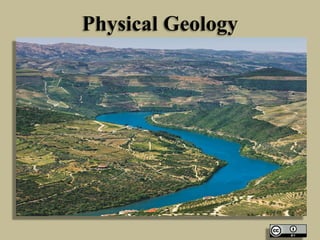
  • 5. Geological Work by River • Method of River Erosion • By erosion is meant disintegration and decomposition of the rocks and soil material by a natural agent through mechanical, chemical, and other physico- chemical processes accompanied by removal of the disintegrated or decomposed product to far off places by the same agent. • Stream and rivers are the most powerful sub aerial agents of erosion. Others are wind and ice.
  • 6. Feature of Stream Erosion • Prolonged erosion by a river and the associated streams produces many interesting and important surface features along their channels directly and in the drainage basin in an indirect manner some of these features develop, with the passage of time to major geomorphological landforms.
  • 7. Potholes • Potholes • These are various shaped depressions of different dimensions that are developed in the river bed by excessive localized erosion by the streams. The pot holes are generally cylindrical or bowl shaped in outline these are commonly formed in the softer rocks occurring at critical location in the bedrock of a stream. • The formation process for a pothole may be initiated by a simple plucking out of a protuding or outstanding rock projection at the river bed by hydraulic action.
  • 8. River Valleys River Valleys • A valley may be defined as a low land surrounded on sides by inclined hill slopes and mountain. Every major river is associated with a valley of its own. In fact, rivers are responsible for the origin, development and modification of their valleys through well- understood process of river erosion.
  • 9. River Valleys • (a) Origin. A river valley may have a modest origin when traced backward in the geological history of the area. On a gentle sloping surface, river water gets collected along lower level and flows as small streamlets. In a short time small gullies are produced where rainwater gets naturally collected from adjoining slopes, further erosion deepens and widens an original gully that can accommodate bigger volumes of water. • (b) Valley deepening It is achieved by cooperative action of all the processes involved in erosion. Deepening is obviously caused due to cutting down of the river bed. • (c) Lengthening of river Valley. A peculiar type of process called headword erosion is generally held responsible for lengthening of river valleys. • River capture (Piracy) A peculiar phenomenon of capture of draining basin of one river by another river fast eroding its channel in headword directions has been seen at many places. • (d) Stream achieved valley widening. The stream cut down more their channels and also remove away the loose soil and rocks from the banks thereby widening the valley directly.
  • 13. Georges and Canyons • The process of valley deepening often gives rise to magnificent surface features known as Georges and canyons. • Georges are very deep and narrow valley with very steep and high walls on either side. • A canyon is a specific type of George where the layers cut down by a river are essentially stratified and horizontal in attitude.
  • 15. Waterfalls • These are defined as magnificent jumps made by stream or river water at certain specific parts of their course where there is a sudden and considerable drop in the gradient of the channel. • Many falls are easily attributed to unequal erosion of the channel rocks within a short distance due to the inherent nature of the rocks.
  • 17. Stream Terraces • These are bench like ledges or flat surfaces that occur on the sides of many river valley. From a distance they may appear as successions of several steps of a big natural staircase rising up the riverbed.
  • 19. Sediment Transport by Rivers • Every river receives enormous amount of material during its flow from head to mouth. This material includes the rock and soil particles that the river acquires by its own work of erosion along the channel. Heterogeneous type of materials comprising of branches and trunks of trees washed down by rills and material contributed from processes of mass wasting such as rock falls, soil creep, rain wash and landslides from another distinct category of material that are transported by river.
  • 20. Sediment Transport by Rivers • The load as all the material being transported in running water of a stream or river, may thus be distinguished into following categories. • Suspended load: It is made up of fine sand, silt and clay sediments that are light enough to be transported in the stream water in a state of suspension. • Bed Load : This fraction of the river loads comprises the heavier particles of sand, pebbles, gravels and cobbles and other type of materials which are moved along the other side of the roads. • The dissolved load This fraction include particles of material soluble in water, which the river may gain due to its solvent action on the rock of the channel. Numerous rivers from the land part carry calcium carbonate, calcium sulphate and sodium Chloride and other soluble salts from limestone, gypsum, anhydrite and rock salts etc.
  • 22. Deposition by Rivers • The entire load of a stream or a river will normally remain in transport unless there is a change in one or other factor responsible for its transport. The process of dropping down of its loads by any moving natural agent is technically called deposition. Wind rivers, glaciers and marine water are important natural agent that make typical deposits.
  • 23. Types of Deposits • Alluvial fans and cones: These are cone shaped accumulation of stream deposits that are commonly found at places where small intermittent streamlets coming down from hill slopes enter the low lands. • Natural Levees: these are essentially riverbank deposits made by a river along its bank during floods. • The natural leeves are sometimes helpful in preventing further flooding in a river provided the volume of water a new prospective flood is not much higher than that of a previous floods.
  • 26. Types of Deposits • Deltas: deltas are defined as alluvial deposits of roughly triangular shape that are deposited by major river at their mouth, i.e.. where they enter a sea. • Channel deposits: Many streams are forced by some natural causes to deposit some of their loads along the river bed. These are so-called channel deposits. They are of great economical use being the source of sands and gravel quite suitable for use as construction materials.
  • 29. River Meandering • When a stream flows along a curved, zigzag path acquiring a loop-shaped course, it is said to mender. Menders are developed mostly in the middle and lower reaches of major stream where lateral erosion and depositions along opposite banks become almost concurrent geological activities of the stream, when a stream is flowing through such a channel it cannot be assumed to have absolutely uniform velocities all across its width. Thus the same river is eroding its channel on the concave side and making its progress further inland whereas on the convex side it is depositing. A loop shaped outline for the channel is a natural outcome where a stream seen from a distance.
  • 31. The Oxbow Lakes • In the advanced stages of a meandering stream only relatively narrow strips of land separate the individual loops from each other. During high-water times, as during small floods, when the stream acquires good volume of water, it has a tendency to flow straight, some of the intervening strips of land between the loops get eroded. The stream starts flowing straight in those limited stretches, thereby leaving the loops or loops on the sides either completely detached or only slightly connected. This isolated curved or looped shaped area of the river, which often contains some water are called oxbow lakes.
  • 34. Geological Works by Winds • Air in motion is called Wind. Wind is one of the three major agents of change on the surface of the earth, other two being river and glaciers. • Wind act as agent of erosion, as a carrier for transporting particles and grains so eroded from one place and also for depositing huge quantities of such wind blown material at different places. There are three modes of activities i.e. erosion, transportation and deposition by wind.
  • 35. Geological Works by Winds • Wind Erosion • Wind perform the work of erosion by at least three different methods: Deflation, abrasion and attrition • Deflation • Wind posses not much erosive power over rocks the ground covered with vegetation. But when moving with sufficient velocity over dry and loose sand it can remove or swept away huge quantity of the loose material from the surface. This process of removal of particle of dust and sand by strong wind is called deflation. • Wind Abrasion • Wind becomes a powerful agent for rubbing and abrading the rock surface when naturally loaded with sand and dust particles This type of erosion involving rubbing, grinding, polishing the rock surface by any natural agent is termed as abrasion. • Attrition by wind • The sand particles and other particles lifted by the wind from different places are carried away to considerable distances. The wear and tear of load particles suffered by them due to mutual impacts during the transportation process is termed as attrition
  • 39. Geological Works by Winds Sedimentation Transport by wind • Sources of sediments: Wind is an active agent of sediment transport in nature. Materials of fine particle size such as Clay, silt and sand occurring on surface of the earth are transported in huge volumes from one place to another in different regions of the world. • Methods of Transport: The wind transport is carried out mainly by two distinctly different processes: • Suspension: The light density clay and silt particles may be lifted by the wind from the ground and are carried high up to the upper layer of the wind where they move along with the wind. This is called transport in suspension. • Siltation: the heavier and coarse sediments such as sand grains, pebbles and gravels are lifted up periodically during high velocity wind only for short distance. They may be dropped and picked up again and again during the transport process Siltation is therefore, a process of sediment transport in a series of jumps. • The transport power of wind: The transporting power of wind depends on its velocity as also on the size, shape and density of the particles. The amount of load already present in the wind at a given point of time also determines its capacity to take up further load.
  • 40. Geological Works by Winds • Deposition by Wind Aeolian deposits. • Sediments and particles once picked up by the wind from any source on the surface are carried forward for varying distances depending on the carrying capacity of the wind. Wherever and whenever the velocity of wind suffers a check from one reason or another a part or whole of the wind load is deposited at that place. These wind made deposits may ultimately take the shape of landform that are commonly referred as aeoline deposits. These are of two main types of deposits Dunes and loess.
  • 41. Geological Works by Winds • (a) Dunes These are variously shaped deposits of sand-grade particles accumulated by wind. A typical sand dune is defined as broad conical heap. A dune is normally developed when a sand laden wind comes across some obstruction The obstruction causes some check in the velocity of the wind , which is compelled to drop some load over, against or along the obstruction when the process is continued for a long time, the accumulated sand takes the shape of mound or a ridge. A typical dune is characterized with a gentle windward side and a steep leeward slope.
  • 42. Geological Works by Winds • Loess: The term Loess is used for wind blown deposits of silt and clay grade particles. Typically Loess is unconsolidated, unstratified and porous accumulation of particles. • Strong winds blowing over very extensive area of deserts, outwash plains and soil loosened by plough pick up vast amount of fine grade particles for transportation in suspension, when such dust laden winds passing over steppes and other flat surfaces are intercepted by precipitation they drop their entire loads on the surface below. This process is repeated for years. Accumulations of such sediments over years have resulted in the present loess deposits.
  • 43. Loess
  • 44. Geological Work of Groundwater
  • 45. Geological Work of Groundwater • Ground water like surface water, is also a very powerful natural agent responsible not only for modifying the existing features but also for creating many other geological features on and below the surface of the earth. • Geological works of ground water may be conveniently studied under two headings namely chemical work and mechanical work.
  • 46. Geological work of Groundwater • Water is a great solvent. Groundwater becomes an active agent of dissolution of many rocks like lime stone, dolomites, gypsum, rock salt and the like with which it comes into contact during its downward journey below the surface. It has been observed that water dissolves limestone at a variable rate that depends upon its temperature, composition and above all its carbon dioxide content. • The dissolution of soluble rocks by groundwater is controlled by a number of factors such as climate, geological structure, topography, porosity and permeability of rocks, composition of rocks, composition of ground water, especially its salts and gaseous content , flow velocity, temperature, pressure, pressure and depth at which the water comes in touch with the rocks.
  • 47. Geological work of Groundwater
  • 48. Geological work of Groundwater • Quite a number of forms are developed due to solvent action of water few are mentioned as below: • Dolines: These are also termed as swallow holes, sink holes and sometimes simply as sinks. A typical dolines is circular or oval depression, which when followed in depth becomes bowl-shaped or cylindrical in cross section. • Caves: these may be defined as naturally carved out underground cavities of various dimensions that always have horizontal opening on the surface. They are similar to tunnels with the exception that a cave does not normally have an exit on the other end. • Blind Valley: A blind valley is a valley like feature where a stream flowing through it in the upper reaches suddenly disappears in the lower reaches.
  • 50. Caves
  • 52. Geological work of Groundwater • Groundwater is also an active agent of deposition in regions of proper climate and geology. These deposits are typically found to occur in caves and other underground openings and also fissures and crakes in the form of mineral bands, mineral streak or even as distinct mineral layer. Among the minerals very often deposited from the groundwater by precipitation etc. may be mentioned varieties of calcite, silica, flourite and barite. • The two most commonly known cave deposits are stalactites and stalagmites. • Stalactites: are carbonate projections that hang down from the roof of the caves. They may acquire fantastic shapes like slender rods and cones with flattered bases attached firmly with the roof. • Stalagmites: are also groundwater deposits of carbonate rich droplets from ground upwards.
  • 55. Geological work of Groundwater • Mechanical Work: Subsurface water is also invariably characterized with some motion due to one or another reason for instances, under the influence of gravity in the zone of aeration and that of hydrostatic head in the Aquifer and underground streams. The velocity of subsurface flow however, is much less when compared to surface water. Hence the mechanical work of subsurface water is more in theory than in practice.
  • 57. Geological Work of Oceans • Marine water is spread over more than two third of the earth’s surface and is classed among the most powerful geological agents operating on the earth. Marine geology is fast acquiring the status of a separate branch of geology where the study of oceans, as said above has become the domain of specific branch of science. • Like other geological agencies, seawater also acts as an agent of erosion, transport and deposition. Since seawater is almost confined within boundaries and broadly standing in nature unlike river that flows downwards, the mechanism of geological work of sea differ in detail from that of river. All the geological work performed by marine water is due to regular and irregular disturbances taking places in the body of water. Mostly in the surface layer and distinguished as waves and currents.
  • 60. Geological Work of Oceans • Marine Erosion • Marine water erodes the rocks at the shore and elsewhere with which it comes in contact in a manner broadly similar to that of stream water. The work of erosion is accomplished in three ways. Hydraulic action, abrasion, and corrosion. • Hydraulic Action: This is the process of erosion by water involving breaking, loosening and plucking out of loose, disjointed blocks of rocks from their original places by the strong forces created by the impact of sea waves and currents. • Marine Abrasion This involves the rubbing and grinding action of seawater on the rocks of the shore with the help of sand particles and other small fragments that are hurdled up again these rocks. • Corrosion: It is the solvent action of seawater which is particularly strong in environment where the shore is of vulnerable chemical composition.
  • 64. Geological Work of Oceans • Feature of Marine Erosion: • Some very common features of marine erosion are headlands, bays, sea cliff and wave-cut terraces. • Headlands and Bays • In an originally uniform sloping shoreline composed of materials of unequal hardness, the softer rocks get eroded easily and quickly. Seawater enters the inland spaces so created along the shore, These form the bays. The stronger rocks, however, resist erosion to a great extent and stand for a considerable time. These may get smoothened and variously modified but still stand as projecting parts of original as headlands.
  • 66. Geological Work of Oceans • Sea Cliffs • A Sea cliff is seaward facing steep front of a moderately high shoreline and indicates the first stage of the work of waves on the shore rocks. There may be a number of sea cliffs seen on a shore line. They are outstanding rock projection having smoothened seaward sloping surface. • Wave-Cut Terraces • A wave-Cut Terrace is a shallow shelf type structure, carved out from the shore rocks by the advancing sea waves. The waves first of all cut a notch where they strike against the cliff rock again and again. The notch is gradually extended backward to such a depth below the overlying rock that the latter becomes unsupported from below. The cliff eventually falls down along the notch. A platform or bench is thus created over which the seawater may rush temporarily and periodically. The resulting structure is called a wave curt terrace.
  • 67. Marine Deposition • Seas are regarded as most important and extensive sedimentation basins, this becomes evident from the fact that marine deposits of practically of all the geological ages. These deposits are exposed at many places in almost all the continents all the marine deposits are conveniently classified into two groups: Shallow water deposits and Deep-water deposits. • Shallow Water( Neritic Deposits) • These include marine deposits laid down in neritic zone of the sea, which extends from the lowest tide limit to the place of the continent shelf where the slope becomes steeper. • (i) Beaches: These are loose deposits made by the sea near the shore from the materials eroded from nearby regions. The lower margin of a beach is commonly beneath the waves whereas the upper margin is a few meter above the still water. Waves and currents play a greater role in formation of a beach. • (ii) Splits and Bars: These are ridge shaped deposits of sand and shingle that often extends across the embayment. • (iii) Tombola: It is the form of marine deposit that connects a headland and an island or one island with another island.
  • 74. Marine Deposition • Deep Water Deposits: These deposits consists mostly of Mud and oozes and are called as pelagic deposits. The oozes that form bulk of some such deposits consist of small organisms known collectively as planktons. Death and decay of these organisms and plants followed by their accumulation in regular and irregular shapes These deposits are commonly called as reefs.
  • 75. Marine Deposition • Coral Reefs: These are peculiar type of ridge like marine deposits that have been found due to accumulation of dead parts of certain type of sea- organisms. Corals a typically a calcium secreting organisms predominate the source for such reefs hence they are commonly designated as coral reefs. • Economic Importance: reefs have acquired considerable strategic and economic importance during recent years. Strategically some of the reef deposits are ideal as air bases in the vast expanse of sea. Economically, the old reef are known to be the source rock for the oil deposits.
  • 77. Geological Work of Glaciers • Glaciers are defined as huge bodies of ice characterized with downward and outward movement. They are formed in suitable climate and topography in favorably located regions. • Under its own load after falling over an area for considerable time, the snow undergoes a process of progressive compaction. With continued compaction due to increasing mass of snow from above after every snowfall,firn undergoes further change towards a very compact, dense, coarsely crystalline mass. This condensed compacted and solid mass of snow is defined as ice. A glacier is composed mostly of ice and firn.
  • 79. Geological Work of Glaciers • Glaciers like other geological agencies, perform their work in three ways: erosion, transport and deposition. Glaciers have been particularly active in recent geological past and are held responsible for development and modification of many land features on the globe. Glacier Erosion: Erosive work is accompanied by glaciers in two ways: by plucking and by abrasion. Glacier Plucking • It may be broadly defined as loosening and breaking of rock masses by the pressure of glacier ice. It is also called as glacier quarrying. Thus, a block is torn out of position and moves away long with the glacial ice and leaving behind a rough and rugged rock surface. • These plucked-out surfaces are observed conspicuously in many glaciated areas on the steeper sides of hill-like structures called the stross and Lee forms. Glacial Abrasion. • It is the rubbing, scratching, grooving and polishing action of the glaciers on the rock surface along or over which these ice mass happens to move. Ice itself is capable of abrading the soft rocks only. But when it is carrying along its stone fragments and rock pieces, sand, silt and clay, it acts as a powerful abrading medium.
  • 81. Geological Work of Glaciers
  • 83. Geological Work of Glaciers
  • 84. Features of Glacial Erosion Whaleback forms: • These are commonly called roaches moutonee and may be described as glacially eroded residual hillocks or hummocks. One side of such a feature rises up very gently and is smooth, curved and much longer than wide. The other side of the same hillock may be rugged, rough and steep. The direction of ice is indicated by gentle slope. Crag and Tail: • When in the course of glacier a highly resistant rock stands as an obstruction, it generally retards the erosive action of ice on the soft bed rock sheltered behind the obstruction thus a peculiar feature results in which the obstructing rock facing the ice is known as CRAG. The sheltered and softer bed rock is termed as the TAIL . And the combined structure as CRAG and TAIL.
  • 87. Features of Glacial Erosion • Glacial Valley: Most Valley-glaciers originate and disappear in pre- existing valleys carved out by stream. These glaciers stream valley, however are eventually so much modified in their longitudinal and transverse profile because of prolonged glacial erosion that their origin due to stream erosion may become doubtful. In their transverse profile, glacial valleys presnt a typical U-Shaped outline, tending more towards a semi-circle. • Hanging Valleys: A valley glacier may have one or more small tributary glaciers meeting it from sides. The rate of glacial erosion being more in the main valley glacier, a time may come when the side glacier are no longer in contact with main valley. Their small valleys are gradually left higher at junctions with main valley. Such Tributary glacial valleys are called Hanging Valleys.
  • 92. Features of Glacial Erosion • Cirques (Corries): A cirque may be defined as a semicircular or half-bowl shaped depression within an otherwise uniform glaciated valley slope. Such a depression is invariable bounded on sides by Steep Wall. Cirques range in diameter from a few meters to a few kilometers and occur commonly at the heads of valley glaciers. • Fiords: these are highly over deepened narrow elongated valley-like channels that have been excavated by the glacial ice between high walled rock. It is typical of many of the fiords that they reach the coastline below the sea level. Due to this reason, many of the fiord become inland extensions of the sea.
  • 96. Features of Glacial Erosion • Glacial erosion modifies the original form of mountainous regions to a great extent with development of valley and cirques. Further growth of these glacial excavation assisted by mechanical disintegration results in the development of certain peculiar forms. Are’tes, horns and cols are some such noteworthy features. • An Are’te is a knife-edge sharp and narrow crest of a glaciated mountain. A horn is pyramidal, multi-facetted projecting form in mountainous region. A col is a pass or depression on a ridge in a glaciated mountain.
  • 99. Glacial Transport • Glaciers are defined as moving bodies of ice, As such they are capable of transporting any load they gather during the movement. Such loads consists of all sorts of heterogeneous materials. The load being carried by glaciers may be located along its base or it may be embedded within its body. The rate of movement of the glacial load depend on the position that the load material occupies in a glacier.
  • 101. Glacial Deposits • Glaciers carry enormous quantities of hetrogeneous load with them which is kept in a state of transport till the conditions are favorable or till the glacier reach their lower ends or terminal points. the load is then deposited or dropped and may form huge accumulations of glacial debris varying shapes and characters. • Drift: All such accumulation of glacial debris that have been deposited by glaciers directly or indirectly from glacial meltwaters are collectively known as drift. This is further distinguished into two types: Till and Fluvio-glacial drift. • Till it is also called unstratified drift and is the most common form of glacial deposit. Till may consist of an unassorted mixture of boulders and clay having an undisputed glacial origin.
  • 102. Drift
  • 105. Volcanism • When magma formed at depth finds a through passage to the surface of the earth through cracks and fissures in crustal rocks it is outpoured on the surface through volcanoes as lava. This extrusion of lava is one of the phases of igneous activities and is called as volcanism or volcanicity. • A volcano is a more or less conical hill with a pipe at the centre through which magma rises to the surface, the cone is built up of the products of volcanicity issuing from the central pipe. At the top of the cone, around the pipe there is a basin shaped depression called crater, which in some cases contains liquid magma that appears to be boiling because of the escaping gases.
  • 108. Volcanism • Fissure eruptions • But in past geological ages another type of volcanic activity has taken place. Extensive tensional fissures were formed in the earth’s crust through which magma flowed out in enormous quantity forming horizontal lava sheets. This type of volcanicity is called fissure type.
  • 109. Geological Work of Volcano • Volcanic Accumulation Pyroclastic material and lava coming out of the central vent of a volcano accumulate around the vent and build a cone, such accumulations may grow to considerable heights giving rise to volcanic mountains. • Igneous Intrusions Due to intrusions of viscous magma from below stratified rocks may be raised forming a dome.
  • 112. Geological Work of Volcano • Volcanic rock is a rock formed from magma erupted from a volcano. In other words, it differs from other igneous rock by being of volcanic origin. • Volcanic rocks are among the most common rock types on Earth's surface, particularly in the oceans. On land, they are very common at plate boundaries and in flood basalt provinces. • Volcanic rocks are named according to both their chemical composition and texture. Basalt is a very common volcanic rock with low silica content. Rhyolite is a volcanic rock with high silica content. Rhyolite has silica content similar to that of granite while basalt is compositionally equal to gabbro. Intermediate volcanic rocks include andesite, dacite, trachyte, and latite.
  • 113. Geological Work of Volcano
  • 114. Geological Work of Volcano • Pyroclastic rocks are the product of explosive volcanism. They are often felsic (high in silica). Pyroclastic rocks are often the result of volcanic debris, such as ash, bombs and tephra, and other volcanic ejecta. Examples of pyroclastic rocks are tuff and ignimbrite. • Shallow intrusions, which possess structure similar to volcanic rather than plutonic rocks are also considered to be volcanic.
  • 115. Geological Work of Volcano
  • 116. Geological Work of Volcano • The sub-family of rocks that form from volcanic lava are called igneous volcanic rocks (to differentiate them from igneous rocks that form from magma below the surface, called igneous plutonic rocks). • The lavas of different volcanoes, when cooled and hardened, differ much in their appearance and composition. If a rhyolite lava-stream cools quickly, it can quickly freeze into a black glassy substance called obsidian. When filled with bubbles of gas, the same lava may form the spongy appearing pumice. Allowed to cool slowly, it forms a light-colored, uniformly solid rock called rhyolite.
  • 117. Geological Work of Volcano
  • 118. Earthquakes • Earthquakes are caused by the passage of vibrations set up in the rocks due to various reasons. All the important severe ones which are felt over extensive areas and cause widespread damage are due to sudden movements along faults associated with orogenic and epeirogenic earth movements and are called tectonic.
  • 120. Earthquakes • The vibrations that are set up when an earthquake takes place are propagated as a number of different types of waves. Different types of seismographs are designed to record these waves. A major shock is recorded by seismographs all over the world, and its epicentre, time of origin, depth of focus, magnitude etc. can be worked out from these records called seismograms. • Of the various types of waves set up by an earthquake the most important are i) P primary waves, which are the fastest. ii) S waves or secondary waves which are slower and iii) L or long wave which arrive at a station later than P & S wave as they follow zig zag path.
  • 122. Earthquakes • Geological effects: Geologically earthquakes are an insignificant phenomenon and produces only minor geological effects. Even these are temporary as they are soon obliterated by other geological processes such as weathering and eosion. • Minor faulting takes place and where faults cross river coursses like lakes or waterfalls may be produced according as the downthrow is upstream or downstream. Fissures are opened up in the ground from which ground water may issue. Distribution of ground water is disturbed by the slumping and dipression that follow, and new lakes and swamps may be formed or old ones drained. Because of compression of water bearing sands sandy jets may issue and sand craters may be built up around them.. Land slides are started on unstable slopes.
  • 124. Earthquake Zoning of India • The Indian subcontinent has a history of devastating earthquakes. The major reason for the high frequency and intensity of the earthquakes is that the Indian plate is driving into Asia at a rate of approximately 47 mm/year. Geographical statistics of India show that almost 54% of the land is vulnerable to earthquakes. • The latest version of seismic zoning map of India given in the earthquake resistant design code of India [IS 1893 (Part 1) 2002] assigns four levels of seismicity for India in terms of zone factors. In other words, the earthquake zoning map of India divides India into 4 seismic zones (Zone 2, 3, 4 and 5) unlike its previous version which consisted of five or six zones for the country. According to the present zoning map, Zone 5 expects the highest level of seismicity whereas Zone 2 is associated with the lowest level of seismicity
  • 126. Earthquake Zoning of India Zone 5 • Zone 5 covers the areas with the highest risks zone that suffers earthquakes. The IS code assigns zone factor of 0.36 for Zone 5. Structural designers use this factor for earthquake resistant design of structures in Zone 5. The zone factor of 0.36 is indicative of effective (zero period) peak horizontal ground accelerations of 0.36 g (36% of gravity) that may be generated during Maximum Considered Earthquake MCE level earthquake in this zone. It is referred to as the Very High Damage Risk Zone. The state of Kashmir,the western and central Himalayas, the North-East Indian region and the Rann of Kutch fall in this zone. • Generally, the areas having trap or basaltic rock are prone to earthquakes.
  • 127. Earthquake Zoning of India • Zone 4 • This zone is called the High Damage Risk Zone. The IS code assigns zone factor of 0.24 for Zone 4. The Indo-Gangetic basin and the capital of the country (Delhi), Jammu and Kashmir fall in Zone 4. In Maharashtra Patan area(Koyananager) also in zone 4.
  • 128. Earthquake Zoning of India • Zone 3 • The Andaman and Nicobar Islands, parts of Kashmir, Western Himalayas fall under this zone. This zone is classified as Moderate Damage Risk Zone. and also 7.8 The IS code assigns zone factor of 0.16 for Zone 3.
  • 129. Earthquake Zoning of India • Zone 2 • This region is classified as the Low Damage Risk Zone. The IS code assigns zone factor of 0.10 (maximum horizontal acceleration that can be experienced by a structure in this zone is 10% of gravitational acceleration) for Zone 2.