Submit Search
Upload
Mapping Multan and beyond with OSM
•
2 likes
•
917 views
Shoaib Burq
Follow
Slides from a recent talk about mapping Multan, Pakistan with openstreetmap (OSM).
Read less
Read more
Technology
Business
Report
Share
Report
Share
1 of 44
Download now
Download to read offline
Recommended
Notes to accompany 1017ordnance survey
Julian Swindell
Introduction to Nespak_2016
Atiqa khan
Gis in transportation
Ashan Senarathne
GPS & its integration with GIS & RS
EhsanYousaf1
Methos
Methos
chrislivesey
GIS and GPS
GIS and GPS
TRIDIP BORUAH
Gps 1.christina.background
cmhutson0
Gps 1.christina.background
cmhutson0
Field move clino
Field move clino
Shalini Palanivel
Hawaii Pacific GIS Conference 2012: National Data Sets - New US Topos for Haw...
Hawaii Geographic Information Coordinating Council
Modified Resource Google Presentation
William Worford
Spatial Technology Resources for Teachers
Rebecca Nicholas
step by step mapping with hale for inspire
silli
application of gis
application of gis
Abhiram Kanigolla
First GIS Software that Convert GIS Shape files to HTML Google Map Web Site a...
Gis Gis
GPS and GIS
GPS and GIS
Naeem Bari
The Integration of Geospatial Technologies: GIS and GPS
Lindsey Landolfi
Using Spatial Technologies in the Geography Classroom
Rebecca Nicholas
Gis and gps
Gis and gps
littrpgaddict
Application of gis and remote sensing in modern transport system
Sabhapathy Civil
GPS & GIS
GPS & GIS
Chittranjan Vaishnav
Plantation dss
Plantation dss
akudarya
Unique methods of GIS in Transportation
Andrew Harrison
Module for principles and application of precision agriculture
JAWI Herbs Centre
My ppt on gis
My ppt on gis
gargsonakshi1
Geographic Information System and use in Agriculture
PritiKumari131
Multan intro By Backstreet boys
Ishtiaq Bhatti
Socio-culture formation of Pakistan society with reference to women Placement
FARAH FAREEHA
culture of pakistan
culture of pakistan
mb kayani
Slides on punjabi culture
Shafaq Saleem
More Related Content
What's hot
Field move clino
Field move clino
Shalini Palanivel
Hawaii Pacific GIS Conference 2012: National Data Sets - New US Topos for Haw...
Hawaii Geographic Information Coordinating Council
Modified Resource Google Presentation
William Worford
Spatial Technology Resources for Teachers
Rebecca Nicholas
step by step mapping with hale for inspire
silli
application of gis
application of gis
Abhiram Kanigolla
First GIS Software that Convert GIS Shape files to HTML Google Map Web Site a...
Gis Gis
GPS and GIS
GPS and GIS
Naeem Bari
The Integration of Geospatial Technologies: GIS and GPS
Lindsey Landolfi
Using Spatial Technologies in the Geography Classroom
Rebecca Nicholas
Gis and gps
Gis and gps
littrpgaddict
Application of gis and remote sensing in modern transport system
Sabhapathy Civil
GPS & GIS
GPS & GIS
Chittranjan Vaishnav
Plantation dss
Plantation dss
akudarya
Unique methods of GIS in Transportation
Andrew Harrison
Module for principles and application of precision agriculture
JAWI Herbs Centre
My ppt on gis
My ppt on gis
gargsonakshi1
Geographic Information System and use in Agriculture
PritiKumari131
What's hot
(18)
Field move clino
Field move clino
Hawaii Pacific GIS Conference 2012: National Data Sets - New US Topos for Haw...
Modified Resource Google Presentation
Spatial Technology Resources for Teachers
step by step mapping with hale for inspire
application of gis
application of gis
First GIS Software that Convert GIS Shape files to HTML Google Map Web Site a...
GPS and GIS
GPS and GIS
The Integration of Geospatial Technologies: GIS and GPS
Using Spatial Technologies in the Geography Classroom
Gis and gps
Gis and gps
Application of gis and remote sensing in modern transport system
GPS & GIS
GPS & GIS
Plantation dss
Plantation dss
Unique methods of GIS in Transportation
Module for principles and application of precision agriculture
My ppt on gis
My ppt on gis
Geographic Information System and use in Agriculture
Viewers also liked
Multan intro By Backstreet boys
Ishtiaq Bhatti
Socio-culture formation of Pakistan society with reference to women Placement
FARAH FAREEHA
culture of pakistan
culture of pakistan
mb kayani
Slides on punjabi culture
Shafaq Saleem
Culture of pakistan
Culture of pakistan
Ghulam Murtaza
Multan
Multan
waqqad_khan
Viewers also liked
(6)
Multan intro By Backstreet boys
Socio-culture formation of Pakistan society with reference to women Placement
culture of pakistan
culture of pakistan
Slides on punjabi culture
Culture of pakistan
Culture of pakistan
Multan
Multan
Similar to Mapping Multan and beyond with OSM
[Day 3] Agcommons Quickwin: gRoads
[Day 3] Agcommons Quickwin: gRoads
csi2009
Drupal and the GeoSpatial Web
Andrew Turner
Volunteered Geographic Information and OpenStreetMap
chippy
Maps, mashups and metadata:geospatial standards for access and retrieval
Scottish Library & Information Council (SLIC), CILIP in Scotland (CILIPS)
Talk: "Using Open Data and Crowdsourcing to develop CycleStreets"
CycleStreets
OpenStreetMap mobile tools & visualisation
Tua Sarocha
Where 2.0
Where 2.0
davejohnson
CycleStreets presentation to Cambridge Geek Night (3rd August 2010)
CycleStreets
IRLOGI openstreetmap presentation
Ciaran Staunton
Introduction to OpenStreetMap and Humanitarian OSM Team for Plan Internationa...
chippy
GeOng presentation about OpenStreetMap
chippy
3 using
3 using
Frédéric Bonifas
Gps general-training-and-software-applications-kuala lumpur-nov-2018
Harshali Mane
OpenStreetMap and CycleStreets: collaborative map-making and cartography in t...
CycleStreets
CycleStreets: Our Story - presentation to Net2Camb event
CycleStreets
Greater Cincinnati GPS Household Survey Pilot Results
Andrew Rohne
Mobile Apps for Fieldwork
James Millington
2018 GIS in Education: Car Racing With Collector
GIS in the Rockies
FreeMap Palestine November 2008
mikel_maron
hiking_tuto.pdf
hiking_tuto.pdf
Saka32
Similar to Mapping Multan and beyond with OSM
(20)
[Day 3] Agcommons Quickwin: gRoads
[Day 3] Agcommons Quickwin: gRoads
Drupal and the GeoSpatial Web
Volunteered Geographic Information and OpenStreetMap
Maps, mashups and metadata:geospatial standards for access and retrieval
Talk: "Using Open Data and Crowdsourcing to develop CycleStreets"
OpenStreetMap mobile tools & visualisation
Where 2.0
Where 2.0
CycleStreets presentation to Cambridge Geek Night (3rd August 2010)
IRLOGI openstreetmap presentation
Introduction to OpenStreetMap and Humanitarian OSM Team for Plan Internationa...
GeOng presentation about OpenStreetMap
3 using
3 using
Gps general-training-and-software-applications-kuala lumpur-nov-2018
OpenStreetMap and CycleStreets: collaborative map-making and cartography in t...
CycleStreets: Our Story - presentation to Net2Camb event
Greater Cincinnati GPS Household Survey Pilot Results
Mobile Apps for Fieldwork
2018 GIS in Education: Car Racing With Collector
FreeMap Palestine November 2008
hiking_tuto.pdf
hiking_tuto.pdf
More from Shoaib Burq
Async. and Realtime Geo Applications with Node.js
Shoaib Burq
Global Random Hacks of Kindness Berlin
Shoaib Burq
OpenStreetMap & Walking-Papers Workflow
Shoaib Burq
Ian Batley's MAPS (Spatial@Gov 2009)
Shoaib Burq
OpenStreetMap Response to Haiti earthquake
Shoaib Burq
Haiti Qake2010 Bar Camp Canberra2010
Shoaib Burq
Using Cuda Within Mathematica
Shoaib Burq
Opening of Geographic Data
Shoaib Burq
Where20 2008 Ruby Tutorial
Shoaib Burq
learning interoperability from web2.0
Shoaib Burq
Rails Gis Hacks
Rails Gis Hacks
Shoaib Burq
More from Shoaib Burq
(11)
Async. and Realtime Geo Applications with Node.js
Global Random Hacks of Kindness Berlin
OpenStreetMap & Walking-Papers Workflow
Ian Batley's MAPS (Spatial@Gov 2009)
OpenStreetMap Response to Haiti earthquake
Haiti Qake2010 Bar Camp Canberra2010
Using Cuda Within Mathematica
Opening of Geographic Data
Where20 2008 Ruby Tutorial
learning interoperability from web2.0
Rails Gis Hacks
Rails Gis Hacks
Recently uploaded
EIS-Webinar-Prompt-Knowledge-Eng-2024-04-08.pptx
Earley Information Science
The Role of Taxonomy and Ontology in Semantic Layers - Heather Hedden.pdf
Enterprise Knowledge
How to Troubleshoot Apps for the Modern Connected Worker
ThousandEyes
04-2024-HHUG-Sales-and-Marketing-Alignment.pptx
HampshireHUG
presentation ICT roal in 21st century education
jfdjdjcjdnsjd
Presentation on how to chat with PDF using ChatGPT code interpreter
naman860154
What Are The Drone Anti-jamming Systems Technology?
Antenna Manufacturer Coco
TrustArc Webinar - Stay Ahead of US State Data Privacy Law Developments
TrustArc
Raspberry Pi 5: Challenges and Solutions in Bringing up an OpenGL/Vulkan Driv...
Igalia
Evaluating the top large language models.pdf
ChristopherTHyatt
2024: Domino Containers - The Next Step. News from the Domino Container commu...
Martijn de Jong
Bajaj Allianz Life Insurance Company - Insurer Innovation Award 2024
The Digital Insurer
Automating Google Workspace (GWS) & more with Apps Script
wesley chun
A Domino Admins Adventures (Engage 2024)
Gabriella Davis
The 7 Things I Know About Cyber Security After 25 Years | April 2024
Rafal Los
Data Cloud, More than a CDP by Matt Robison
Anna Loughnan Colquhoun
Apidays Singapore 2024 - Building Digital Trust in a Digital Economy by Veron...
apidays
Handwritten Text Recognition for manuscripts and early printed texts
Maria Levchenko
Boost Fertility New Invention Ups Success Rates.pdf
sudhanshuwaghmare1
Finology Group – Insurtech Innovation Award 2024
The Digital Insurer
Recently uploaded
(20)
EIS-Webinar-Prompt-Knowledge-Eng-2024-04-08.pptx
The Role of Taxonomy and Ontology in Semantic Layers - Heather Hedden.pdf
How to Troubleshoot Apps for the Modern Connected Worker
04-2024-HHUG-Sales-and-Marketing-Alignment.pptx
presentation ICT roal in 21st century education
Presentation on how to chat with PDF using ChatGPT code interpreter
What Are The Drone Anti-jamming Systems Technology?
TrustArc Webinar - Stay Ahead of US State Data Privacy Law Developments
Raspberry Pi 5: Challenges and Solutions in Bringing up an OpenGL/Vulkan Driv...
Evaluating the top large language models.pdf
2024: Domino Containers - The Next Step. News from the Domino Container commu...
Bajaj Allianz Life Insurance Company - Insurer Innovation Award 2024
Automating Google Workspace (GWS) & more with Apps Script
A Domino Admins Adventures (Engage 2024)
The 7 Things I Know About Cyber Security After 25 Years | April 2024
Data Cloud, More than a CDP by Matt Robison
Apidays Singapore 2024 - Building Digital Trust in a Digital Economy by Veron...
Handwritten Text Recognition for manuscripts and early printed texts
Boost Fertility New Invention Ups Success Rates.pdf
Finology Group – Insurtech Innovation Award 2024
Mapping Multan and beyond with OSM
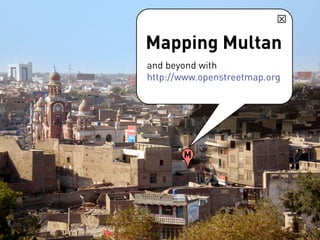
1.
Mapping Multan and beyond
with http://www.openstreetmap.org M
2.
The 5 steps
to mapping Data is anything • Collect data required to make a map: street paths, street names, photos, older maps • Upload data etc. • Create/Edit data • Label/Tag data add details • Render use map
3.
1. Collect data •
GPS tracker and data logger
4.
More information on
the Sparkfun GeoChron GPS logger from: http:// www.sparkfun.com/ commerce/ product_info.php? products_id=8301
Download now